File:Zuberský vrch, CZ180325-041.jpg
Jump to navigation
Jump to search

Size of this preview: 800 × 444 pixels. Other resolutions: 320 × 178 pixels | 640 × 355 pixels | 1,024 × 568 pixels | 1,280 × 710 pixels | 2,560 × 1,421 pixels | 4,769 × 2,647 pixels.
Original file (4,769 × 2,647 pixels, file size: 4.39 MB, MIME type: image/jpeg)
Captions
Captions
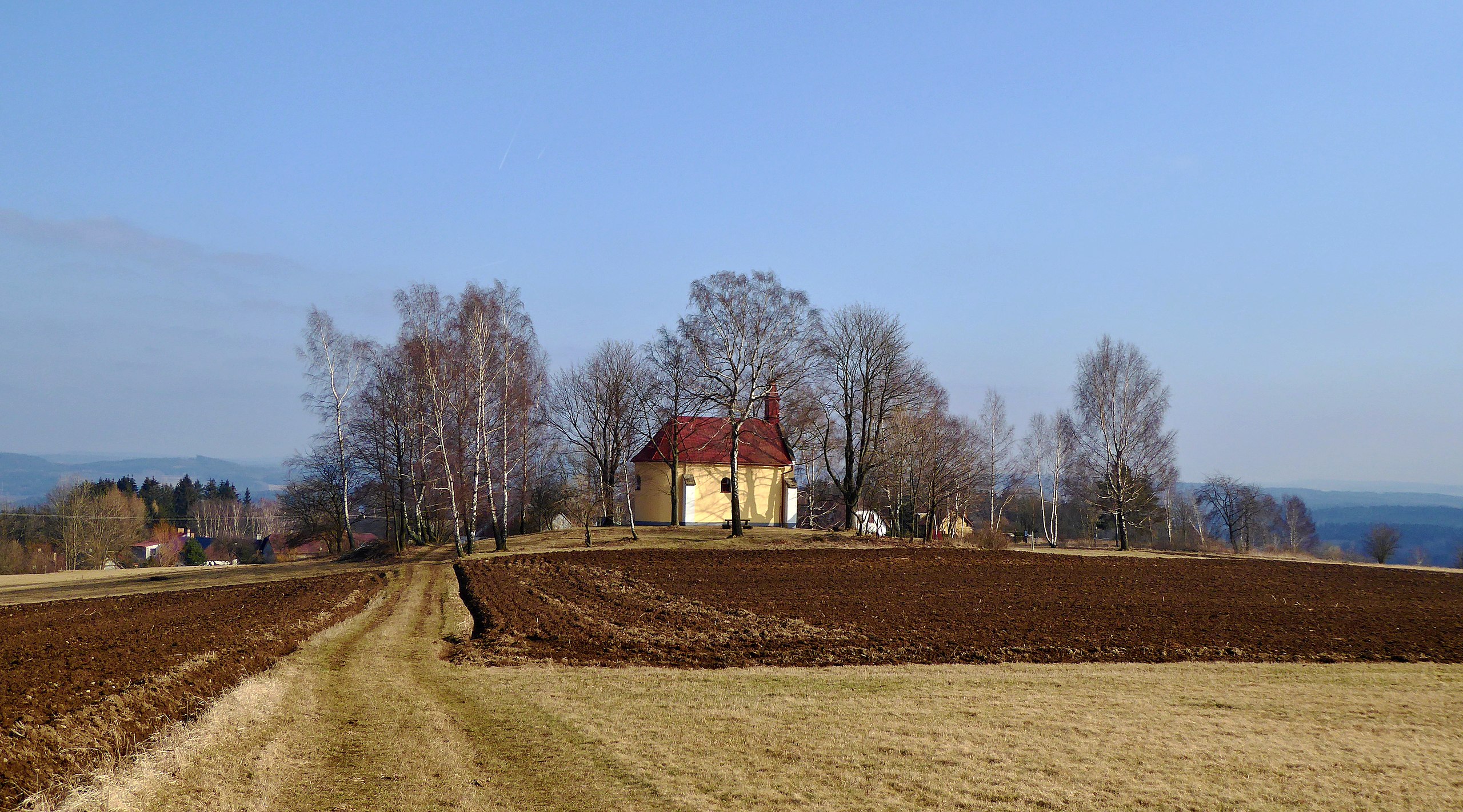
Chapel of St. John of Nepomuk on Zuberský hill (650.5 m) in the Iron Mountains.
Summary
[edit]
| Description |
English: The top part of the Zuberský hill (650.5 m above sea level) in the landscape of the Iron Mountains. At knoll the original Baroque chapel of St. Jana Nepomucký, cultural monument, in 2017 refurbishment of the facade. Built in the early 18th century above the small hamlet of "Zubří" (part of small town of Trhová Kamenice). The locality with meadows and cultivated fields is an observation point in the Protected Landscape Area of Iron Mountains. In the outlook is also the part of the nature reserve "Zubří" and the top Vestec (668 m above sea level), the highest in the protected landscape area (not on the photo). The field road leads from the small hamlet of "Zubří" through the top "Zuberský" hill and forest site to the road "Trhová Kamenice - Hluboká". Photo location: Czechia, Pardubice Region, the small town Trhová Kamenice, the landscape area "Kameničská" Highlands (geomorphological district), azimuth 143°.
Čeština: Plochá vrcholová část Zuberského kopce (650,5 m n. m.) v krajinné oblasti Železných hor. Na terénní vyvýšenině původně barokní kaple sv. Jana Nepomuckého, kulturní památka, v roce 2017 renovace fasády. Postavena počátkem 18. století nad vesničkou Zubří (část městysu Trhová Kamenice). Lokalita s loukami a zemědělsky obdělávanými poli je rozhledovým místem v Chráněné krajinné oblasti Železné hory. Ve výhledu také část přírodní rezervace Zubří a vrchol Vestec (668 m n. m.), nejvyšší v chráněné krajinné oblasti (mimo foto). Polní cesta vede z vesničky Zubří přes vrchol Zuberského kopce a lesní pozemek k silnici Trhová Kamenice – Hluboká. Foto lokace: Česko, Pardubický kraj, městys Trhová Kamenice, vesnička Zubří, krajinná oblast Kameničské vrchoviny (geomorfologický okrsek), azimut 143°. |
| Date | |
| Source | Own work |
| Author | Josef Kreuz (PEPan) |
| Camera location | | View this and other nearby images on: OpenStreetMap |
|---|
Zdroje informací:
[edit]
- AOPK ČR, mapová aplikace – geomorfologický okrsek Kameničská vrchovina, viz
- AOPK ČR, zvláště chráněná území – přírodní rezervace Zubří, viz
- ČÚZK, základní mapa Česka – Zuberský vrch, viz
- Národní památkový ústav, památkový katalog – kaple sv. Jana Nepomuckého v Zubří, viz
- MAS Hlinecko, sakrální stavby – Trhová Kamenice, kaple sv. Jana Nepomuckého, viz
- Městys Trhová Kamenice, webové stránky – Turistika a sport, viz
Licensing
[edit]
I, the copyright holder of this work, hereby publish it under the following license:
This file is licensed under the Creative Commons Attribution-Share Alike 4.0 International license.
- You are free:
- to share – to copy, distribute and transmit the work
- to remix – to adapt the work
- Under the following conditions:
- attribution – You must give appropriate credit, provide a link to the license, and indicate if changes were made. You may do so in any reasonable manner, but not in any way that suggests the licensor endorses you or your use.
- share alike – If you remix, transform, or build upon the material, you must distribute your contributions under the same or compatible license as the original.
File history
Click on a date/time to view the file as it appeared at that time.
| Date/Time | Thumbnail | Dimensions | User | Comment | |
|---|---|---|---|---|---|
| current | 07:51, 1 May 2018 | | 4,769 × 2,647 (4.39 MB) | PEPan (talk | contribs) | User created page with UploadWizard |
You cannot overwrite this file.
File usage on Commons
There are no pages that use this file.
File usage on other wikis
The following other wikis use this file:
- Usage on cs.wikipedia.org