File:Yeadon Dam - geograph.org.uk - 825949.jpg
Jump to navigation
Jump to search
No higher resolution available.
Yeadon_Dam_-_geograph.org.uk_-_825949.jpg (640 × 410 pixels, file size: 76 KB, MIME type: image/jpeg)
Captions
Captions
Add a one-line explanation of what this file represents
Summary
[edit]
| Description |
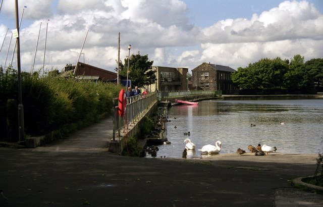
English: Yeadon Dam. Its 'proper' name is Yeadon Tarn, but as Yeadon Dam is has been a popular place of resort for generations of local children and their families. Drained during WWII for fear that German bombers would use the reflection from it as a navigational aid if bombing the nearby (but very well camouflaged) AVRO aircraft factory, (it must have worked - the AVRO never took a hit!) there was rejoicing in the town when it was re-filled. |
| Date | |
| Source | From geograph.org.uk |
| Author | Dr Neil Clifton |
| Attribution (required by the license) | Dr Neil Clifton / Yeadon Dam / |
| Camera location | | View this and other nearby images on: OpenStreetMap |
|---|
_heading:315.00&language=en)
| Object location | | View this and other nearby images on: OpenStreetMap |
|---|
_heading:315.00&language=en)
Licensing
[edit]

|
This image was taken from the Geograph project collection. See this photograph's page on the Geograph website for the photographer's contact details. The copyright on this image is owned by Dr Neil Clifton and is licensed for reuse under the Creative Commons Attribution-ShareAlike 2.0 license.
|
This file is licensed under the Creative Commons Attribution-Share Alike 2.0 Generic license.
Attribution: Dr Neil Clifton
- You are free:
- to share – to copy, distribute and transmit the work
- to remix – to adapt the work
- Under the following conditions:
- attribution – You must give appropriate credit, provide a link to the license, and indicate if changes were made. You may do so in any reasonable manner, but not in any way that suggests the licensor endorses you or your use.
- share alike – If you remix, transform, or build upon the material, you must distribute your contributions under the same or compatible license as the original.
File history
Click on a date/time to view the file as it appeared at that time.
| Date/Time | Thumbnail | Dimensions | User | Comment | |
|---|---|---|---|---|---|
| current | 17:41, 20 February 2011 | | 640 × 410 (76 KB) | GeographBot (talk | contribs) | == {{int:filedesc}} == {{Information |description={{en|1=Yeadon Dam Its 'proper' name is Yeadon Tarn, but as Yeadon Dam is has been a popular place of resort for generations of local children and their families. Drained during WWII for fear that German bo |
You cannot overwrite this file.
File usage on Commons
There are no pages that use this file.