File:YVR Destinations.svg
Jump to navigation
Jump to search

Size of this PNG preview of this SVG file: 800 × 340 pixels. Other resolutions: 320 × 136 pixels | 640 × 272 pixels | 1,024 × 435 pixels | 1,280 × 544 pixels | 2,560 × 1,088 pixels | 842 × 358 pixels.
Original file (SVG file, nominally 842 × 358 pixels, file size: 1.14 MB)
Captions
Captions
Add a one-line explanation of what this file represents
Summary
[edit]
| Description |
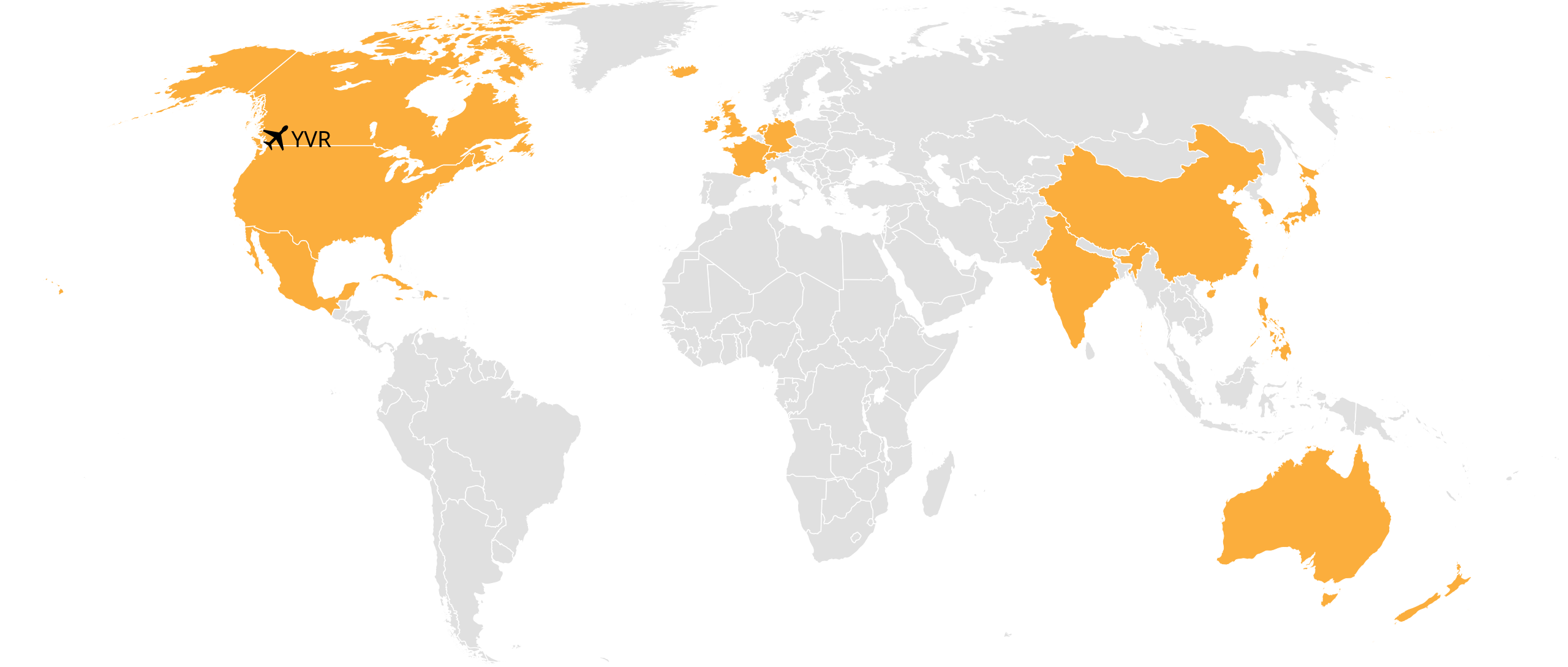
English: A map of all countries served as destinations of Vancouver International Airport (YVR). |
| Date | |
| Source | Own work |
| Author | Briguychau |
| SVG development | This world map was created with Adobe Illustrator. This world map uses embedded text. |
Licensing
[edit]
I, the copyright holder of this work, hereby publish it under the following license:
This file is licensed under the Creative Commons Attribution-Share Alike 4.0 International license.
- You are free:
- to share – to copy, distribute and transmit the work
- to remix – to adapt the work
- Under the following conditions:
- attribution – You must give appropriate credit, provide a link to the license, and indicate if changes were made. You may do so in any reasonable manner, but not in any way that suggests the licensor endorses you or your use.
- share alike – If you remix, transform, or build upon the material, you must distribute your contributions under the same or compatible license as the original.
File history
Click on a date/time to view the file as it appeared at that time.
| Date/Time | Thumbnail | Dimensions | User | Comment | |
|---|---|---|---|---|---|
| current | 04:17, 30 October 2016 | | 842 × 358 (1.14 MB) | Briguychau (talk | contribs) | Remove Italy |
| 15:55, 27 April 2016 |  | 842 × 358 (1.14 MB) | Briguychau (talk | contribs) | Add India | |
| 07:32, 5 April 2016 |  | 842 × 358 (1.14 MB) | Briguychau (talk | contribs) | Add Jamaica and Dominican Republic, both served by Sunwing seasonally. | |
| 05:30, 26 November 2015 |  | 842 × 358 (1.14 MB) | Briguychau (talk | contribs) | Add Ireland | |
| 00:15, 20 November 2015 |  | 842 × 358 (1.14 MB) | Briguychau (talk | contribs) | File didn't seem to be uploaded properly... | |
| 00:13, 20 November 2015 |  | 842 × 358 (1.14 MB) | Briguychau (talk | contribs) | Add Cuba and Italy. | |
| 04:21, 22 June 2015 |  | 842 × 358 (1.14 MB) | Briguychau (talk | contribs) | User created page with UploadWizard |
You cannot overwrite this file.
File usage on Commons
The following 18 pages use this file:
- User:Chumwa/OgreBot/Potential transport maps/2016 April 1-10
- User:Chumwa/OgreBot/Potential transport maps/2016 April 21-30
- User:Chumwa/OgreBot/Potential transport maps/2016 October 21-31
- User:Chumwa/OgreBot/Transport Maps/2015 June 21-30
- User:Chumwa/OgreBot/Transport Maps/2015 November 11-20
- User:Chumwa/OgreBot/Transport Maps/2015 November 21-30
- User:Chumwa/OgreBot/Transport Maps/2016 April 1-10
- User:Chumwa/OgreBot/Transport Maps/2016 April 21-30
- User:Chumwa/OgreBot/Transport Maps/2016 October 21-31
- User:Chumwa/OgreBot/Travel and communication maps/2016 April 1-10
- User:Chumwa/OgreBot/Travel and communication maps/2016 April 21-30
- User:Chumwa/OgreBot/Travel and communication maps/2016 October 21-31
- Commons:WikiProject Aviation/recent uploads/2015 June 22
- Commons:WikiProject Aviation/recent uploads/2015 November 20
- Commons:WikiProject Aviation/recent uploads/2015 November 26
- Commons:WikiProject Aviation/recent uploads/2016 April 27
- Commons:WikiProject Aviation/recent uploads/2016 April 5
- Commons:WikiProject Aviation/recent uploads/2016 October 30
File usage on other wikis
The following other wikis use this file:
- Usage on ast.wikipedia.org
- Usage on es.wikipedia.org
- Usage on fa.wikipedia.org