File:Worcester Bridge from The Cathedral Tower - geograph.org.uk - 217969.jpg
Jump to navigation
Jump to search
No higher resolution available.
Worcester_Bridge_from_The_Cathedral_Tower_-_geograph.org.uk_-_217969.jpg (640 × 427 pixels, file size: 92 KB, MIME type: image/jpeg)
Captions
Captions
Add a one-line explanation of what this file represents
Summary
[edit]
| Description |
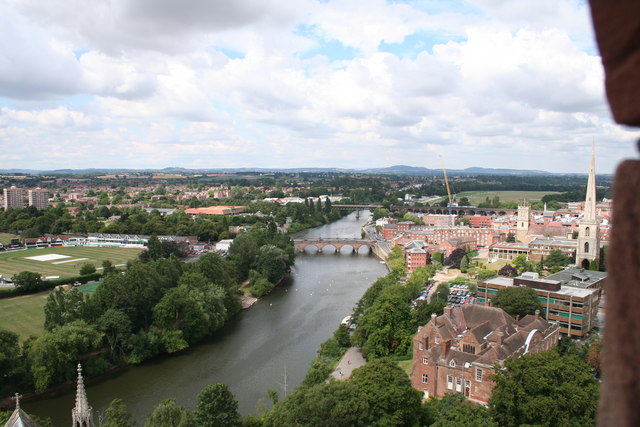
English: Worcester Bridge from The Cathedral Tower. On the left is the famous Worcester cricket ground and beyond that the high rise flats of St. John's. In the middle flows the River Severn towards the cathedral with the road bridge and beyond that the railway to Malvern and Hereford. On the right is the Bishops Palace with, beyond that, Worcester Technical College and then spire known as "Glover's Needle". |
| Date | |
| Source | From geograph.org.uk |
| Author | Bob Embleton |
| Attribution (required by the license) | Bob Embleton / Worcester Bridge from The Cathedral Tower / |
| Camera location | | View this and other nearby images on: OpenStreetMap |
|---|
_heading:292.00&language=en)
| Object location | | View this and other nearby images on: OpenStreetMap |
|---|
_heading:292.00&language=en)
Licensing
[edit]

|
This image was taken from the Geograph project collection. See this photograph's page on the Geograph website for the photographer's contact details. The copyright on this image is owned by Bob Embleton and is licensed for reuse under the Creative Commons Attribution-ShareAlike 2.0 license.
|
This file is licensed under the Creative Commons Attribution-Share Alike 2.0 Generic license.
Attribution: Bob Embleton
- You are free:
- to share – to copy, distribute and transmit the work
- to remix – to adapt the work
- Under the following conditions:
- attribution – You must give appropriate credit, provide a link to the license, and indicate if changes were made. You may do so in any reasonable manner, but not in any way that suggests the licensor endorses you or your use.
- share alike – If you remix, transform, or build upon the material, you must distribute your contributions under the same or compatible license as the original.
File history
Click on a date/time to view the file as it appeared at that time.
| Date/Time | Thumbnail | Dimensions | User | Comment | |
|---|---|---|---|---|---|
| current | 01:52, 1 February 2010 | | 640 × 427 (92 KB) | GeographBot (talk | contribs) | == {{int:filedesc}} == {{Information |description={{en|1=Worcester Bridge from The Cathedral Tower. On the left is the famous Worcester cricket ground and beyond that the high rise flats of St. John's. In the middle flows the River Severn towards the cath |
You cannot overwrite this file.
File usage on Commons
There are no pages that use this file.