File:Wookey Hole caves - geograph.org.uk - 937422.jpg
Jump to navigation
Jump to search
No higher resolution available.
Wookey_Hole_caves_-_geograph.org.uk_-_937422.jpg (640 × 427 pixels, file size: 70 KB, MIME type: image/jpeg)
Captions
Captions
Add a one-line explanation of what this file represents
Summary
[edit]
| Description |
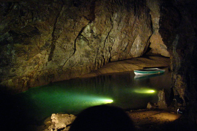
English: Wookey Hole caves After entering the modern dry entrance to the caves the tour descends "Hell's Ladder" to this chamber. The water below feeds the River Axe which emerges from the cliff at Wookey Hole. Flash photography is not permitted on the tour of the caves, for safety reasons (in the semi-darkness it can dazzle others). The boat in this photograph is pointing upstream. |
| Date | |
| Source | From geograph.org.uk |
| Author | Jim Champion |
| Attribution (required by the license) | Jim Champion / Wookey Hole caves / |
| Camera location | | View this and other nearby images on: OpenStreetMap |
|---|
_heading:135.00&language=en)
| Object location | | View this and other nearby images on: OpenStreetMap |
|---|
_heading:135.00&language=en)
Licensing
[edit]

|
This image was taken from the Geograph project collection. See this photograph's page on the Geograph website for the photographer's contact details. The copyright on this image is owned by Jim Champion and is licensed for reuse under the Creative Commons Attribution-ShareAlike 2.0 license.
|
This file is licensed under the Creative Commons Attribution-Share Alike 2.0 Generic license.
Attribution: Jim Champion
- You are free:
- to share – to copy, distribute and transmit the work
- to remix – to adapt the work
- Under the following conditions:
- attribution – You must give appropriate credit, provide a link to the license, and indicate if changes were made. You may do so in any reasonable manner, but not in any way that suggests the licensor endorses you or your use.
- share alike – If you remix, transform, or build upon the material, you must distribute your contributions under the same or compatible license as the original.
File history
Click on a date/time to view the file as it appeared at that time.
| Date/Time | Thumbnail | Dimensions | User | Comment | |
|---|---|---|---|---|---|
| current | 08:17, 22 February 2011 | | 640 × 427 (70 KB) | GeographBot (talk | contribs) | == {{int:filedesc}} == {{Information |description={{en|1=Wookey Hole caves After entering the modern dry entrance to the caves the tour descends "Hell's Ladder" to this chamber. The water below feeds the River Axe which emerges from the cliff at Wookey Ho |
You cannot overwrite this file.
File usage on Commons
There are no pages that use this file.