File:Wolsztyn location map.svg
Jump to navigation
Jump to search

Size of this PNG preview of this SVG file: 625 × 600 pixels. Other resolutions: 250 × 240 pixels | 500 × 480 pixels | 800 × 768 pixels | 1,067 × 1,024 pixels | 2,134 × 2,048 pixels | 1,658 × 1,591 pixels.
Original file (SVG file, nominally 1,658 × 1,591 pixels, file size: 2.21 MB)
Captions
Captions
Add a one-line explanation of what this file represents
| Description |
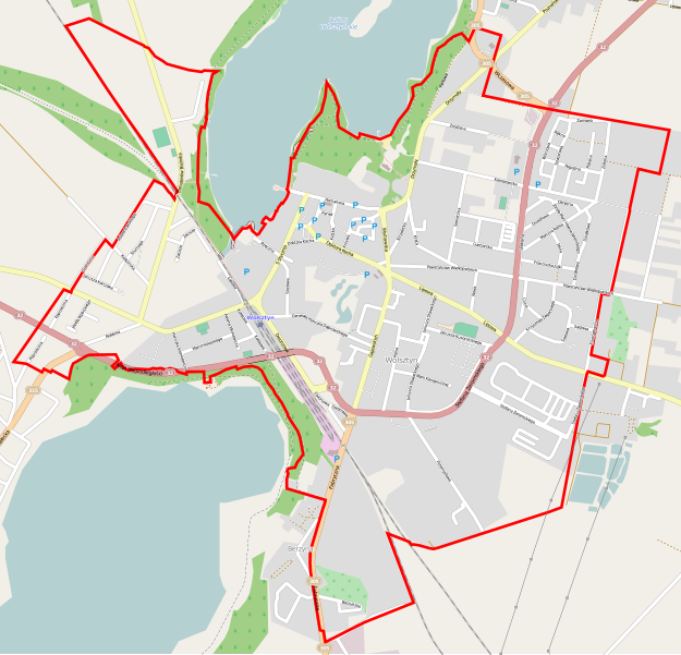
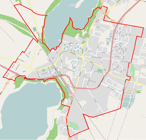
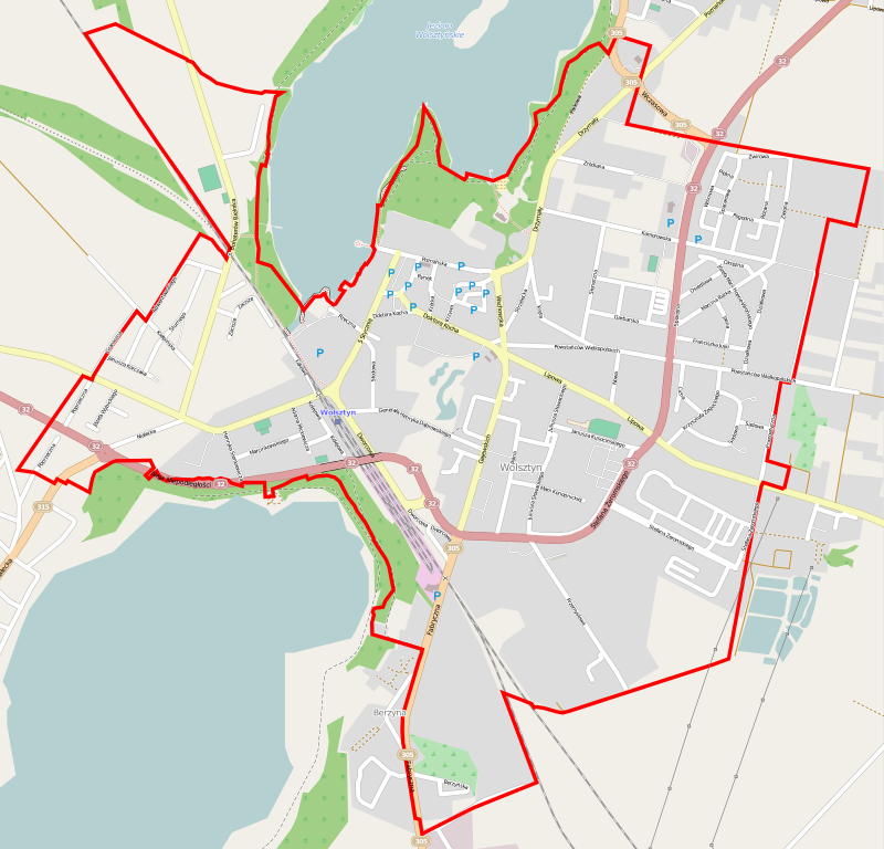
Polski: Mapa Wolsztyna, Polska
English: Map of Wolsztyn, Poland |
|||||||||
| Date | ||||||||||
| Source | You may find a page on the OpenStreetMap wiki page for Wolsztyn | |||||||||
| Creator |
OpenStreetMap contributors OpenStreetMap contributors |
|||||||||
| Permission (Reusing this file) |
OpenStreetMap data is available under the Open Database License (details). Map tiles are licensed under the Creative Commons Attribution-ShareAlike 2.0 license (CC-BY-SA 2.0).
This file is licensed under the Creative Commons Attribution-Share Alike 2.0 Generic license.
|
|||||||||
| Geotemporal data | ||||||||||
| Bounding box |
|
|||||||||
| Georeferencing | If inappropriate please set warp_status = skip to hide. | |||||||||
File history
Click on a date/time to view the file as it appeared at that time.
| Date/Time | Thumbnail | Dimensions | User | Comment | |
|---|---|---|---|---|---|
| current | 05:22, 6 June 2014 | | 1,658 × 1,591 (2.21 MB) | ArkadiuszZ (talk | contribs) | {{OpenStreetMap | name = Wolsztyn | location = Wolsztyn | description = {{pl|Mapa Wolsztyna, Polska}} {{en|Map of Wolsztyn, Poland}} | top = 52.1266 | left = 16.0888 | right = 16.1388 | b... |
You cannot overwrite this file.
File usage on Commons
There are no pages that use this file.
File usage on other wikis
The following other wikis use this file:
- Usage on eo.wikipedia.org
- Usage on fr.wikipedia.org
- Usage on pl.wikipedia.org
- Wolsztyn (stacja kolejowa)
- Parowozownia Wolsztyn
- Cmentarz żydowski w Wolsztynie
- Parafia Najświętszej Maryi Panny Niepokalanie Poczętej w Wolsztynie
- Parafia św. Józefa Opiekuna Kościoła Świętego w Wolsztynie
- Cmentarz Żołnierzy Radzieckich w Wolsztynie
- Muzeum Roberta Kocha w Wolsztynie
- Zbór Kościoła Zielonoświątkowego „Dobra Nowina” w Wolsztynie
- Kościół Najświętszej Maryi Panny Niepokalanie Poczętej w Wolsztynie
- Skansen Budownictwa Ludowego Zachodniej Wielkopolski
- Pałac Wolsztyński
- Kościół Wniebowstąpienia Pańskiego w Wolsztynie
- Muzeum Regionalne w Wolsztynie
- Moduł:Mapa/dane/Wolsztyn
- Osiedle Helena (Wolsztyn)
- Pomnik Powstańca Wielkopolskiego w Wolsztynie
- Cmentarz ewangelicki w Wolsztynie
- Usage on pl.wikibooks.org
- Usage on pt.wikipedia.org