File:WileyPostSeaplaneBaseEnvirons1936.jpg
Jump to navigation
Jump to search
Size of this preview: 800 × 474 pixels. Other resolutions: 320 × 190 pixels | 640 × 379 pixels | 1,024 × 607 pixels | 1,280 × 758 pixels | 2,560 × 1,516 pixels | 6,000 × 3,554 pixels.
Original file (6,000 × 3,554 pixels, file size: 1.33 MB, MIME type: image/jpeg)
Captions
Captions
Add a one-line explanation of what this file represents
Summary
[edit]
| Description |
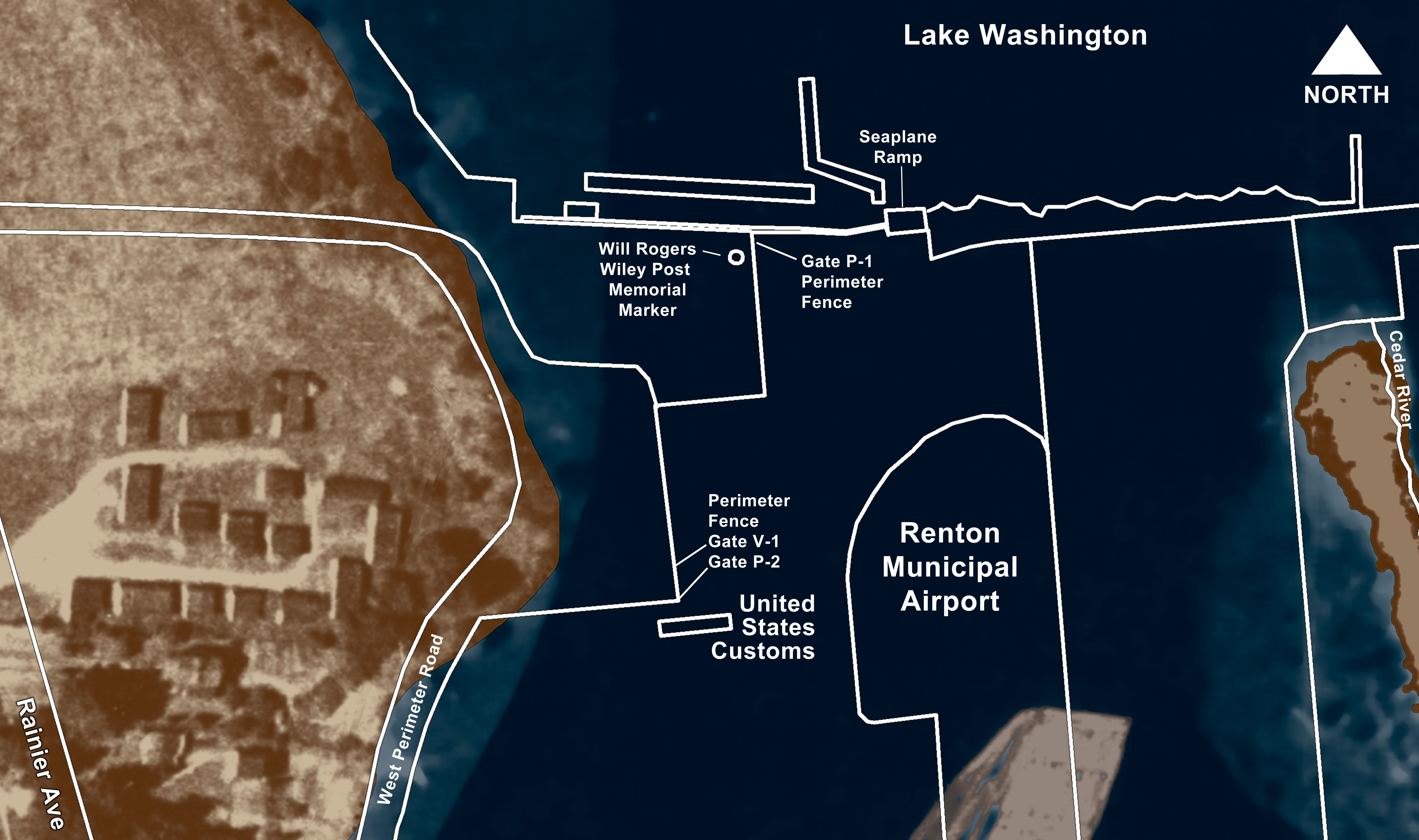
English: Illustration comparing current airport features with 1936 shoreline |
| Date | |
| Source | Own work |
| Author | Geodesy99 |
Licensing
[edit]
I, the copyright holder of this work, hereby publish it under the following license:
This file is licensed under the Creative Commons Attribution 3.0 Unported license.
- You are free:
- to share – to copy, distribute and transmit the work
- to remix – to adapt the work
- Under the following conditions:
- attribution – You must give appropriate credit, provide a link to the license, and indicate if changes were made. You may do so in any reasonable manner, but not in any way that suggests the licensor endorses you or your use.
File history
Click on a date/time to view the file as it appeared at that time.
| Date/Time | Thumbnail | Dimensions | User | Comment | |
|---|---|---|---|---|---|
| current | 22:43, 20 February 2011 | | 6,000 × 3,554 (1.33 MB) | Geodesy99 (talk | contribs) | {{Information |Description ={{en|1=Illustration comparing current airport features with 1936 shoreline}} |Source ={{own}} |Author =Geodesy99 |Date =2011-02-20 |Permission = |other_versions = }} |
You cannot overwrite this file.
File usage on Commons
There are no pages that use this file.
File usage on other wikis
The following other wikis use this file:
- Usage on en.wikipedia.org
- Usage on fa.wikipedia.org