File:Weiberlenner-Pano.jpg
Original file (8,142 × 1,568 pixels, file size: 6.97 MB, MIME type: image/jpeg)
Captions
Summary
[edit]Germany Hesse Rheingau-Taunus-Kreis Niedernhausen Oberjosbach - Taunus 310 m ü. NHN
DescriptionWeiberlenner-Pano.jpg |
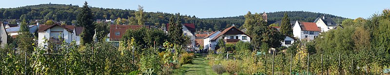
Deutsch: Von den Gärten unweit des Börnchens blicken wir auf Oberjosbach mit Buchwalds- und Lindenkopf. |
Date | Taken on 29 September 2013, 16:35:04 |
Source | Own work |
Author | FkMohr |
Camera location | 50° 10′ 04.45″ N, 8° 20′ 16.02″ E | View this and other nearby images on: OpenStreetMap | 50.167902; 8.337784 |
---|
HE {PF130929-1636} übertragen von Panoramio (User Mohr=1080936, Bild 107270685).
Licensing
[edit]- You are free:
- to share – to copy, distribute and transmit the work
- to remix – to adapt the work
- Under the following conditions:
- attribution – You must give appropriate credit, provide a link to the license, and indicate if changes were made. You may do so in any reasonable manner, but not in any way that suggests the licensor endorses you or your use.
- share alike – If you remix, transform, or build upon the material, you must distribute your contributions under the same or compatible license as the original.
File history
Click on a date/time to view the file as it appeared at that time.
Date/Time | Thumbnail | Dimensions | User | Comment | |
---|---|---|---|---|---|
current | 12:25, 25 September 2017 | 8,142 × 1,568 (6.97 MB) | FkMohr (talk | contribs) | Transferred from http://static.panoramio.com/photos/original/107270685.jpg |
You cannot overwrite this file.
File usage on Commons
There are no pages that use this file.
Metadata
This file contains additional information such as Exif metadata which may have been added by the digital camera, scanner, or software program used to create or digitize it. If the file has been modified from its original state, some details such as the timestamp may not fully reflect those of the original file. The timestamp is only as accurate as the clock in the camera, and it may be completely wrong.
Image title |
|
---|---|
Camera manufacturer | SONY |
Camera model | SLT-A65V |
Author | DSC01073;Friedo |
Exposure time | 1/160 sec (0.00625) |
F-number | f/8 |
ISO speed rating | 100 |
Date and time of data generation | 16:35, 29 September 2013 |
Lens focal length | 40 mm |
Latitude | 50° 10′ 4.45″ N |
Longitude | 8° 20′ 16.02″ E |
Altitude | 310 meters above sea level |
Short title |
|
City that the picture was taken in | Niedernhausen |
City shown | Niedernhausen |
Orientation | Normal |
Horizontal resolution | 350 dpi |
Vertical resolution | 350 dpi |
Software used | SLT-A65V v1.04 |
File change date and time | 10:55, 22 May 2014 |
Y and C positioning | Co-sited |
Exposure Program | Normal program |
Exif version | 2.3 |
Date and time of digitizing | 16:35, 29 September 2013 |
Meaning of each component |
|
Image compression mode | 4 |
APEX brightness | 8.57578125 |
APEX exposure bias | 0 |
Maximum land aperture | 4.96875 APEX (f/5.6) |
Metering mode | Pattern |
Light source | Daylight |
Flash | Flash did not fire, compulsory flash suppression |
DateTimeOriginal subseconds | 00 |
DateTimeDigitized subseconds | 00 |
Supported Flashpix version | 1 |
Color space | sRGB |
File source | Digital still camera |
Scene type | A directly photographed image |
Custom image processing | Normal process |
Exposure mode | Auto exposure |
White balance | Manual white balance |
Focal length in 35 mm film | 60 mm |
Scene capture type | Standard |
Contrast | Normal |
Saturation | Normal |
Sharpness | Normal |
Unique image ID | 025A6DA3571A4585A05185A40CD2E5EA |
GPS time (atomic clock) | 14:35 |
Receiver status | Measurement in progress |
Measurement mode | 3-dimensional measurement |
Measurement precision | Poor (1.3094) |
Speed unit | Kilometers per hour |
Speed of GPS receiver | 0.097 |
Reference for direction of movement | True direction |
Direction of movement | 348.61 |
Reference for direction of image | True direction |
Direction of image | 338.22 |
Geodetic survey data used | WGS-84 |
Latitude destination | 50° 10′ 49.01″ N |
Longitude of destination | 8° 19′ 48.21″ E |
GPS date | 29 September 2013 |
GPS differential correction | 0 |
GPS tag version | 2.3.0.0 |
Supported Flashpix version | 1 |
Image width | 8,192 px |
Image height | 1,856 px |
Compression scheme | JPEG (old) |
Country that the picture was taken in | Deutschland |
Province or state that the picture was taken in | Hessen |
Sublocation of the city that the picture was taken in | Oberjosbach |
Code for country shown | DEU |
Sublocation of city shown | Oberjosbach |
Country shown | Deutschland |
Province or state shown | Hessen |
IIM version | 4 |