File:Wągrowiec location map.svg
Jump to navigation
Jump to search

Size of this PNG preview of this SVG file: 562 × 599 pixels. Other resolutions: 225 × 240 pixels | 450 × 480 pixels | 721 × 768 pixels | 961 × 1,024 pixels | 1,922 × 2,048 pixels | 1,019 × 1,086 pixels.
Original file (SVG file, nominally 1,019 × 1,086 pixels, file size: 856 KB)
Captions
Captions
Add a one-line explanation of what this file represents
| Description |
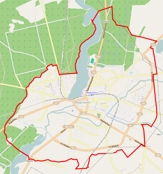
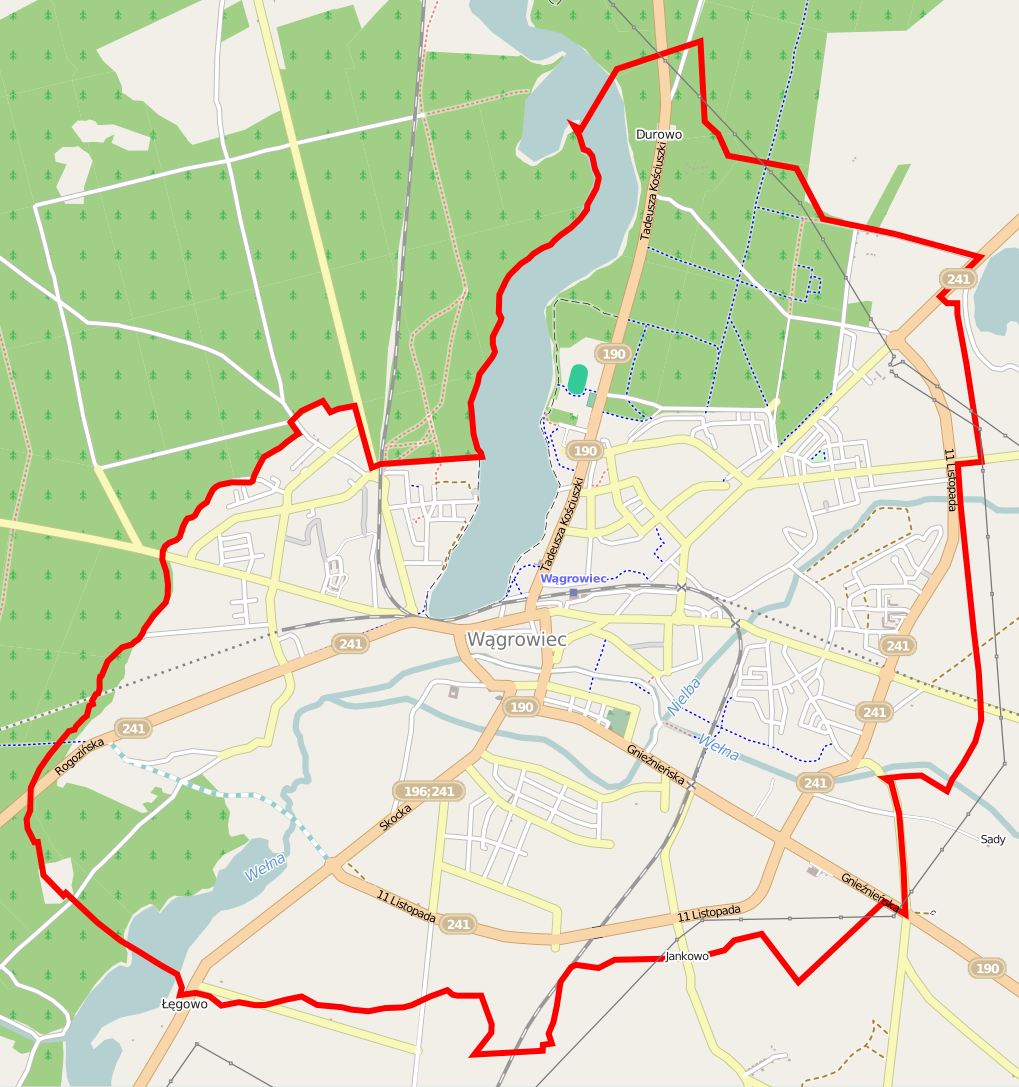
Polski: Mapa Wągrowca, Polska
English: Map of Wągrowiec, Poland |
|||||||||
| Date | ||||||||||
| Source | You may find a page on the OpenStreetMap wiki page for Wągrowiec | |||||||||
| Creator |
OpenStreetMap contributors OpenStreetMap contributors |
|||||||||
| Permission (Reusing this file) |
OpenStreetMap data is available under the Open Database License (details). Map tiles are licensed under the Creative Commons Attribution-ShareAlike 2.0 license (CC-BY-SA 2.0).
This file is licensed under the Creative Commons Attribution-Share Alike 2.0 Generic license.
|
|||||||||
| Geotemporal data | ||||||||||
| Bounding box |
|
|||||||||
| Georeferencing | If inappropriate please set warp_status = skip to hide. | |||||||||
File history
Click on a date/time to view the file as it appeared at that time.
| Date/Time | Thumbnail | Dimensions | User | Comment | |
|---|---|---|---|---|---|
| current | 19:09, 6 June 2014 | | 1,019 × 1,086 (856 KB) | ArkadiuszZ (talk | contribs) | {{OpenStreetMap | name = Wągrowiec | location = Wągrowiec | description = {{pl|Mapa Wągrowca, Polska}} {{en|Map of Wągrowiec, Poland}} | top = 52.8398 | left = 17.1541 | right = 17.23... |
You cannot overwrite this file.
File usage on Commons
There are no pages that use this file.
File usage on other wikis
The following other wikis use this file:
- Usage on fr.wikipedia.org
- Usage on pl.wikipedia.org
- Skrzyżowanie Wełny z Nielbą
- Durowo (jezioro)
- Cmentarz żydowski w Wągrowcu
- Wągrowiec (stacja kolejowa)
- Stadion im. Stanisława Bąka
- Parafia św. Wojciecha w Wągrowcu
- Parafia bł. Michała Kozala BM w Wągrowcu
- Parafia Wniebowzięcia Najświętszej Maryi Panny w Wągrowcu
- Parafia św. Jakuba Apostoła w Wągrowcu
- Kościół Wniebowzięcia Najświętszej Marii Panny w Wągrowcu
- Opactwo Cystersów w Wągrowcu
- Kościół św. Jakuba Apostoła w Wągrowcu
- Kościół Świętych Apostołów Piotra i Pawła w Wągrowcu
- TSR Wągrowiec
- Muzeum Regionalne w Wągrowcu
- Moduł:Mapa/dane/Wągrowiec
- Berdychowo (Wągrowiec)
- Kaliska (Wągrowiec)
- Durowo (Wągrowiec)
- Straszewo (Wągrowiec)
- Osada (Wągrowiec)
- Osiedle Wschód (Wągrowiec)
- Osiedle Kolejowe (Wągrowiec)
- Osiedle Jeżyka
- Osiedle Północ (Wągrowiec)
- Osiedle Niepodległości (Wągrowiec)
- Marcinkowo (Wągrowiec)
- Cmentarz ewangelicki w Wągrowcu
- Kościół św. Wojciecha w Wągrowcu
- Kościół bł. Michała Kozala Biskupa i Męczennika w Wągrowcu
- Usage on pl.wikibooks.org
- Usage on pt.wikipedia.org