File:View towards Dover from North Downs Way 2736551 87b14c4c.jpg
Jump to navigation
Jump to search
No higher resolution available.
View_towards_Dover_from_North_Downs_Way_2736551_87b14c4c.jpg (782 × 586 pixels, file size: 131 KB, MIME type: image/jpeg)
Captions
Captions
Add a one-line explanation of what this file represents
Summary
[edit]
| Description |
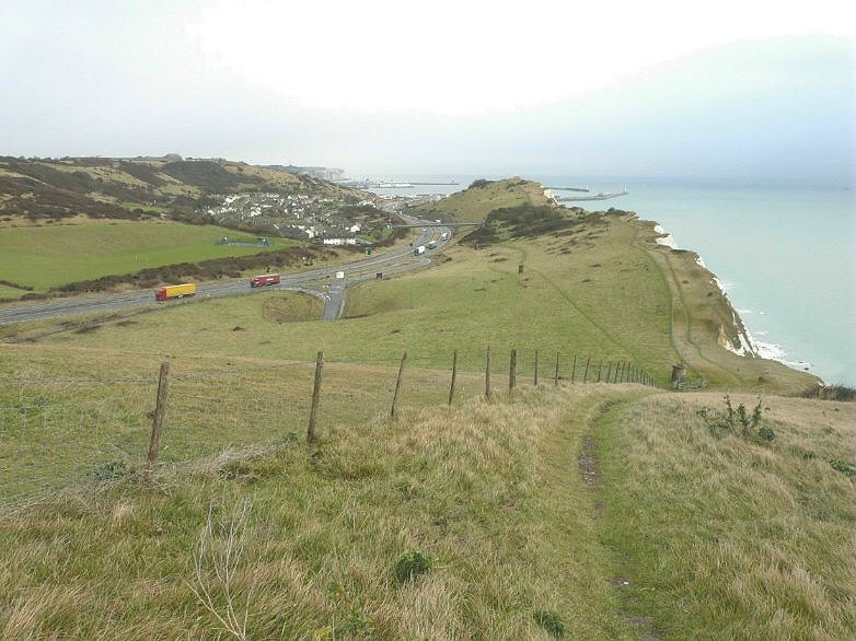
English: View towards Dover from North Downs Way. The dual carriageway of the A20 (built in 1993) with the exit/entrance junction to Samphire Hoe winds past the Aycliff estate (built in the 1950s) towards the port of Dover. The route of the Folkestone to Dover railway is marked by two ventilation chimneys to the right of the Samphire Hoe road junction. |
| Date | |
| Source | From geograph.org.uk |
| Author | John Baker |
| Permission (Reusing this file) |
Creative Commons Attribution Share-alike license 2.0 |
| Attribution (required by the license) | John Baker / View towards Dover from North Downs Way / |
| Camera location | | View this and other nearby images on: OpenStreetMap |
|---|
_heading:90.00&language=en)
| Object location | | View this and other nearby images on: OpenStreetMap |
|---|
_heading:90.00&language=en)
Licensing
[edit]

|
This image was taken from the Geograph project collection. See this photograph's page on the Geograph website for the photographer's contact details. The copyright on this image is owned by John Baker and is licensed for reuse under the Creative Commons Attribution-ShareAlike 2.0 license.
|
This file is licensed under the Creative Commons Attribution-Share Alike 2.0 Generic license.
Attribution: John Baker
- You are free:
- to share – to copy, distribute and transmit the work
- to remix – to adapt the work
- Under the following conditions:
- attribution – You must give appropriate credit, provide a link to the license, and indicate if changes were made. You may do so in any reasonable manner, but not in any way that suggests the licensor endorses you or your use.
- share alike – If you remix, transform, or build upon the material, you must distribute your contributions under the same or compatible license as the original.
File history
Click on a date/time to view the file as it appeared at that time.
| Date/Time | Thumbnail | Dimensions | User | Comment | |
|---|---|---|---|---|---|
| current | 09:29, 21 July 2021 | | 782 × 586 (131 KB) | Geograph Update Bot (talk | contribs) | Higher-resolution version from Geograph |
| 17:53, 7 March 2021 |  | 640 × 480 (77 KB) | Storye book (talk | contribs) | == {{int:filedesc}} == {{Information |Description={{en|1=View towards Dover from North Downs Way. The dual carriageway of the A20 (built in 1993) with the exit/entrance junction to Samphire Hoe winds past the Aycliff estate (built in the 1950s) towards the port of Dover. The route of the Folkestone to Dover railway is marked by two ventilation chimneys to the right of the Samphire Hoe road junction.}} |Source=From [https://www.geograph.org.uk/photo/2736551 geograph.org.uk] |Date=2011-12-18 |A... |
You cannot overwrite this file.
File usage on Commons
There are no pages that use this file.