File:View north west across St Helena, taken c1982. Location matched well, in Google Earth position north at 11-00, go to earth level, match the zig-zag road in the distant right, the bare patch dead centre, and the pine on - panoramio.jpg
Jump to navigation
Jump to search

Size of this preview: 800 × 545 pixels. Other resolutions: 320 × 218 pixels | 640 × 436 pixels | 1,024 × 697 pixels | 1,280 × 871 pixels | 2,560 × 1,743 pixels | 4,141 × 2,819 pixels.
Original file (4,141 × 2,819 pixels, file size: 7 MB, MIME type: image/jpeg)
Captions
Captions
Add a one-line explanation of what this file represents
Summary
[edit]
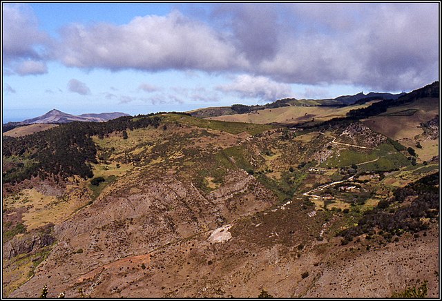
| Description | View north west across St Helena, taken c1982. Location matched well; in Google Earth position north at 11:00, go to earth level, match the zig-zag road in the distant right, the bare patch dead centre, and the pine on Diana's Peak on the right. Image from scanned slide. Peter Neaum. | ||
| Date | Taken on 17 November 2013 | ||
| Source | https://web.archive.org/web/20161031063550/http://www.panoramio.com/photo/112963962 | ||
| Author | Peter Neaum | ||
| Permission (Reusing this file) |
This file is licensed under the Creative Commons Attribution 3.0 Unported license. Attribution: Peter Neaum
|
||
| Panoramio Tags | Saint Helena, 1985, Neaum, Saint Helena, Sandy Bay, slide |
| Camera location | | View this and other nearby images on: OpenStreetMap |
|---|
File history
Click on a date/time to view the file as it appeared at that time.
| Date/Time | Thumbnail | Dimensions | User | Comment | |
|---|---|---|---|---|---|
| current | 00:38, 10 May 2017 | | 4,141 × 2,819 (7 MB) | Panoramio upload bot (talk | contribs) | == {{int:filedesc}} == {{Information |description=View north west across St Helena, taken c1982. Location matched well; in Google Earth position north at 11:00, go to earth level, match the zig-zag road in the distant right, the bare patch dead centr... |
You cannot overwrite this file.
File usage on Commons
There are no pages that use this file.
File usage on other wikis
The following other wikis use this file:
- Usage on ceb.wikipedia.org
- Usage on www.wikidata.org