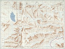
File:Txu-oclc-10552568-nh46-14.jpg
Jump to navigation
Jump to search

Size of this preview: 790 × 600 pixels. Other resolutions: 316 × 240 pixels | 633 × 480 pixels | 1,012 × 768 pixels | 1,280 × 972 pixels | 2,560 × 1,943 pixels | 5,000 × 3,795 pixels.
Original file (5,000 × 3,795 pixels, file size: 4.04 MB, MIME type: image/jpeg)
Categories:
- China AMS Topographic Maps
- Old maps of Arunachal Pradesh
- Maps of Lhokha
- 1954 maps of Asia
- Gold mines
- Trigu Tso
- Maps of Sikang
- Trigu Dzong
- Dzongs of Tibet
- Konam Dzong
- Yeti, Tibet
- Gompa
- Darljiling Gompa
- Sharkhalep La
- Mountain passes in the Himalayas
- Trashi Tongme Gompa
- Lhontse Dzong
- Dongkar Dzong
- Nyala La
- Chayul Dzong
- Gyala Lamo La
- Tra La
- Yaksang La
- Gomokong La
- Gendru La
- Cho La
- Shamda La
- Lhakong La
- Seon La
- Porom La
- Kamba La
- Druk La
- Karkang La
- Shoboto La
- Tak La
- Se La
- Shangya La
- Baru La
- Gu La
- Kego La
- Kambala Pass
- Hor La
- Mata La
- Dochung La
- Sire La
- Namtu La
- Amaten La
- Karu La
- Gyandro La
- McMahon Line


