File:Trecho do Mappa da Capitania de São Paulo c. 1750.jpg
Jump to navigation
Jump to search
Size of this preview: 800 × 401 pixels. Other resolutions: 320 × 161 pixels | 640 × 321 pixels | 1,024 × 514 pixels | 1,919 × 963 pixels.
Original file (1,919 × 963 pixels, file size: 424 KB, MIME type: image/jpeg)
Captions
Captions
Add a one-line explanation of what this file represents
Summary
[edit]
| Description |
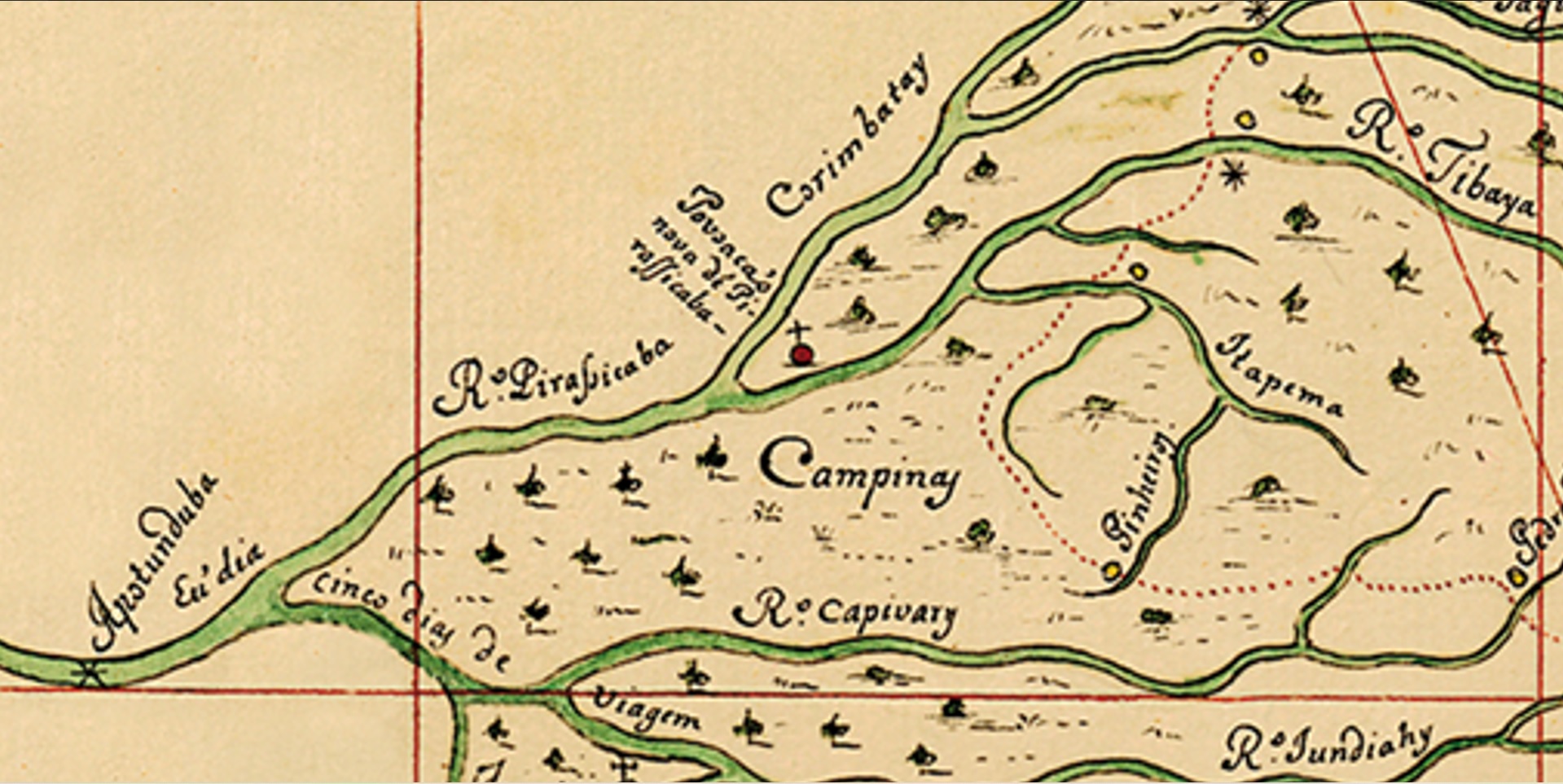
Português: Documento cartográfico produzido na década de 1750, sob encomenda da Coroa Portuguesa, mostrando a Capitania de São Paulo e caminhos para as regiões das minas na América do Sul sob domínio lusitano.
English: Cartographic document produced during the 1750s by order of the Portuguese Crown, showing the São Paulo Captaincy and ways to the mining regions in South America under portuguese domain. |
| Date | circa 1750 |
| Source | Biblioteca Digital Luso-Brasileira |
| Author | Francesco Tosi Colombina |
Licensing
[edit]
|
This work is in the public domain in its country of origin and other countries and areas where the copyright term is the author's life plus 70 years or fewer. This work is in the public domain in the United States because it was published (or registered with the U.S. Copyright Office) before January 1, 1929. | |
| This file has been identified as being free of known restrictions under copyright law, including all related and neighboring rights. | |
File history
Click on a date/time to view the file as it appeared at that time.
| Date/Time | Thumbnail | Dimensions | User | Comment | |
|---|---|---|---|---|---|
| current | 18:15, 15 September 2022 | | 1,919 × 963 (424 KB) | IAHBatatais (talk | contribs) | Uploaded a work by Francesco Tosi Colombina from Biblioteca Digital Luso-Brasileira with UploadWizard |
You cannot overwrite this file.
File usage on Commons
The following 2 pages use this file:
File usage on other wikis
The following other wikis use this file:
- Usage on pt.wikipedia.org