File:Totes Gebirge, eastern side, pano.jpg
Jump to navigation
Jump to search

Size of this preview: 800 × 281 pixels. Other resolutions: 320 × 112 pixels | 640 × 224 pixels | 1,024 × 359 pixels | 1,280 × 449 pixels | 2,560 × 898 pixels | 6,000 × 2,104 pixels.
Original file (6,000 × 2,104 pixels, file size: 7.1 MB, MIME type: image/jpeg)
Captions
Captions
Add a one-line explanation of what this file represents
Summary
[edit]
| Description |
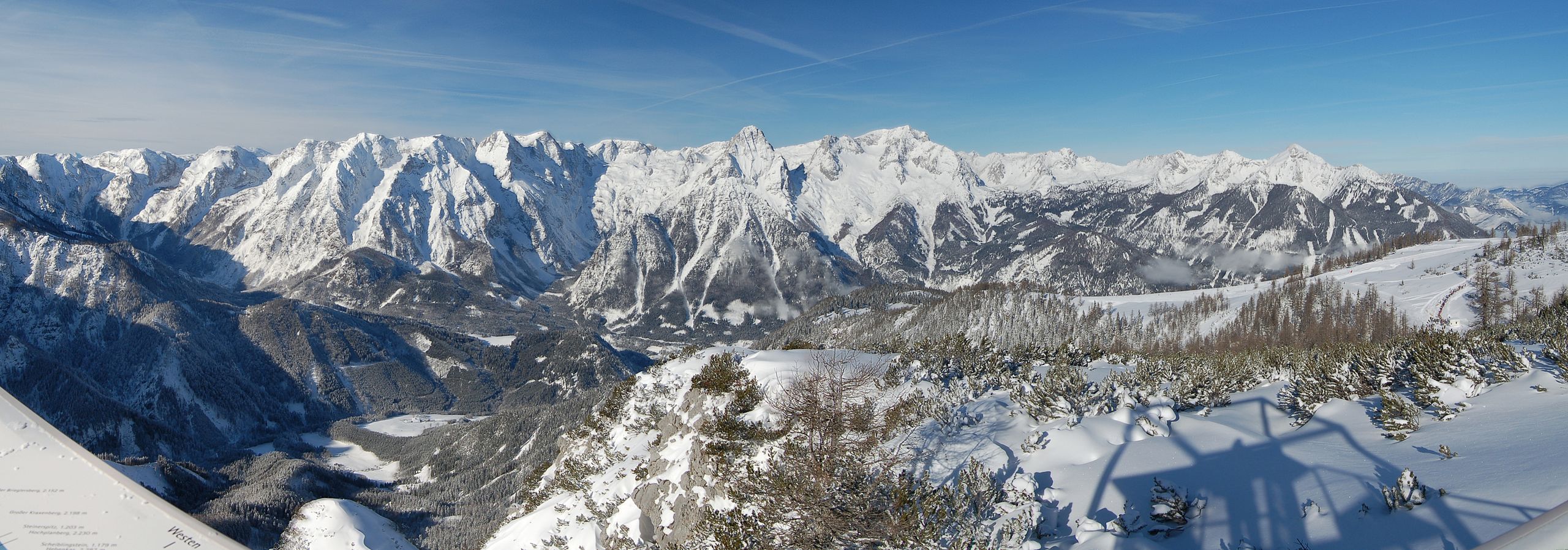
English: Totes Gebirge, Styria. East face of the mountain range falling down to the Stodertal. Here are the highest mountains of the group, Großer Priel (right), and Spitzmauer (left). For further details see annotations.
Deutsch: Totes Gebirge, Steiermark. Ostseite der Gruppe über dem hinteren Stodertal. Hier sind die höchsten Gipfel der Gruppe, Großer Priel (rechts), und Spitzmauer (links). Ganz rechts der kleine Priel. Mehr in den Annotierungen. |
| Date | |
| Source | Own work |
| Author | Herzi Pinki |
| Camera location | | View this and other nearby images on: OpenStreetMap |
|---|
This panoramic image was created with Autostitch (stitched images may differ from reality).
Licensing
[edit]
I, the copyright holder of this work, hereby publish it under the following licenses:
This file is licensed under the Creative Commons Attribution-Share Alike 3.0 Unported license.
- You are free:
- to share – to copy, distribute and transmit the work
- to remix – to adapt the work
- Under the following conditions:
- attribution – You must give appropriate credit, provide a link to the license, and indicate if changes were made. You may do so in any reasonable manner, but not in any way that suggests the licensor endorses you or your use.
- share alike – If you remix, transform, or build upon the material, you must distribute your contributions under the same or compatible license as the original.

|
Permission is granted to copy, distribute and/or modify this document under the terms of the GNU Free Documentation License, Version 1.2 or any later version published by the Free Software Foundation; with no Invariant Sections, no Front-Cover Texts, and no Back-Cover Texts. A copy of the license is included in the section entitled GNU Free Documentation License. |
You may select the license of your choice.
| Annotations | This image is annotated: View the annotations at Commons |
File history
Click on a date/time to view the file as it appeared at that time.
| Date/Time | Thumbnail | Dimensions | User | Comment | |
|---|---|---|---|---|---|
| current | 00:07, 30 January 2013 | 6,000 × 2,104 (7.1 MB) | Slick-o-bot (talk | contribs) | Bot: convert to a non-interlaced jpeg (see bug #17645) | |
| 16:46, 21 February 2010 | 6,000 × 2,104 (6.78 MB) | Herzi Pinki (talk | contribs) | {{Information |Description={{en|1=Totes Gebirge, Styria. East face of the mountain range falling down to the Stodertal. Here are the highest mountains of the group, Großer Priel (right), and Spitzmauer (left). For further details see annotations.}} { |
You cannot overwrite this file.
File usage on Commons
The following page uses this file:
File usage on other wikis
The following other wikis use this file:
- Usage on arz.wikipedia.org
- Usage on ceb.wikipedia.org
- Usage on de.wikipedia.org
- Usage on he.wikipedia.org
- Usage on sv.wikipedia.org
- Usage on www.wikidata.org