File:TodenArakawaline linemap Japanese.jpg
Jump to navigation
Jump to search

Size of this preview: 800 × 593 pixels. Other resolutions: 320 × 237 pixels | 640 × 475 pixels | 1,024 × 759 pixels | 1,280 × 949 pixels | 2,560 × 1,899 pixels | 3,898 × 2,891 pixels.
Original file (3,898 × 2,891 pixels, file size: 1.38 MB, MIME type: image/jpeg)
Captions
Captions
Add a one-line explanation of what this file represents
Summary
[edit]
| Description |
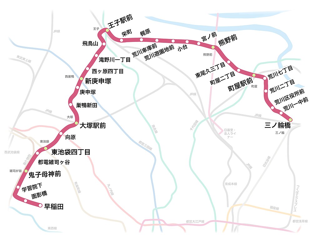
日本語: 都電荒川線(東京さくらトラム)の路線図。 |
| Date | |
| Source | Own work |
| Author | しんぎんぐきゃっと |
Licensing
[edit]
I, the copyright holder of this work, hereby publish it under the following license:
This file is licensed under the Creative Commons Attribution-Share Alike 4.0 International license.
- You are free:
- to share – to copy, distribute and transmit the work
- to remix – to adapt the work
- Under the following conditions:
- attribution – You must give appropriate credit, provide a link to the license, and indicate if changes were made. You may do so in any reasonable manner, but not in any way that suggests the licensor endorses you or your use.
- share alike – If you remix, transform, or build upon the material, you must distribute your contributions under the same or compatible license as the original.
File history
Click on a date/time to view the file as it appeared at that time.
| Date/Time | Thumbnail | Dimensions | User | Comment | |
|---|---|---|---|---|---|
| current | 11:29, 8 March 2023 | | 3,898 × 2,891 (1.38 MB) | しんぎんぐきゃっと (talk | contribs) | |
| 06:28, 23 February 2023 |  | 3,898 × 2,891 (1.38 MB) | しんぎんぐきゃっと (talk | contribs) | ||
| 03:37, 18 September 2022 |  | 3,898 × 2,891 (1.38 MB) | しんぎんぐきゃっと (talk | contribs) | ||
| 12:20, 25 July 2022 |  | 3,898 × 2,891 (1.38 MB) | しんぎんぐきゃっと (talk | contribs) | Uploaded own work with UploadWizard |
You cannot overwrite this file.
File usage on Commons
The following 6 pages use this file:
- User:Chumwa/OgreBot/Public transport information/2022 September 11-20
- User:Chumwa/OgreBot/Public transport information/2023 February 19-28
- User:Chumwa/OgreBot/Public transport information/2023 March 1-10
- User:Chumwa/OgreBot/Transport Maps/2022 September 11-20
- User:Chumwa/OgreBot/Transport Maps/2023 February 19-28
- User:Chumwa/OgreBot/Transport Maps/2023 March 1-10
File usage on other wikis
The following other wikis use this file:
- Usage on ja.wikipedia.org
- Usage on zh.wikipedia.org