File:Tectonic map Mediterranean UK.svg
Jump to navigation
Jump to search

Size of this PNG preview of this SVG file: 800 × 447 pixels. Other resolutions: 320 × 179 pixels | 640 × 358 pixels | 1,024 × 572 pixels | 1,280 × 715 pixels | 2,560 × 1,430 pixels.
Original file (SVG file, nominally 1,280 × 715 pixels, file size: 608 KB)
Captions
Captions
Add a one-line explanation of what this file represents
Summary
[edit]| Description |
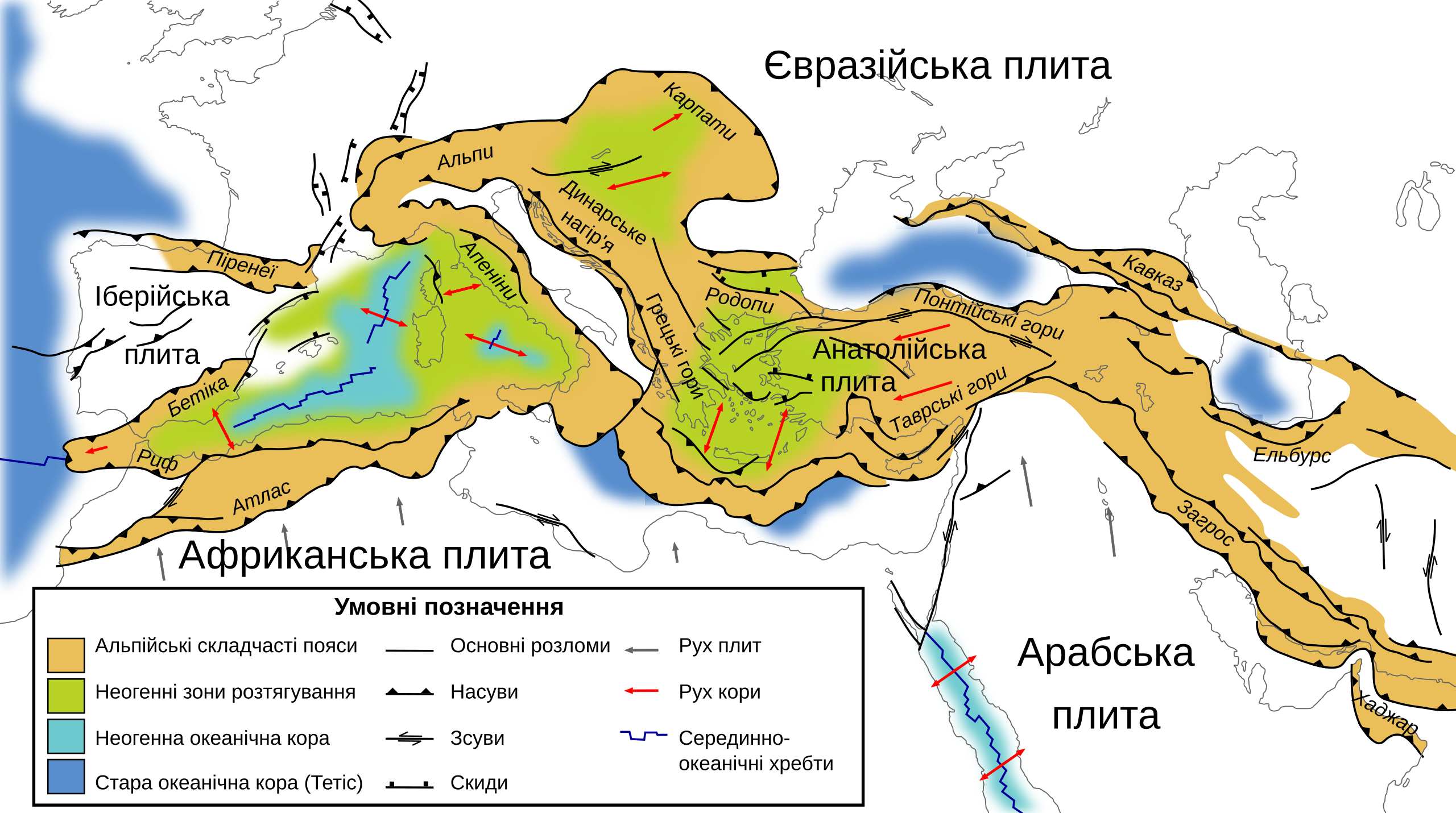
Українська: Тектонічна карта південної Європи, північної Африки та близького сходу. Зображає структури західного Альпійського гірського поясу. Показані лише структури часів третинного періоду. |
| Date | |
| Source |
This file was derived from: Tectonic map Mediterranean EN.svg |
| Author |
|
| Other versions |
[]
|


Licensing
[edit]
This file is licensed under the Creative Commons Attribution-Share Alike 1.0 Generic license.
- You are free:
- to share – to copy, distribute and transmit the work
- to remix – to adapt the work
- Under the following conditions:
- attribution – You must give appropriate credit, provide a link to the license, and indicate if changes were made. You may do so in any reasonable manner, but not in any way that suggests the licensor endorses you or your use.
- share alike – If you alter, transform, or build upon this work, you must distribute the resulting work under the same license as the original.
File history
Click on a date/time to view the file as it appeared at that time.
| Date/Time | Thumbnail | Dimensions | User | Comment | |
|---|---|---|---|---|---|
| current | 11:39, 2 April 2023 | | 1,280 × 715 (608 KB) | SerhiyHelp (talk | contribs) | Uploaded a work by *Original: Woudloper *Derivative work: {{U|SerhiyHelp}} from {{derived from|Tectonic map Mediterranean EN.svg}} with UploadWizard |
You cannot overwrite this file.
File usage on Commons
The following 11 pages use this file:
- User:SerhiyHelp
- File:Tectonic map Mediterranean DE.svg
- File:Tectonic map Mediterranean EN.svg
- File:Tectonic map Mediterranean FR.svg
- File:Tectonic map Mediterranean He.jpg
- File:Tectonic map Mediterranean IT.svg
- File:Tectonic map Mediterranean MK.svg
- File:Tectonic map Mediterranean NL.svg
- File:Tectonic map Mediterranean UK.svg
- File:Tectonic map Mediterranean es.svg
- Template:Other versions/Tectonic map Mediterranean
File usage on other wikis
The following other wikis use this file:
- Usage on uk.wikipedia.org