
File:TIR-Map-World.svg

Size of this PNG preview of this SVG file: 800 × 411 pixels. Other resolutions: 320 × 164 pixels | 640 × 329 pixels | 1,024 × 526 pixels | 1,280 × 657 pixels | 2,560 × 1,314 pixels.
Original file (SVG file, nominally 2,560 × 1,314 pixels, file size: 1.1 MB)
Captions
Captions
Add a one-line explanation of what this file represents
Summary
[edit]
| Description |
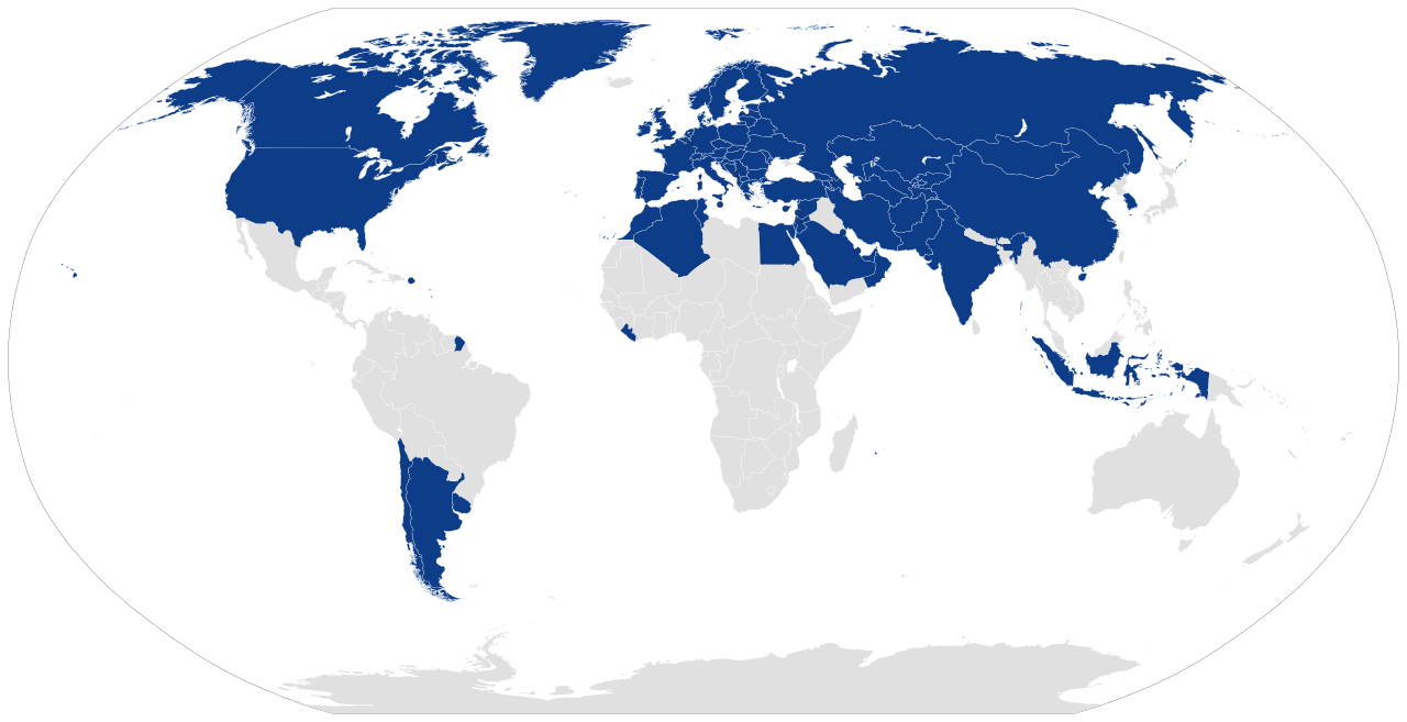
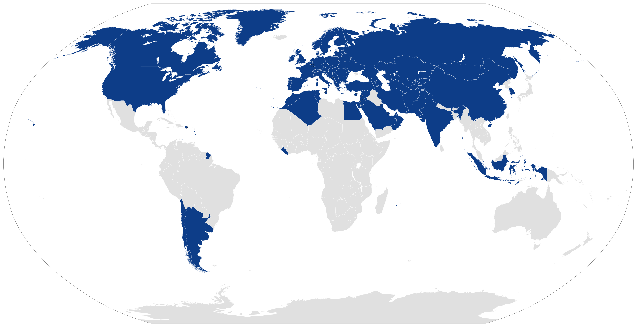
Español: Países que utilizan el TIR English: Members of the Convention on International Transport of Goods Under Cover of TIR Carnets (TIR Convention), represented in dark blue. |
| Date | |
| Source |
|
| Author | Own work |
Licensing
[edit]
This file is licensed under the Creative Commons Attribution-Share Alike 4.0 International license.
- You are free:
- to share – to copy, distribute and transmit the work
- to remix – to adapt the work
- Under the following conditions:
- attribution – You must give appropriate credit, provide a link to the license, and indicate if changes were made. You may do so in any reasonable manner, but not in any way that suggests the licensor endorses you or your use.
- share alike – If you remix, transform, or build upon the material, you must distribute your contributions under the same or compatible license as the original.
File history
Click on a date/time to view the file as it appeared at that time.
| Date/Time | Thumbnail | Dimensions | User | Comment | |
|---|---|---|---|---|---|
| current | 10:21, 19 March 2021 | | 2,560 × 1,314 (1.1 MB) | Mwkhateeb (talk | contribs) | Reverted to version as of 00:58, 19 March 2021 (UTC) |
| 10:18, 19 March 2021 |  | 2,560 × 1,314 (1.1 MB) | Mwkhateeb (talk | contribs) | Fixed SVG file to reflect updates to convention parties | |
| 00:58, 19 March 2021 |  | 2,560 × 1,314 (1.1 MB) | Mwkhateeb (talk | contribs) | Updated to Egypt. (Accession in Dec 2020) | |
| 00:55, 19 March 2021 |  | 2,560 × 1,314 (1.1 MB) | Mwkhateeb (talk | contribs) | Updated to Egypt. (Accession in Dec 2020) | |
| 16:35, 6 April 2019 |  | 2,560 × 1,314 (1.06 MB) | CarlosArturoAcosta (talk | contribs) | Add Greenland | |
| 16:24, 6 April 2019 |  | 2,560 × 1,314 (1.06 MB) | CarlosArturoAcosta (talk | contribs) | User created page with UploadWizard |
You cannot overwrite this file.
File usage on Commons
There are no pages that use this file.
File usage on other wikis
The following other wikis use this file:
- Usage on es.wikipedia.org