File:Swiss-confederation-shepherd-atlas 1-2245x1259.jpg
Jump to navigation
Jump to search

Size of this preview: 800 × 449 pixels. Other resolutions: 320 × 179 pixels | 640 × 359 pixels | 1,024 × 574 pixels | 1,280 × 718 pixels | 2,245 × 1,259 pixels.
Original file (2,245 × 1,259 pixels, file size: 838 KB, MIME type: image/jpeg)
Captions
Captions
Add a one-line explanation of what this file represents
| Description |
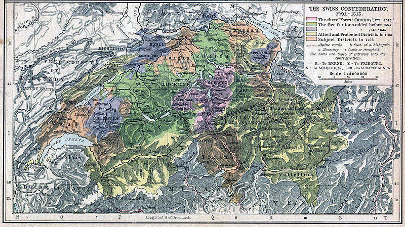
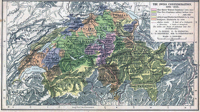
English: Historical map showing the growth of the Old Swiss Confederacy (Switzerland)1291–1515. The map is not very accurate, there are some errors. The yellow area for Valtellina reaches to far to the south. |
| Date | |
| Source | Shepherd, William R.: Historical Atlas. New York: Henry Holt and Company, 1923 |
| Author | revised by: wolpertinger |
| Other versions | original version |
|
This work is in the public domain in its country of origin and other countries and areas where the copyright term is the author's life plus 70 years or fewer. | |
| This file has been identified as being free of known restrictions under copyright law, including all related and neighboring rights. | |
File history
Click on a date/time to view the file as it appeared at that time.
| Date/Time | Thumbnail | Dimensions | User | Comment | |
|---|---|---|---|---|---|
| current | 15:59, 25 June 2005 | | 2,245 × 1,259 (838 KB) | ¡0-8-15! (talk | contribs) | Die schweizerische Eidgenossenschaft 1291-1515 *'''Source:''' Shepherd, William R.: ''Historical Atlas.'' New York: Henry Holt and Company, 1923 *'''revised by:''' wolpertinger {{PD-Old}} [[de:Bild:Swis |
You cannot overwrite this file.
File usage on Commons
The following 3 pages use this file: