File:Stained-glass hatchment (geograph 4511642).jpg
Jump to navigation
Jump to search

Size of this preview: 537 × 600 pixels. Other resolutions: 215 × 240 pixels | 430 × 480 pixels | 688 × 768 pixels | 917 × 1,024 pixels | 1,433 × 1,600 pixels.
Original file (1,433 × 1,600 pixels, file size: 522 KB, MIME type: image/jpeg)
Captions
Captions
Add a one-line explanation of what this file represents
Summary
[edit].jpg&action=edit§ion=1)
| Description |
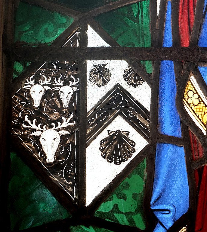
English: Unusual rendering of a hatchment in stained glass in the porch of St Deiniol's Church, Hawarden, Flintshire, Wales. Cavendish impaling Lyttleton. Lord Frederick Cavendish was the son of William Cavendish, 7th Duke of Devonshire and a younger brother of Spencer Compton, 8th Duke of Devonshire. On 7 June 1864 he married Lucy Lyttelton (d.1925), the daughter of 4th Baron Lyttelton. |
| Date | |
| Source | From geograph.org.uk |
| Author | Bill Harrison |
| Permission (Reusing this file) |
Creative Commons Attribution Share-alike license 2.0 |
| Attribution (required by the license) | Bill Harrison / Stained-glass hatchment / |
| Camera location | | View this and other nearby images on: OpenStreetMap |
|---|
.jpg¶ms=053.185859_N_-003.025957_E_globe:Earth_type:camera_heading:337.00_source:geograph&language=en)
| Object location | | View this and other nearby images on: OpenStreetMap |
|---|
.jpg¶ms=053.185810_N_-003.026000_E_globe:Earth_class:object_type:object_source:geograph-osgb36(SJ31536590)_region:GB-GBN_heading:337.00&language=en)
Licensing
[edit].jpg&action=edit§ion=2)

|
This image was taken from the Geograph project collection. See this photograph's page on the Geograph website for the photographer's contact details. The copyright on this image is owned by Bill Harrison and is licensed for reuse under the Creative Commons Attribution-ShareAlike 2.0 license.
|
This file is licensed under the Creative Commons Attribution-Share Alike 2.0 Generic license.
Attribution: Bill Harrison
- You are free:
- to share – to copy, distribute and transmit the work
- to remix – to adapt the work
- Under the following conditions:
- attribution – You must give appropriate credit, provide a link to the license, and indicate if changes were made. You may do so in any reasonable manner, but not in any way that suggests the licensor endorses you or your use.
- share alike – If you remix, transform, or build upon the material, you must distribute your contributions under the same or compatible license as the original.
File history
Click on a date/time to view the file as it appeared at that time.
| Date/Time | Thumbnail | Dimensions | User | Comment | |
|---|---|---|---|---|---|
| current | 10:29, 30 September 2017 | | 1,433 × 1,600 (522 KB) | Kaliforniyka (talk | contribs) | Transferred from geograph.co.uk using [https://tools.wmflabs.org/geograph2commons/ geograph2commons] |
You cannot overwrite this file.
File usage on Commons
There are no pages that use this file.
File usage on other wikis
The following other wikis use this file:
- Usage on en.wikipedia.org
- Usage on es.wikipedia.org
.jpg&oldid=944473534)