File:South georgia Islands map-be.svg
Jump to navigation
Jump to search

Size of this PNG preview of this SVG file: 800 × 485 pixels. Other resolutions: 320 × 194 pixels | 640 × 388 pixels | 1,024 × 620 pixels | 1,280 × 776 pixels | 2,560 × 1,551 pixels | 954 × 578 pixels.
Original file (SVG file, nominally 954 × 578 pixels, file size: 64 KB)
Captions
Captions
Add a one-line explanation of what this file represents
Summary
[edit]| Description |
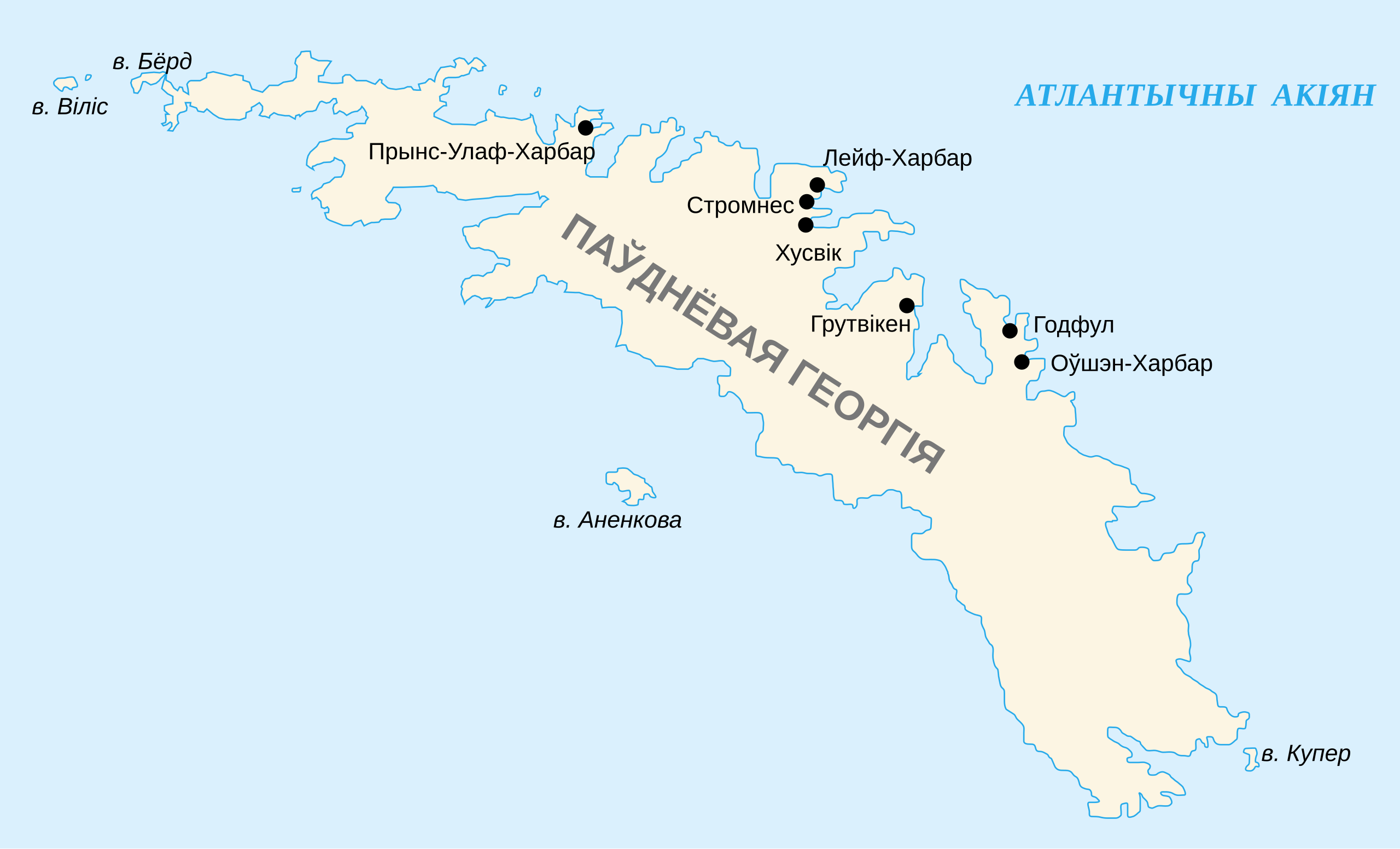
English: Map of South Georgia Island in Belarusian.
Беларуская: Карта Паўднёвай Геогргіі |
||||||||
| Date | |||||||||
| Source | historicair | ||||||||
| Author | Historicair 22:10, 30 May 2007 (UTC), translated by: Frantishak | ||||||||
| Permission (Reusing this file) |
|
||||||||
| Other versions |
[]
|


|
This SVG file contains embedded text that can be translated into your language, using any capable SVG editor, text editor or the SVG Translate tool. For more information see: About translating SVG files. |
File history
Click on a date/time to view the file as it appeared at that time.
| Date/Time | Thumbnail | Dimensions | User | Comment | |
|---|---|---|---|---|---|
| current | 23:18, 7 November 2013 | | 954 × 578 (64 KB) | Frantishak (talk | contribs) | User created page with UploadWizard |
You cannot overwrite this file.
File usage on Commons
The following 16 pages use this file:
- User:4ing/Falkland Islands/2013-11
- File:South georgia Islands map-CA.svg
- File:South georgia Islands map-HE.svg
- File:South georgia Islands map-He.svg
- File:South georgia Islands map-ar.svg
- File:South georgia Islands map-be.svg
- File:South georgia Islands map-ca.svg
- File:South georgia Islands map-de.svg
- File:South georgia Islands map-en.svg
- File:South georgia Islands map-es.svg
- File:South georgia Islands map-fr-locations.PNG
- File:South georgia Islands map-lv.svg
- File:South georgia Islands map-mk.svg
- File:South georgia Islands map-no.svg
- File:South georgia Islands map-ru.svg
- Template:Other versions/South Georgia Islands