File:Salta in Argentina (+Falkland hatched)-2.svg
Jump to navigation
Jump to search

Size of this PNG preview of this SVG file: 356 × 600 pixels. Other resolutions: 142 × 240 pixels | 285 × 480 pixels | 456 × 768 pixels | 608 × 1,024 pixels | 1,216 × 2,048 pixels | 1,276 × 2,149 pixels.
Original file (SVG file, nominally 1,276 × 2,149 pixels, file size: 1.05 MB)
Captions
Captions
Add a one-line explanation of what this file represents
Summary
[edit]-2.svg&action=edit§ion=1)
| Description |
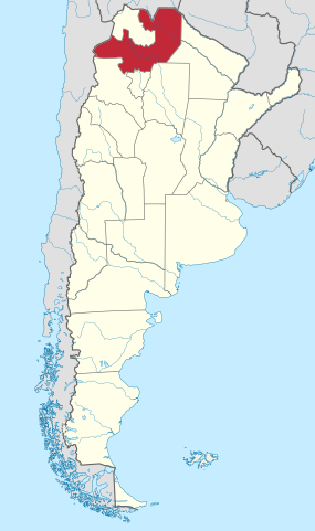
English: Locator map of Salta Province within Argentina. Conic projection. |
| Date | |
| Source |
This file was derived from: Argentina adm location map.svg |
| Author | NordNordWest, GrandEscogriffe |
Licensing
[edit]-2.svg&action=edit§ion=2)
This file is licensed under the Creative Commons Attribution-Share Alike 4.0 International license.
- You are free:
- to share – to copy, distribute and transmit the work
- to remix – to adapt the work
- Under the following conditions:
- attribution – You must give appropriate credit, provide a link to the license, and indicate if changes were made. You may do so in any reasonable manner, but not in any way that suggests the licensor endorses you or your use.
- share alike – If you remix, transform, or build upon the material, you must distribute your contributions under the same or compatible license as the original.
File history
Click on a date/time to view the file as it appeared at that time.
| Date/Time | Thumbnail | Dimensions | User | Comment | |
|---|---|---|---|---|---|
| current | 19:00, 26 September 2023 | | 1,276 × 2,149 (1.05 MB) | GrandEscogriffe (talk | contribs) | Uploaded a work by {{u|NordNordWest}}, {{u|GrandEscogriffe}} from {{derived from|Argentina adm location map.svg}} with UploadWizard |
You cannot overwrite this file.
File usage on Commons
The following 13 pages use this file:
- Category:Births in Salta Province
- Category:Cities in Salta Province
- Category:Dams in Salta Province
- Category:Deaths in Salta Province
- Category:Departments of Salta Province
- Category:Geography of Salta Province
- Category:Maps of Salta Province
- Category:People of Salta Province
- Category:Populated places in Salta Province
- Category:Salta Province
- Category:Sports in Salta Province
- Category:Train stations in Salta Province
- Category:Transport in Salta Province
File usage on other wikis
The following other wikis use this file:
- Usage on ar.wikipedia.org
- Usage on ast.wikipedia.org
- Usage on bg.wikipedia.org
- Usage on ca.wikipedia.org
- Usage on de.wikivoyage.org
- Usage on el.wikipedia.org
- Usage on en.wikipedia.org
- Usage on es.wikipedia.org
- Usage on eu.wikipedia.org
- Usage on fr.wikipedia.org
- Salta
- Province de Salta
- Cafayate
- San Antonio de los Cobres
- San Ramón de la Nueva Orán
- Tartagal
- Aguaray
- Iruya
- La Viña (Salta)
- Cachi
- La Poma
- Molinos (Salta)
- San Carlos (Salta)
- Angastaco
- Payogasta
- General Güemes
- La Caldera
- Guachipas
- La Candelaria (Salta)
- Embarcación
- Pichanal
- Seclantás
- Santa Rosa de los Pastos Grandes
- Campo Quijano
- Aguas Blancas (Salta)
- Profesor Salvador Mazza
- General Mosconi
- General Ballivián
- Joaquín Víctor González (Salta)
- Rivadavia (Salta)
- Cerrillos (Salta)
- Chicoana
- San José de Metán
- Rosario de la Frontera
- Rosario de Lerma
- Santa Victoria Oeste
- Colonia Santa Rosa
- Hipólito Yrigoyen (Salta)
- Coronel Juan Solá
View more global usage of this file.
-2.svg)
-2.svg&oldid=805328176)