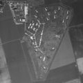
File:S-200 site FRAG-511 Eckolstädt.png
From Wikimedia Commons, the free media repository
Jump to navigation
Jump to search

Size of this preview: 600 × 600 pixels. Other resolutions: 240 × 240 pixels | 480 × 480 pixels | 768 × 768 pixels | 1,024 × 1,024 pixels | 2,048 × 2,048 pixels | 8,800 × 8,800 pixels.
Original file (8,800 × 8,800 pixels, file size: 50.06 MB, MIME type: image/png)
File information
Structured data
Captions
Captions
Add a one-line explanation of what this file represents
Summary
[edit]| Warning | The original file is very high-resolution. It might not load properly or could cause your browser to freeze when opened at full size. | Open in ZoomViewer |
|---|
| DescriptionS-200 site FRAG-511 Eckolstädt.png |
English: Former S-200 (SA-5) site of the NVA's Fla-Raketenabteilungsgruppe 511 (FRAG-511) near Eckolstädt, Thüringen. The site was never used due to German reunification preempting full delivery of its equipment. |
| Date | |
| Source | Offene Geodaten Thüringen, Historisches Luftbild 199502 0196 |
| Author | GDI-Th |
| Object location | 51° 02′ 33″ N, 11° 37′ 32.16″ E | View this and other nearby images on: OpenStreetMap |
|---|
Licensing
[edit]
|
This file is licensed under the terms of the Data licence Germany – attribution – version 2.0 |
|
You are free:
Under the following conditions:
|
File history
Click on a date/time to view the file as it appeared at that time.
| Date/Time | Thumbnail | Dimensions | User | Comment | |
|---|---|---|---|---|---|
| current | 01:00, 27 July 2024 |  | 8,800 × 8,800 (50.06 MB) | SteinsplitterBot (talk | contribs) | Bot: Image rotated by 180° |
| 17:35, 1 August 2023 |  | 8,800 × 8,800 (50.05 MB) | Recoil16 (talk | contribs) | Uploaded a work by GDI-Th, dl-de/by-2-0 from [https://www.geoportal-th.de/de-de/Downloadbereiche/Download-Offene-Geodaten-Th%C3%BCringen Offene Geodaten Thüringen, Historisches Luftbild 199502 0196] with UploadWizard |
You cannot overwrite this file.
File usage on Commons
There are no pages that use this file.
Metadata
This file contains additional information such as Exif metadata which may have been added by the digital camera, scanner, or software program used to create or digitize it. If the file has been modified from its original state, some details such as the timestamp may not fully reflect those of the original file. The timestamp is only as accurate as the clock in the camera, and it may be completely wrong.
| Horizontal resolution | 666.14 dpc |
|---|---|
| Vertical resolution | 666.14 dpc |
| File change date and time | 01:00, 27 July 2024 |