File:Rensselaerswyck Original Map Large.png

Original file (24,244 × 8,078 pixels, file size: 69.29 MB, MIME type: image/png)
Captions
Captions
Summary
[edit]
| Warning | The original file is very high-resolution. It might not load properly or could cause your browser to freeze when opened at full size. |
|---|
| Description |
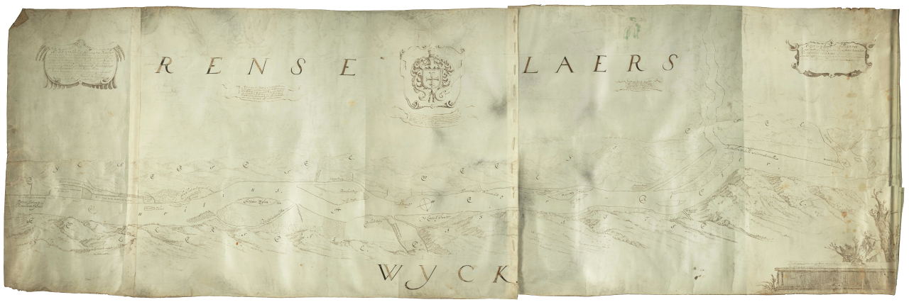
English: Original Map of Rensselaerswyck, probably created around 1632, but not known exactly. Authorship is usually credited to Gillis van Schendel, but due to timing inconsistencies, this is most likely not true. Believed to be the first map created of the Manor of Rensselaerswyck. The Hudson River flows from left to right; north is to the right. |
| Date | Shortly after July 20, 1632 (most likely) |
| Source | Map of Renselaerswyck. New York State Library (1632). |
| Author | Unknown (but most likely not Gillis van Schendel, as is typically assumed) |
| Other versions |
Medium-sized version (10,000 × 3,332 pixels, file size: 24.28 MB) |
Licensing
[edit]
This image is in the public domain because it is a mere mechanical scan or photocopy of a public domain original, or – from the available evidence – is so similar to such a scan or photocopy that no copyright protection can be expected to arise. The original itself is in the public domain for the following reason:
This tag is designed for use where there may be a need to assert that any enhancements (eg brightness, contrast, colour-matching, sharpening) are in themselves insufficiently creative to generate a new copyright. It can be used where it is unknown whether any enhancements have been made, as well as when the enhancements are clear but insufficient. For known raw unenhanced scans you can use an appropriate {{PD-old}} tag instead. For usage, see Commons:When to use the PD-scan tag.  | ||||
File history
Click on a date/time to view the file as it appeared at that time.
| Date/Time | Thumbnail | Dimensions | User | Comment | |
|---|---|---|---|---|---|
| current | 02:40, 19 August 2009 | 24,244 × 8,078 (69.29 MB) | MattWade (talk | contribs) | {{Information |Description={{en|1=Original en:Map of Rensselaerswyck, probably created around 1632, but not known exactly. Authorship is usually credited to Gillis van Schendel, but due to timing inconsistencies, this is most likely not true. Believ |
You cannot overwrite this file.
File usage on Commons
There are no pages that use this file.