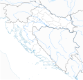
File:Relief Map of Croatia.svg
From Wikimedia Commons, the free media repository
Jump to navigation
Jump to search

Size of this PNG preview of this SVG file: 626 × 599 pixels. Other resolutions: 251 × 240 pixels | 501 × 480 pixels | 802 × 768 pixels | 1,070 × 1,024 pixels | 2,140 × 2,048 pixels | 631 × 604 pixels.
Original file (SVG file, nominally 631 × 604 pixels, file size: 4.23 MB)
File information
Structured data
Captions
Captions
Add a one-line explanation of what this file represents
Summary
[edit]| DescriptionRelief Map of Croatia.svg |
Hrvatski: Topografska karta Hrvatske
English: Relief Map of Croatia Български: Топографска карта на Хърватия Bosanski: Topografska karta Hrvatske Crnogorski: Topografska mapa Hrvatske Čeština: Topografická mapa Chorvatska Dansk: Topografisk kort over Kroatien Deutsch: Topographische Karte von Kroatien Ελληνικά: Τοπογραφικός χάρτης της Κροατίας. Español: Mapa topográfico de Croacia Eesti: Topograafiline kaart Horvaatia. Français : Carte Croatie topographique Gaeilge: Léarscáil topagrafach de An Chróit Italiano: Carta topografica della Croazia Latviešu: Topogrāfiskā karte Horvātija. Magyar: Topográfiai térkép a Horvátország. Македонски: Топографска карта на Хрватска Polski: Mapa topograficzna Chorwacja Slovenčina: Topografická mapa Chorvátsko Slovenščina: Topografska karta Hrvaške. Shqip: Harta topografike e Kroacia Српски / srpski: Топографска мапа Хрватске Suomi: Topografinen kartta Kroatian Svenska: Topografisk karta över Kroatien |
| Date | |
| Source | http://sr.wikipedia.org/wiki/Датотека:Dinarides_relief_location_map.jpg |
| Author |
|
Licensing
[edit]This file is licensed under the Creative Commons Attribution-Share Alike 3.0 Unported license.
- You are free:
- to share – to copy, distribute and transmit the work
- to remix – to adapt the work
- Under the following conditions:
- attribution – You must give appropriate credit, provide a link to the license, and indicate if changes were made. You may do so in any reasonable manner, but not in any way that suggests the licensor endorses you or your use.
- share alike – If you remix, transform, or build upon the material, you must distribute your contributions under the same or compatible license as the original.
File history
Click on a date/time to view the file as it appeared at that time.
| Date/Time | Thumbnail | Dimensions | User | Comment | |
|---|---|---|---|---|---|
| current | 21:27, 31 January 2016 |  | 631 × 604 (4.23 MB) | Tromber (talk | contribs) | Reverted to version as of 21:05, 31 January 2016 (UTC) |
| 21:26, 31 January 2016 |  | 631 × 604 (4.23 MB) | Tromber (talk | contribs) | No changes! Trying to upload a new version without errors (white areas). | |
| 21:05, 31 January 2016 |  | 631 × 604 (4.23 MB) | Tromber (talk | contribs) | Reverted to version as of 13:15, 17 March 2012 (UTC) | |
| 20:03, 31 January 2016 |  | 675 × 654 (5.64 MB) | Larske (talk | contribs) | no changes, just a new upload trying to remove white areas | |
| 13:25, 24 March 2012 |  | 675 × 654 (5.64 MB) | Ivan25 (talk | contribs) | checking | |
| 13:19, 24 March 2012 |  | 675 × 654 (5.64 MB) | Ivan25 (talk | contribs) | update | |
| 13:15, 17 March 2012 |  | 631 × 604 (4.23 MB) | Ivan25 (talk | contribs) |
You cannot overwrite this file.
File usage on Commons
There are no pages that use this file.
File usage on other wikis
The following other wikis use this file:
- Usage on de.wikipedia.org
- Usage on sv.wikipedia.org
Metadata
This file contains additional information such as Exif metadata which may have been added by the digital camera, scanner, or software program used to create or digitize it. If the file has been modified from its original state, some details such as the timestamp may not fully reflect those of the original file. The timestamp is only as accurate as the clock in the camera, and it may be completely wrong.
| Width | 630.71997 |
|---|---|
| Height | 603.88 |