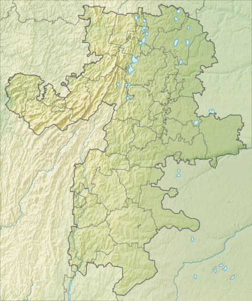
File:Relief Map of Chelyabinsk Oblast OSM.png
From Wikimedia Commons, the free media repository
Jump to navigation
Jump to search

Size of this preview: 503 × 600 pixels. Other resolutions: 201 × 240 pixels | 402 × 480 pixels | 738 × 880 pixels.
Original file (738 × 880 pixels, file size: 870 KB, MIME type: image/png)
File information
Structured data
Captions
Captions
Add a one-line explanation of what this file represents
Summary
[edit]| DescriptionRelief Map of Chelyabinsk Oblast OSM.png |
Русский: Физическая карта Челябинской области, на основе OpenStreetMap.
|
| Date | |
| Source |
|
| Author | Nzeemin |
Licensing
[edit]This file is licensed under the Creative Commons Attribution-Share Alike 2.0 Generic license.
- You are free:
- to share – to copy, distribute and transmit the work
- to remix – to adapt the work
- Under the following conditions:
- attribution – You must give appropriate credit, provide a link to the license, and indicate if changes were made. You may do so in any reasonable manner, but not in any way that suggests the licensor endorses you or your use.
- share alike – If you remix, transform, or build upon the material, you must distribute your contributions under the same or compatible license as the original.
File history
Click on a date/time to view the file as it appeared at that time.
| Date/Time | Thumbnail | Dimensions | User | Comment | |
|---|---|---|---|---|---|
| current | 08:58, 17 March 2012 |  | 738 × 880 (870 KB) | Nzeemin (talk | contribs) |
You cannot overwrite this file.
File usage on Commons
The following page uses this file:
File usage on other wikis
The following other wikis use this file:
- Usage on ar.wikipedia.org
- Usage on ba.wikipedia.org
- Мейәс (йылға)
- Ҡороусан
- Шәһит (йылға)
- Оло Ҡылығаҙы
- Зилға (Йүрүҙән ҡушылдығы)
- Кәркәде
- Ҡалып:ПозКарта Рәсәй Силәбе өлкәһе
- Оло Һатҡы
- Ҡуһа (йылға)
- Түргеяҡ
- Мисәш
- Һуңкүл
- Ҡалды (күл)
- Йөрәккүл
- Нөргөш (тау һырты)
- Болашты
- Мәскәйле (һырт)
- Синара (күл)
- Эҫем быуаһы
- Косотур
- Ишкүл һырты
- Оло Алаҡай күленең таш палаткалары
- Ҡытаутамаҡ ҡала округы
- Троицк һыуһаҡлағысы
- Потанин тауҙары
- Вишневые тауы
- Тал һырты
- Бахмур (тау)
- Оло Ҡыл (йылға)
- Кесе Һуңыкүл
- Бүретау
- Ташкүл
- Тураташ
- Извоз (тау)
- Шәке (тау)
- Ҡаштаҡ ҡарағайлығы
- Шершни һыуһаҡлағысы
- Һыуғомаҡ мәмерйәһе
- Казачий стан (мәмерйә)
- Ҡараташ (тау, Ҡуҫа районы)
- Көнсығыш Урал радиация ҡурсаулығы
- Ирентек (күл)
- Кесе Ирентек (күл)
- Usage on be.wikipedia.org
View more global usage of this file.
Metadata
This file contains additional information such as Exif metadata which may have been added by the digital camera, scanner, or software program used to create or digitize it. If the file has been modified from its original state, some details such as the timestamp may not fully reflect those of the original file. The timestamp is only as accurate as the clock in the camera, and it may be completely wrong.
| Horizontal resolution | 35.45 dpc |
|---|---|
| Vertical resolution | 35.45 dpc |
| Software used |
Hidden categories: