File:Powiat włodawski location map.png

Original file (1,368 × 1,684 pixels, file size: 383 KB, MIME type: image/png)
Captions
Captions
Summary
[edit]
| Description |
English: Location map |
| Date | |
| Source | Own work |
| Author | Smat |
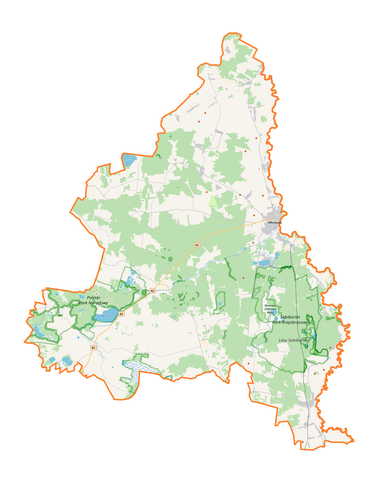
| Description |
Polski: Mapa powiatu włodawskiego, Polska
English: Map of powiat włodawski, Poland |
|||||||||
| Date | ||||||||||
| Source | You may find a page on the OpenStreetMap wiki page for powiat włodawski | |||||||||
| Creator |
OpenStreetMap contributors OpenStreetMap contributors |
|||||||||
| Permission (Reusing this file) |
OpenStreetMap data is available under the Open Database License (details). Map tiles are licensed under the Creative Commons Attribution-ShareAlike 2.0 license (CC-BY-SA 2.0).
This file is licensed under the Creative Commons Attribution-Share Alike 2.0 Generic license.
|
|||||||||
| Geotemporal data | ||||||||||
| Bounding box |
|
|||||||||
| Georeferencing | If inappropriate please set warp_status = skip to hide. | |||||||||
Licensing
[edit]
| This work contains information from OpenStreetMap, which is made available under the Open Database License (ODbL).
The ODbL does not require any particular license for maps produced from ODbL data. Prior to 1 August 2020, map tiles produced by the OpenStreetMap Foundation were licensed under the CC-BY-SA-2.0 license. Maps produced by other people may be subject to other licences. |
File history
Click on a date/time to view the file as it appeared at that time.
| Date/Time | Thumbnail | Dimensions | User | Comment | |
|---|---|---|---|---|---|
| current | 11:09, 12 October 2017 | | 1,368 × 1,684 (383 KB) | Smat (talk | contribs) | User created page with UploadWizard |
You cannot overwrite this file.
File usage on Commons
There are no pages that use this file.
File usage on other wikis
The following other wikis use this file:
- Usage on eo.wikipedia.org
- Usage on id.wikipedia.org
- Usage on pl.wikipedia.org
- Sobiborski Park Krajobrazowy
- Włodawa
- Rezerwat przyrody Żółwiowe Błota
- Sobibór
- Powiat włodawski
- Rezerwat przyrody Brudzieniec
- Rezerwat przyrody Jezioro Orchowe
- Rezerwat przyrody Magazyn
- Rezerwat przyrody Małoziemce
- Rezerwat przyrody Trzy Jeziora
- Różanka (województwo lubelskie)
- Okuninka
- Jezioro Białe (województwo lubelskie)
- Borysik
- Bukowski Las
- Dańce
- Dołhobrody
- Dominiczyn
- Dubeczno
- Hańsk Drugi
- Hańsk-Kolonia
- Horostyta
- Horostyta-Kolonia
- Holeszów (Polska)
- Hanna (województwo lubelskie)
- Jamniki
- Krzywowierzba
- Kulczyn-Kolonia
- Kuzawka (powiat włodawski)
- Kaplonosy
- Kaplonosy-Kolonia
- Kołacze
- Korolówka
- Korolówka-Kolonia
- Korolówka-Osada
- Kozubata
- Konstantyn (województwo lubelskie)
- Lack
- Laski Bruskie
- Lubowierz
- Macoszyn Duży
- Macoszyn Mały
- Majdan Stuleński
- Mszanna-Kolonia
- Nowe Załucze
- Nowy Brus
- Nowy Holeszów
- Pawluki
View more global usage of this file.