File:Powiat ropczycko-sędziszowski location map.png

Original file (1,754 × 2,271 pixels, file size: 1.47 MB, MIME type: image/png)
Captions
Captions
Summary
[edit]
| Description |
English: Location map |
| Date | |
| Source | Own work |
| Author | Smat |
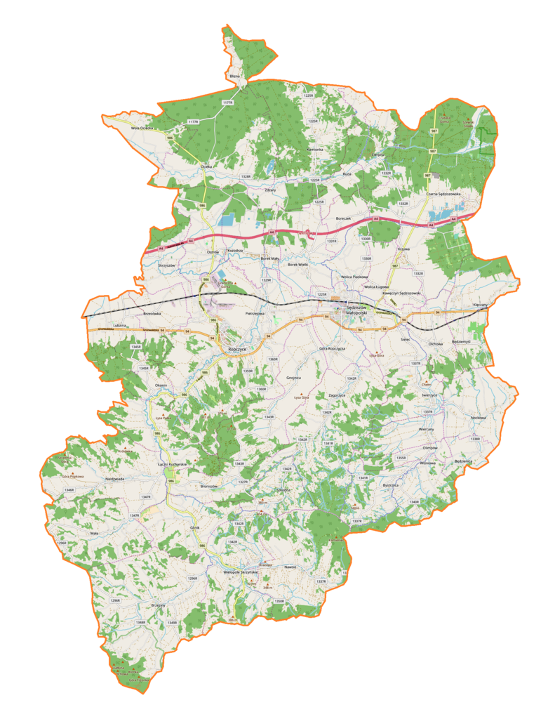
| Description |
Polski: Mapa powiatu ropczycko-sędziszowskiego, Polska
English: Map of powiat ropczycko-sędziszowski, Poland |
|||||||||
| Date | ||||||||||
| Source | You may find a page on the OpenStreetMap wiki page for powiat ropczycko-sędziszowski | |||||||||
| Creator |
OpenStreetMap contributors OpenStreetMap contributors |
|||||||||
| Permission (Reusing this file) |
OpenStreetMap data is available under the Open Database License (details). Map tiles are licensed under the Creative Commons Attribution-ShareAlike 2.0 license (CC-BY-SA 2.0).
This file is licensed under the Creative Commons Attribution-Share Alike 2.0 Generic license.
|
|||||||||
| Geotemporal data | ||||||||||
| Bounding box |
|
|||||||||
| Georeferencing | If inappropriate please set warp_status = skip to hide. | |||||||||
Licensing
[edit]
| This work contains information from OpenStreetMap, which is made available under the Open Database License (ODbL).
The ODbL does not require any particular license for maps produced from ODbL data. Prior to 1 August 2020, map tiles produced by the OpenStreetMap Foundation were licensed under the CC-BY-SA-2.0 license. Maps produced by other people may be subject to other licences. |
File history
Click on a date/time to view the file as it appeared at that time.
| Date/Time | Thumbnail | Dimensions | User | Comment | |
|---|---|---|---|---|---|
| current | 18:14, 16 August 2018 | | 1,754 × 2,271 (1.47 MB) | Smat (talk | contribs) | User created page with UploadWizard |
You cannot overwrite this file.
File usage on Commons
There are no pages that use this file.
File usage on other wikis
The following other wikis use this file:
- Usage on pl.wikipedia.org
- Ropczyce
- Rezerwat przyrody Szwajcaria Ropczycka
- Sędziszów Małopolski
- Brzeziny (województwo podkarpackie)
- Będziemyśl
- Będzienica
- Borek Mały
- Borek Wielki
- Czarna Sędziszowska
- Gnojnica (Polska)
- Góra Ropczycka
- Iwierzyce
- Kawęczyn Sędziszowski
- Kozodrza
- Lubzina
- Łączki Kucharskie
- Mała
- Nawsie
- Nockowa
- Ocieka
- Olimpów
- Szkodna
- Wielopole Skrzyńskie
- Wiercany
- Wola Ociecka
- Wolica Ługowa
- Wolica Piaskowa
- Zdżary
- Blizna (województwo podkarpackie)
- Boreczek (województwo podkarpackie)
- Broniszów (województwo podkarpackie)
- Bystrzyca (województwo podkarpackie)
- Glinik (województwo podkarpackie)
- Klęczany (województwo podkarpackie)
- Krzywa (województwo podkarpackie)
- Niedźwiada (województwo podkarpackie)
- Okonin (województwo podkarpackie)
- Sielec (województwo podkarpackie)
- Skrzyszów (województwo podkarpackie)
- Zagorzyce (województwo podkarpackie)
- Brzezówka (powiat ropczycko-sędziszowski)
- Cierpisz (powiat ropczycko-sędziszowski)
- Kamionka (powiat ropczycko-sędziszowski)
- Olchowa (powiat ropczycko-sędziszowski)
- Ostrów (powiat ropczycko-sędziszowski)
- Ruda (powiat ropczycko-sędziszowski)
- Wiśniowa (powiat ropczycko-sędziszowski)
- Lubzina (przystanek kolejowy)
- Bystrzyca (dopływ Wielopolki)
- Parafia Narodzenia Najświętszej Maryi Panny w Sędziszowie Małopolskim
View more global usage of this file.