File:Post0195 - Flickr - NOAA Photo Library.jpg
Original file (2,048 × 1,536 pixels, file size: 500 KB, MIME type: image/jpeg)
Captions
Captions
Summary
[edit]
| Description |
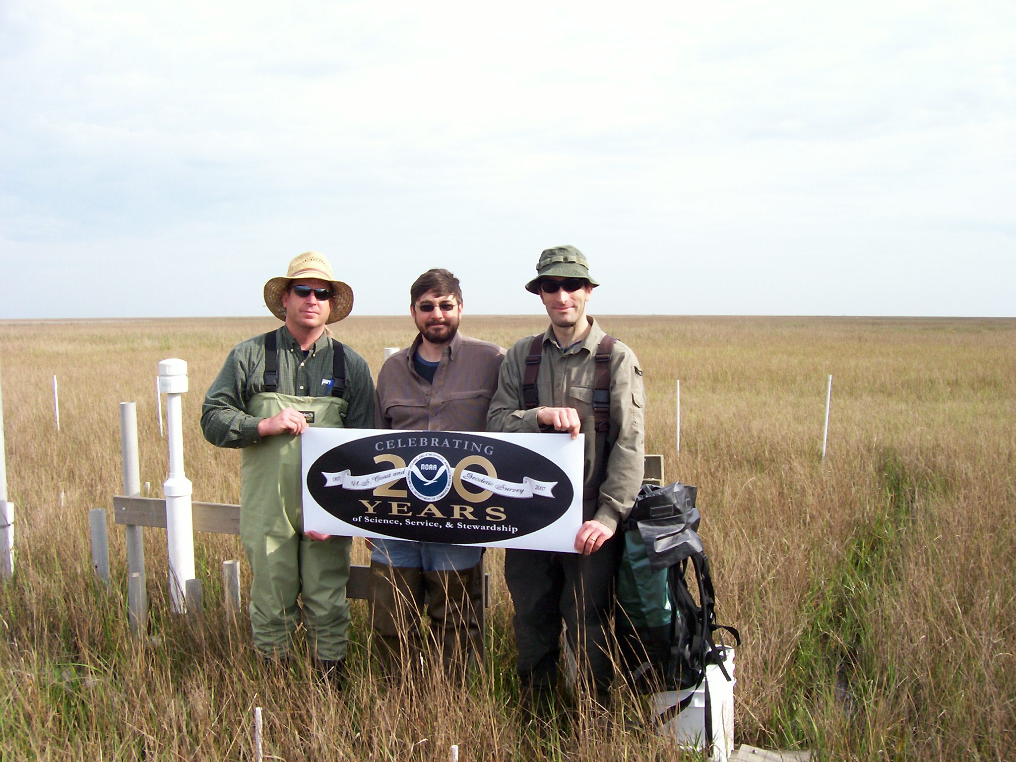
A field crew from NOS’ National Geodetic Survey conducted a GPS survey of Surface Elevation Tables throughout Southeastern Louisiana, in cooperation with the University of New Orleans, the U.S Geological Survey, and the Louisiana Department of Natural Resources. This project site is at Old Oyster Bayou, in the wetlands of the Mississippi Delta only a few kilometers from the Gulf of Mexico. Studies conducted by NOAA partners using SETs are providing critical data on elevation changes within these wetlands. The GPS survey methodology being developed by NGS is enabling these elevation trends to be related to local land elevations and water levels for the first time, providing researchers a better understanding of processes leading to land loss, and providing managers a way to evaluate the risk of coastal submergence. Pictured (from left): Charlie Geoghegan, Project Manager, from NGS Instrumentation and Methodologies Branch; Galen Scott, NGS COASTAL Team Lead; and Philippe Hensel, Coastal Elevation Dynamics Specialist, from NGS Spatial Reference Systems Division. |
| Date | |
| Source | post0195 |
| Author | NOAA Photo Library |
Licensing
[edit]
- You are free:
- to share – to copy, distribute and transmit the work
- to remix – to adapt the work
- Under the following conditions:
- attribution – You must give appropriate credit, provide a link to the license, and indicate if changes were made. You may do so in any reasonable manner, but not in any way that suggests the licensor endorses you or your use.
| This image was originally posted to Flickr by NOAA Photo Library at https://www.flickr.com/photos/51647007@N08/5161741142. It was reviewed on 3 January 2013 by FlickreviewR and was confirmed to be licensed under the terms of the cc-by-2.0. |
This image is in the public domain because it contains materials that originally came from the U.S. National Oceanic and Atmospheric Administration, taken or made as part of an employee's official duties.
|
File history
Click on a date/time to view the file as it appeared at that time.
| Date/Time | Thumbnail | Dimensions | User | Comment | |
|---|---|---|---|---|---|
| current | 12:07, 7 January 2012 | | 2,048 × 1,536 (500 KB) | Kobac (talk | contribs) | {{Information |Description=A field crew from NOS’ National Geodetic Survey conducted a GPS survey of Surface Elevation Tables throughout Southeastern Louisiana, in cooperation with the University of New Orleans, the U.S Geological Survey, and the Louisi |
You cannot overwrite this file.
File usage on Commons
There are no pages that use this file.