
File:Portsmouth Semaphore Tower.jpg
Original file (4,288 × 3,216 pixels, file size: 3.41 MB, MIME type: image/jpeg)
Captions
Captions
Summary
[edit]
| Description |
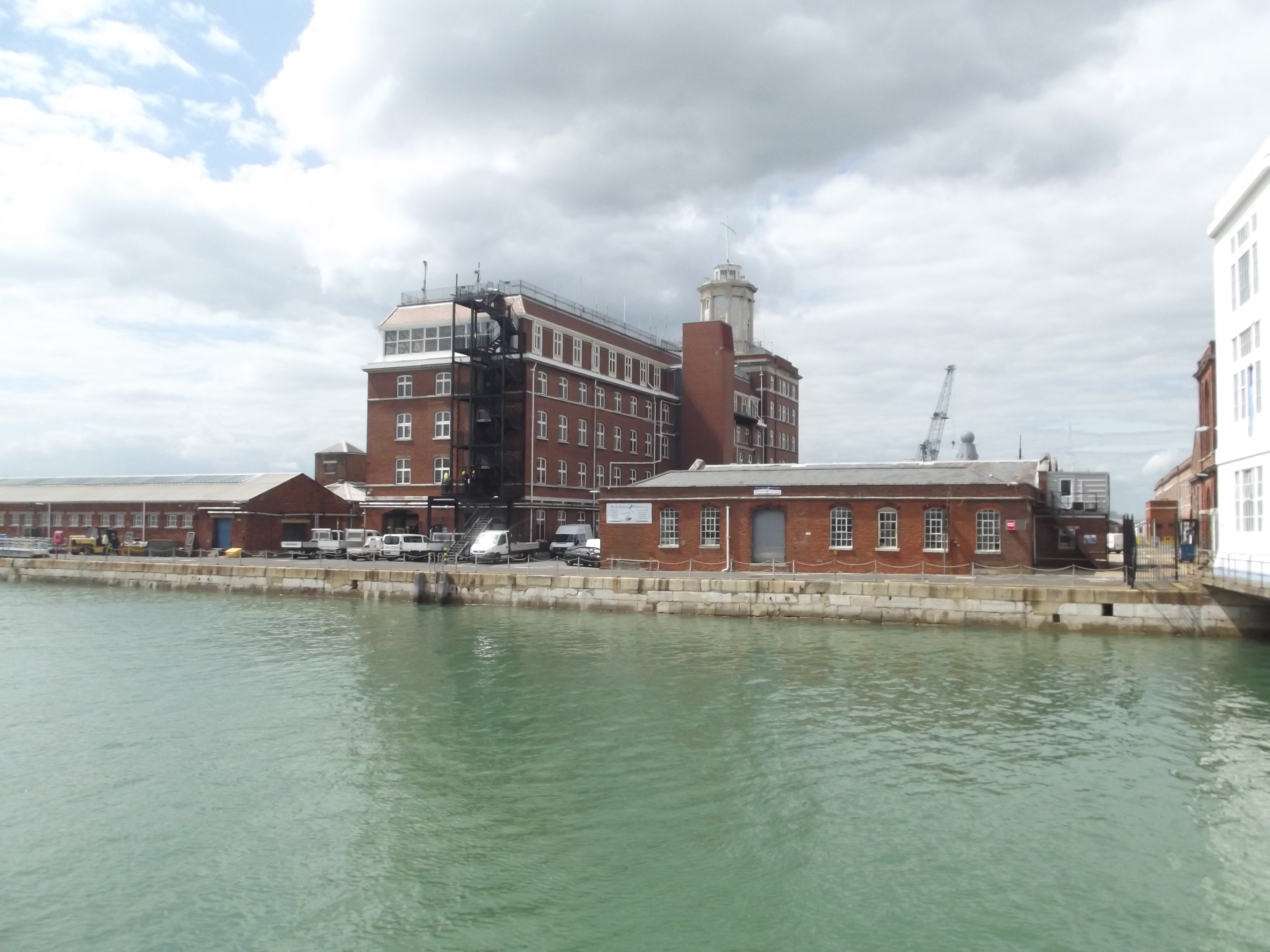
English: Heading to the Dockyard Pier to get on the boat for Harbour Tours at Portsmouth Historic Dockyard.
View of the The Lion Gate / Semaphore Tower from the Dockyard Pier. The Lion Gate. Grade II listed building. The Lion Gate, Portsmouth SU 6200 SE SOUTH RAILWAY JETTY HM Naval Base The lion Gate 774-1/18/235 GV II Town gate, now naval entrance way. 1778, dismantled C19 and re-erected in present position 1929 (date stone). Ashlar. Central round archway with tripartite keystone and voussoirs aligned to the courses of the rusticated ashlar surround. Flanking paired pilasters with vermiculated bands support cornice and pediment in which is lion couchant bearing flag. To either side a similar pedestrian archway with round window over. On right side of central arch is block inscribed "The lion Gateway Portsea. Built 1778. Incorporated in this building in the year 1929". The present appearance of the entrances owes much to the 1929 rebuilding. The archway was originally erected as one of the town gateways of Portsea (Lloyd). (Source: The Buildings of England: Lloyd D: Hampshire and the Isle of Wight: Harmondsworth: 1985: 410). Listing NGR: SU6299200361 This text is a legacy record and has not been updated since the building was originally listed. Details of the building may have changed in the intervening time. You should not rely on this listing as an accurate description of the building. Source: English Heritage Another site says that this is also the Semaphore Tower. The control centre for Portsmouth Harbour. In 1913 Sempahore Tower was destroyed by fire. It was rebuilt and now incorporates the resited Lion Gate. It is the Head Office of the Naval Base Commander and Queen's Harbour Master. Semaphore Tower is not accessible to the public as it is situated in the Naval Base. |
| Date | |
| Source | https://www.flickr.com/photos/ell-r-brown/9362035224/ |
| Author | Elliott Brown |
| Camera location | | View this and other nearby images on: OpenStreetMap |
|---|
Licensing
[edit]
- You are free:
- to share – to copy, distribute and transmit the work
- to remix – to adapt the work
- Under the following conditions:
- attribution – You must give appropriate credit, provide a link to the license, and indicate if changes were made. You may do so in any reasonable manner, but not in any way that suggests the licensor endorses you or your use.
- share alike – If you remix, transform, or build upon the material, you must distribute your contributions under the same or compatible license as the original.
| This image was originally posted to Flickr by ell brown at https://flickr.com/photos/39415781@N06/9362035224. It was reviewed on 13 January 2021 by FlickreviewR 2 and was confirmed to be licensed under the terms of the cc-by-sa-2.0. |
File history
Click on a date/time to view the file as it appeared at that time.
| Date/Time | Thumbnail | Dimensions | User | Comment | |
|---|---|---|---|---|---|
| current | 16:33, 13 January 2021 | | 4,288 × 3,216 (3.41 MB) | ErraticDrumlin (talk | contribs) | Uploaded a work by Elliott Brown from https://www.flickr.com/photos/ell-r-brown/9362035224/ with UploadWizard |
You cannot overwrite this file.
File usage on Commons
There are no pages that use this file.
File usage on other wikis
The following other wikis use this file:
- Usage on ca.wikipedia.org
- Usage on en.wikipedia.org
- Usage on ko.wikipedia.org
- Usage on ru.wikipedia.org