File:Pont sur le Trient à Vernayaz.jpg
Jump to navigation
Jump to search

Size of this preview: 794 × 600 pixels. Other resolutions: 318 × 240 pixels | 636 × 480 pixels | 1,017 × 768 pixels | 1,280 × 966 pixels | 2,580 × 1,948 pixels.
Original file (2,580 × 1,948 pixels, file size: 1.19 MB, MIME type: image/jpeg)
Captions
Captions
Add a one-line explanation of what this file represents
Summary
[edit]
| Description |
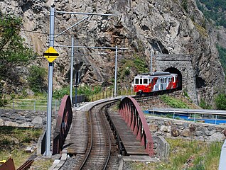
English: Bridge over Trient river in Vernayaz
Français : Pont sur le Trient à Vernayaz, et embrasures camouflées du fort de Vernayaz |
| Date | |
| Source | Own work |
| Author | ChrisJ |
| Camera location | | View this and other nearby images on: OpenStreetMap |
|---|
Licensing
[edit]
I, the copyright holder of this work, hereby publish it under the following licenses:

|
Permission is granted to copy, distribute and/or modify this document under the terms of the GNU Free Documentation License, Version 1.2 or any later version published by the Free Software Foundation; with no Invariant Sections, no Front-Cover Texts, and no Back-Cover Texts. A copy of the license is included in the section entitled GNU Free Documentation License. |
This file is licensed under the Creative Commons Attribution-Share Alike 3.0 Unported, 2.5 Generic, 2.0 Generic and 1.0 Generic license.
- You are free:
- to share – to copy, distribute and transmit the work
- to remix – to adapt the work
- Under the following conditions:
- attribution – You must give appropriate credit, provide a link to the license, and indicate if changes were made. You may do so in any reasonable manner, but not in any way that suggests the licensor endorses you or your use.
- share alike – If you remix, transform, or build upon the material, you must distribute your contributions under the same or compatible license as the original.
You may select the license of your choice.
File history
Click on a date/time to view the file as it appeared at that time.
| Date/Time | Thumbnail | Dimensions | User | Comment | |
|---|---|---|---|---|---|
| current | 21:41, 19 October 2010 | | 2,580 × 1,948 (1.19 MB) | ChrisJ (talk | contribs) | {{Information |Description={{en|1=Bridge over Trient river in Vernayaz}} {{fr|1=Pont sur le Trient à Vernayaz}} |Source={{own}} |Author=ChrisJ |Date= |Permission= |other_versions= }} Category:Martigny-Châtelard line |
You cannot overwrite this file.
File usage on Commons
There are no pages that use this file.
File usage on other wikis
The following other wikis use this file:
- Usage on de.wikipedia.org
- Usage on fr.wikipedia.org
- Usage on pt.wikipedia.org
Metadata
Categories:
- Martigny-Châtelard line
- Catenary signals in Switzerland
- MC ABFeh 4/4 4-8
- Passenger trains in Martigny
- Vernayaz
- Bridges in Martigny
- Railway bridges in the canton of Valais
- Rail tunnels in the canton of Valais
- Position de barrage Vernayaz
- Military structures in the canton of Valais
- 2010 in Martigny
- July 2010 in the canton of Valais
- End catenary signs