File:Pont de Godinne en travaux 2.jpg
Jump to navigation
Jump to search

Size of this preview: 800 × 600 pixels. Other resolutions: 320 × 240 pixels | 640 × 480 pixels | 1,024 × 768 pixels | 1,280 × 960 pixels | 2,560 × 1,920 pixels | 3,264 × 2,448 pixels.
Original file (3,264 × 2,448 pixels, file size: 2.49 MB, MIME type: image/jpeg)
Captions
Captions
Add a one-line explanation of what this file represents
Summary
[edit]| Description |
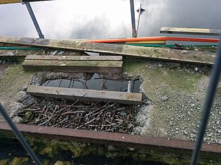
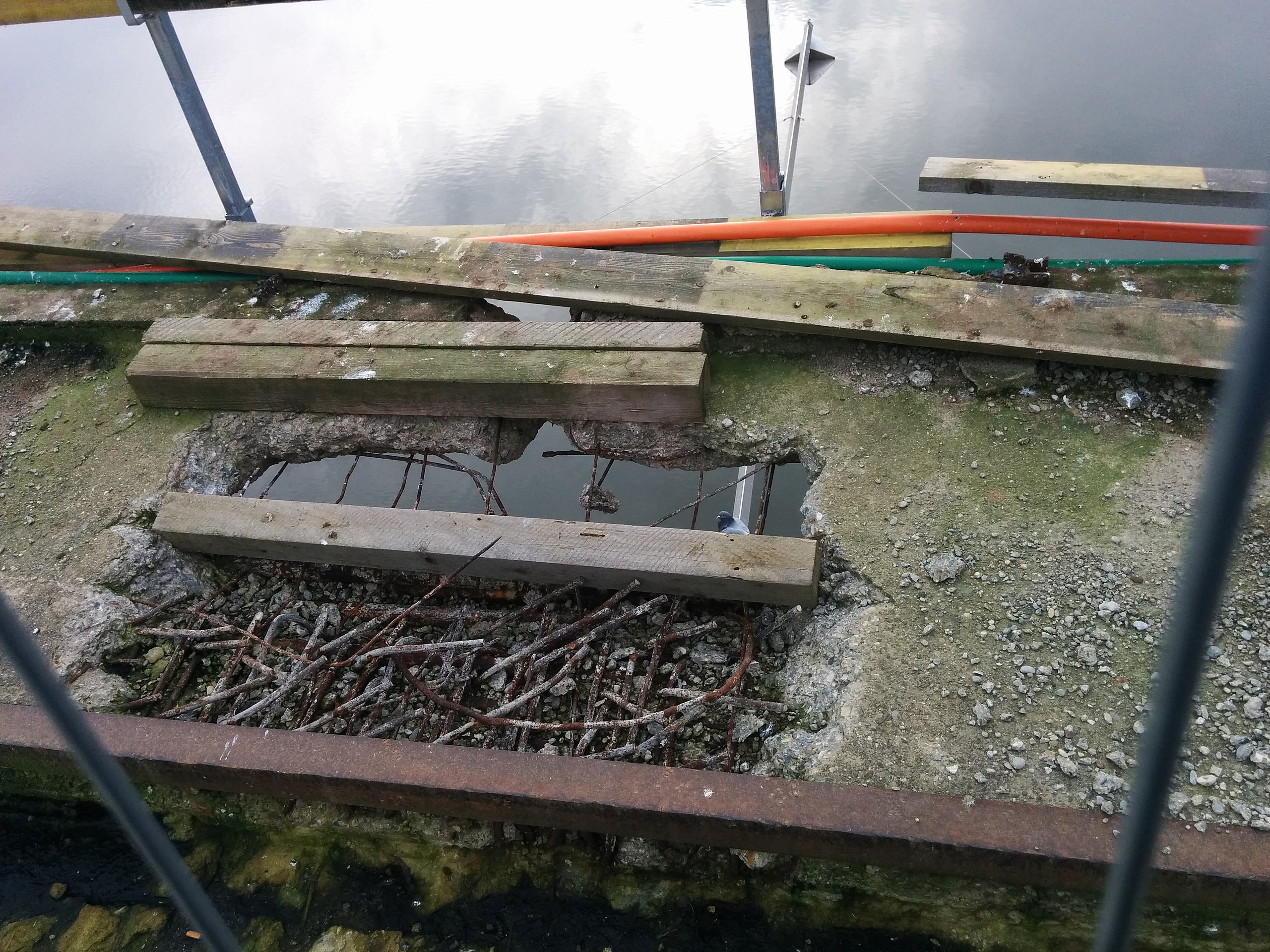
Français : Tablier du pont de Godinne, au moment où il est fermé à la circulation.
|
|||
| Date | ||||
| Source | Own work | |||
| Author | Miguel Tremblay |


| Camera location | | View this and other nearby images on: OpenStreetMap |
|---|

|
This image was uploaded as part of the photo contest Wiki Loves Heritage in Belgium in 2018 in the European Year of Cultural Heritage.
|
Licensing
[edit]
I, the copyright holder of this work, hereby publish it under the following license:
| This file is made available under the Creative Commons CC0 1.0 Universal Public Domain Dedication. | |
| The person who associated a work with this deed has dedicated the work to the public domain by waiving all of their rights to the work worldwide under copyright law, including all related and neighboring rights, to the extent allowed by law. You can copy, modify, distribute and perform the work, even for commercial purposes, all without asking permission.
|
File history
Click on a date/time to view the file as it appeared at that time.
| Date/Time | Thumbnail | Dimensions | User | Comment | |
|---|---|---|---|---|---|
| current | 20:25, 7 November 2018 | | 3,264 × 2,448 (2.49 MB) | Dirac (talk | contribs) | User created page with UploadWizard |
You cannot overwrite this file.
File usage on Commons
There are no pages that use this file.
File usage on other wikis
The following other wikis use this file:
- Usage on fr.wikipedia.org
- Usage on www.wikidata.org