File:Pleasant Hill Battlefield Louisiana.jpg
Jump to navigation
Jump to search
Size of this preview: 455 × 599 pixels. Other resolutions: 182 × 240 pixels | 364 × 480 pixels | 583 × 768 pixels | 777 × 1,024 pixels | 1,420 × 1,870 pixels.
Original file (1,420 × 1,870 pixels, file size: 1,011 KB, MIME type: image/jpeg)
Captions
Captions
Add a one-line explanation of what this file represents
Summary
[edit]
| Description |
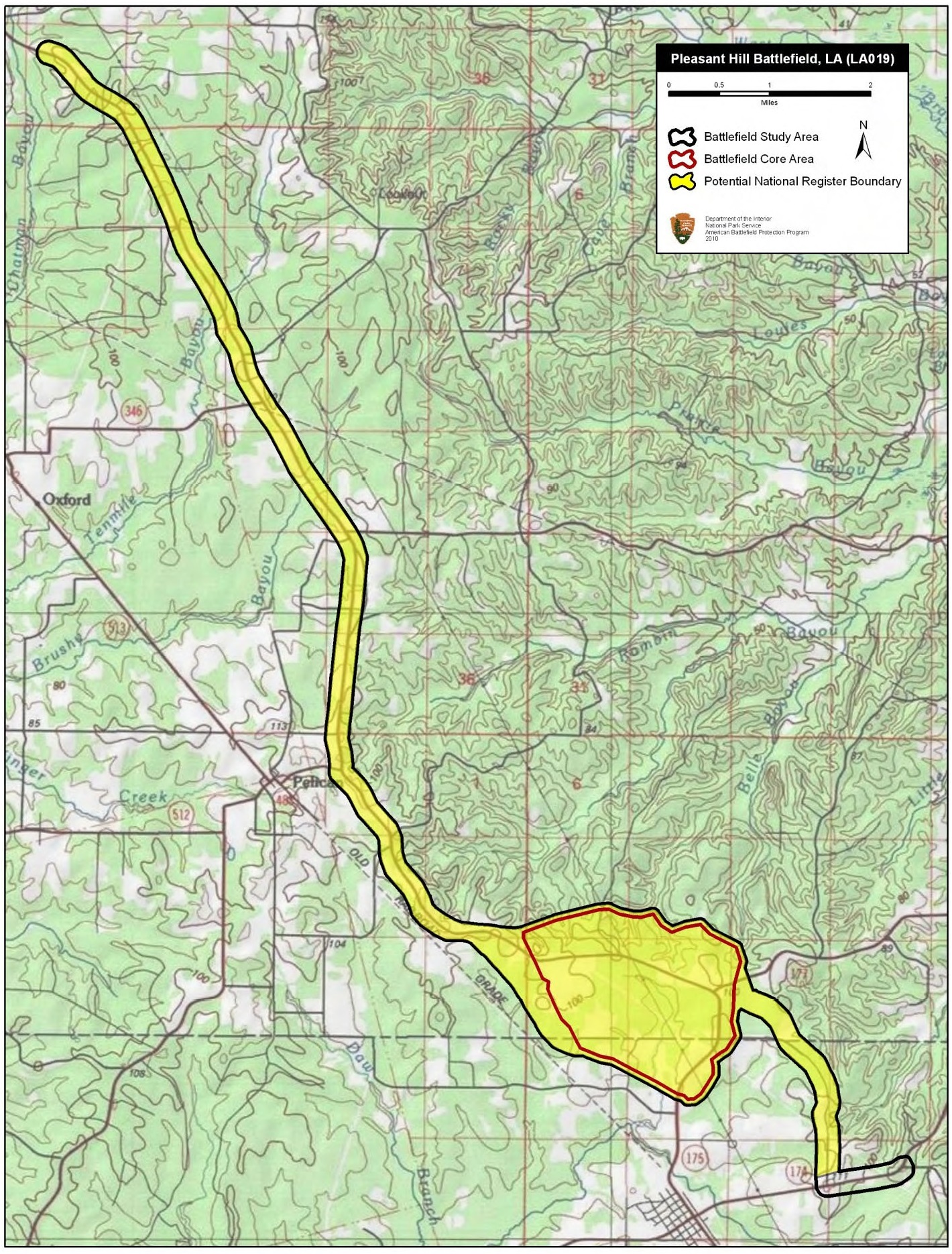
English: Map of battlefield core and study areas.
The revised Study Area includes the Confederate route of advance from the Mansfield battlefield, where the two armies had fought the previous day, to the vicinity of the Federal position at Pleasant Hill. The Study Area also includes the route of the Federal retreat towards Grand Ecore as the battle ended. The Core Area was widened to the north and south to include land over which the Confederates attempted flanking manouevres against the Federal left. |
| Date | |
| Source | National Park Service |
| Author | American Battlefield Protection Program |
Licensing
[edit]
This work is in the public domain in the United States because it is a work prepared by an officer or employee of the United States Government as part of that person’s official duties under the terms of Title 17, Chapter 1, Section 105 of the US Code.
Note: This only applies to original works of the Federal Government and not to the work of any individual U.S. state, territory, commonwealth, county, municipality, or any other subdivision. This template also does not apply to postage stamp designs published by the United States Postal Service since 1978. (See § 313.6(C)(1) of Compendium of U.S. Copyright Office Practices). It also does not apply to certain US coins; see The US Mint Terms of Use.
|
 | |
| This file has been identified as being free of known restrictions under copyright law, including all related and neighboring rights. | ||
File history
Click on a date/time to view the file as it appeared at that time.
| Date/Time | Thumbnail | Dimensions | User | Comment | |
|---|---|---|---|---|---|
| current | 22:47, 15 April 2017 | | 1,420 × 1,870 (1,011 KB) | SDriskell (talk | contribs) | User created page with UploadWizard |
You cannot overwrite this file.
File usage on Commons
The following page uses this file:
File usage on other wikis
The following other wikis use this file:
- Usage on en.wikipedia.org