File:Plan Paris Métro ligne 18.svg
Jump to navigation
Jump to search

Size of this PNG preview of this SVG file: 800 × 309 pixels. Other resolutions: 320 × 124 pixels | 640 × 247 pixels | 1,024 × 396 pixels | 1,280 × 495 pixels | 2,560 × 989 pixels | 2,650 × 1,024 pixels.
Original file (SVG file, nominally 2,650 × 1,024 pixels, file size: 84 KB)
Captions
Captions
Add a one-line explanation of what this file represents
Summary
[edit]
| Description |
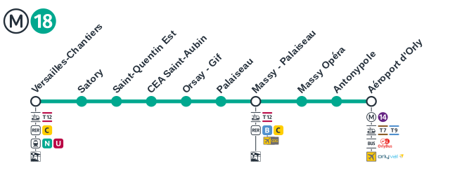
Français : Plan de la ligne 18 du métro parisien |
| Date | |
| Source | Own work |
| Author | Léo Wiki |
Licensing
[edit]
I, the copyright holder of this work, hereby publish it under the following license:
This file is licensed under the Creative Commons Attribution-Share Alike 4.0 International license.
- You are free:
- to share – to copy, distribute and transmit the work
- to remix – to adapt the work
- Under the following conditions:
- attribution – You must give appropriate credit, provide a link to the license, and indicate if changes were made. You may do so in any reasonable manner, but not in any way that suggests the licensor endorses you or your use.
- share alike – If you remix, transform, or build upon the material, you must distribute your contributions under the same or compatible license as the original.
File history
Click on a date/time to view the file as it appeared at that time.
| Date/Time | Thumbnail | Dimensions | User | Comment | |
|---|---|---|---|---|---|
| current | 01:09, 15 May 2022 | 2,650 × 1,024 (84 KB) | AlexBurn44 (talk | contribs) | +s à "Chantier" | |
| 21:10, 19 December 2021 | 2,650 × 1,024 (84 KB) | Léo Wiki (talk | contribs) | Nouvelle version avec le nouveau design de IDFM des logos des lignes | ||
| 12:34, 31 December 2019 |  | 1,263 × 667 (156 KB) | AlexBurn44 (talk | contribs) | +++ | |
| 10:38, 20 October 2018 |  | 1,263 × 667 (109 KB) | Naturals (talk | contribs) | Colour updated correctly, according to Île-de-France Mobilités ([https://www.iledefrance-mobilites.fr/projet/metro-18-nouvelle-ligne-aeroport-dorly-versailles-chantiers/ source]). | |
| 19:40, 5 February 2018 |  | 1,263 × 667 (109 KB) | Chabe01 (talk | contribs) | Fichier vraiment vectoriel, formes plus correctes. | |
| 15:13, 11 July 2017 |  | 1,920 × 1,080 (555 KB) | The BurnPheonix (talk | contribs) | CORRES T1 | |
| 21:14, 24 March 2017 |  | 1,920 × 1,080 (102 KB) | The BurnPheonix (talk | contribs) | User created page with UploadWizard |
You cannot overwrite this file.
File usage on Commons
The following 21 pages use this file:
- User:Chumwa/OgreBot/Potential transport maps/2017 July 11-20
- User:Chumwa/OgreBot/Potential transport maps/2017 March 21-31
- User:Chumwa/OgreBot/Potential transport maps/2018 February 1-9
- User:Chumwa/OgreBot/Potential transport maps/2018 October 11-20
- User:Chumwa/OgreBot/Public transport information/2017 July 11-20
- User:Chumwa/OgreBot/Public transport information/2017 March 21-31
- User:Chumwa/OgreBot/Public transport information/2018 February 1-9
- User:Chumwa/OgreBot/Public transport information/2018 October 11-20
- User:Chumwa/OgreBot/Public transport information/2021 December 11-20
- User:Chumwa/OgreBot/Public transport information/2022 May 11-20
- User:Chumwa/OgreBot/Transport Maps/2017 July 11-20
- User:Chumwa/OgreBot/Transport Maps/2017 March 21-31
- User:Chumwa/OgreBot/Transport Maps/2018 February 1-9
- User:Chumwa/OgreBot/Transport Maps/2018 October 11-20
- User:Chumwa/OgreBot/Transport Maps/2021 December 11-20
- User:Chumwa/OgreBot/Transport Maps/2022 May 11-20
- User:Chumwa/OgreBot/Travel and communication maps/2017 July 11-20
- User:Chumwa/OgreBot/Travel and communication maps/2017 March 21-31
- User:Chumwa/OgreBot/Travel and communication maps/2018 February 1-9
- User:Chumwa/OgreBot/Travel and communication maps/2018 October 11-20
- File:Dessin-18.svg (file redirect)
File usage on other wikis
The following other wikis use this file:
- Usage on en.wikipedia.org
- Usage on fr.wikipedia.org
- Usage on it.wikipedia.org
- Usage on pt.wikipedia.org