File:Pico de Orizaba, Mexico.JPG
Jump to navigation
Jump to search
Size of this preview: 800 × 532 pixels. Other resolutions: 320 × 213 pixels | 640 × 425 pixels | 1,024 × 681 pixels | 1,280 × 851 pixels | 2,560 × 1,701 pixels | 4,288 × 2,850 pixels.
Original file (4,288 × 2,850 pixels, file size: 3.3 MB, MIME type: image/jpeg)
Captions
Captions
Add a one-line explanation of what this file represents
Summary
[edit]
| Description |
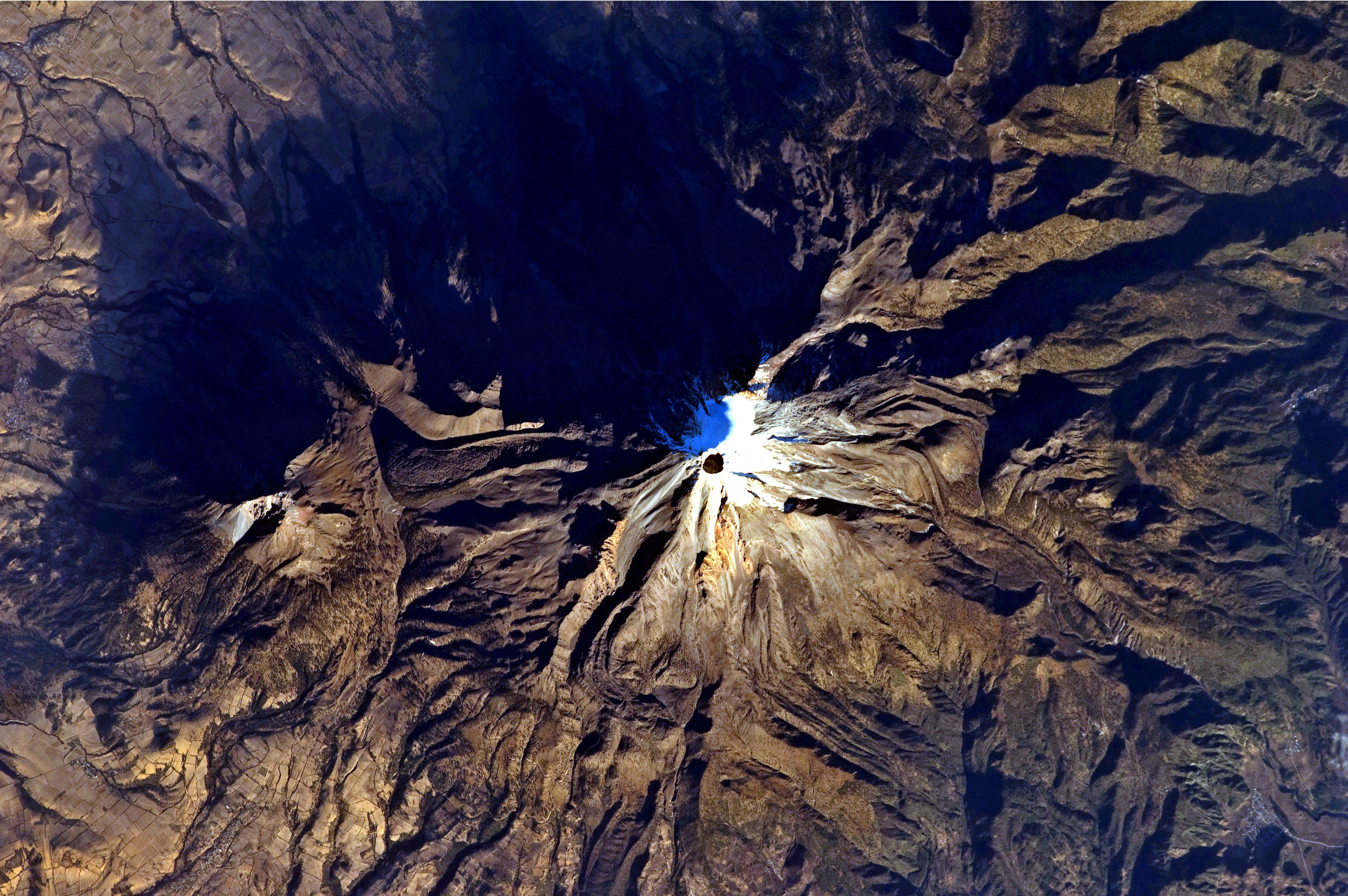
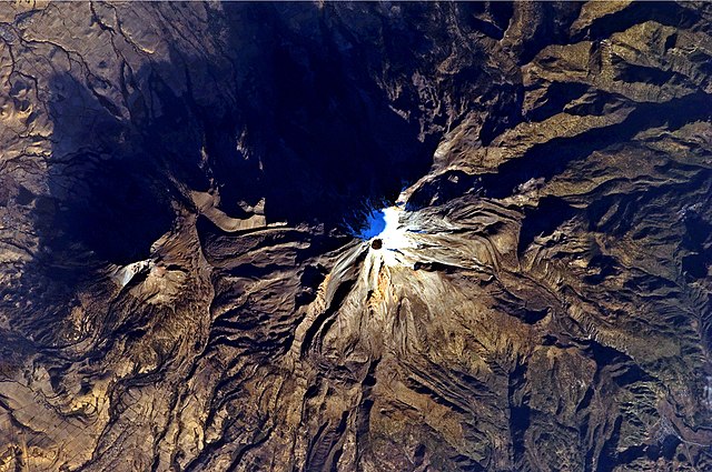
English: Shadows accentuate several features of the Pico de Orizaba, a stratovolcano, visible in this astronaut photograph from the International Space Station. The 300-meter-deep summit crater is clearly visible against surrounding ice and snow cover near image centre. Several lava flows extend down the flanks of the volcano, made readily visible by prominent cooling ridges along their sides known as flow levees. One of the most clearly visible examples is located on the south-west flank of the cone. |
| Date | |
| Source | NASA Earth Observatory |
| Author | ISS Expedition 26 crew |
| Camera location | | View this and other nearby images on: OpenStreetMap |
|---|
This image or video was catalogued by Johnson Space Center of the United States National Aeronautics and Space Administration (NASA) under Photo ID: ISS026-E-25437. This tag does not indicate the copyright status of the attached work. A normal copyright tag is still required. See Commons:Licensing. Other languages:
|
Image acquired with a Nikon D2Xs digital camera using a 400 mm lens, and is provided by the ISS Crew Earth Observations experiment and Image Science & Analysis Laboratory, Johnson Space Center.
Licensing
[edit]
| This file is in the public domain in the United States because it was solely created by NASA. NASA copyright policy states that "NASA material is not protected by copyright unless noted". (See Template:PD-USGov, NASA copyright policy page or JPL Image Use Policy.) | ||
 |
Warnings:
|
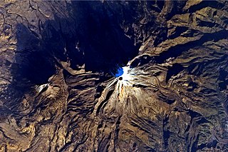
| Annotations | This image is annotated: View the annotations at Commons |
File history
Click on a date/time to view the file as it appeared at that time.
| Date/Time | Thumbnail | Dimensions | User | Comment | |
|---|---|---|---|---|---|
| current | 12:05, 28 February 2011 | | 4,288 × 2,850 (3.3 MB) | Originalwana (talk | contribs) | {{Information |Description ={{en|1=Shadows accentuate several features of the Pico de Orizaba, a stratovolcano, visible in this astronaut photograph from the International Space Station. The 300-meter-deep summit crater is clearly visible again |
You cannot overwrite this file.
File usage on Commons
There are no pages that use this file.
File usage on other wikis
The following other wikis use this file:
- Usage on af.wikipedia.org
- Usage on en.wikipedia.org
- Usage on fr.wikipedia.org
- Usage on ja.wikipedia.org
- Usage on mk.wikipedia.org
- Usage on uk.wikipedia.org
Metadata
Categories:
- Citlaltépetl
- ISS Expedition 26 Crew Earth Observations
- Volcanic craters in Puebla
- Eruptive vents in Puebla
- Volcanoes (annotated)
- Glaciers of Citlaltépetl
- Sierra Negra (Puebla)
- Subglacial volcanoes in Mexico in 2011
- Volcanic craters in Veracruz
- Eruptive vents in Veracruz
- Satellite pictures of volcanoes in Mexico in 2011