File:Phang Nga Bay, Karst formations, Thailand.jpg
Jump to navigation
Jump to search

Size of this preview: 800 × 533 pixels. Other resolutions: 320 × 213 pixels | 640 × 427 pixels | 1,024 × 683 pixels | 1,280 × 853 pixels | 2,560 × 1,707 pixels | 3,072 × 2,048 pixels.
Original file (3,072 × 2,048 pixels, file size: 4.13 MB, MIME type: image/jpeg)
Captions
Captions
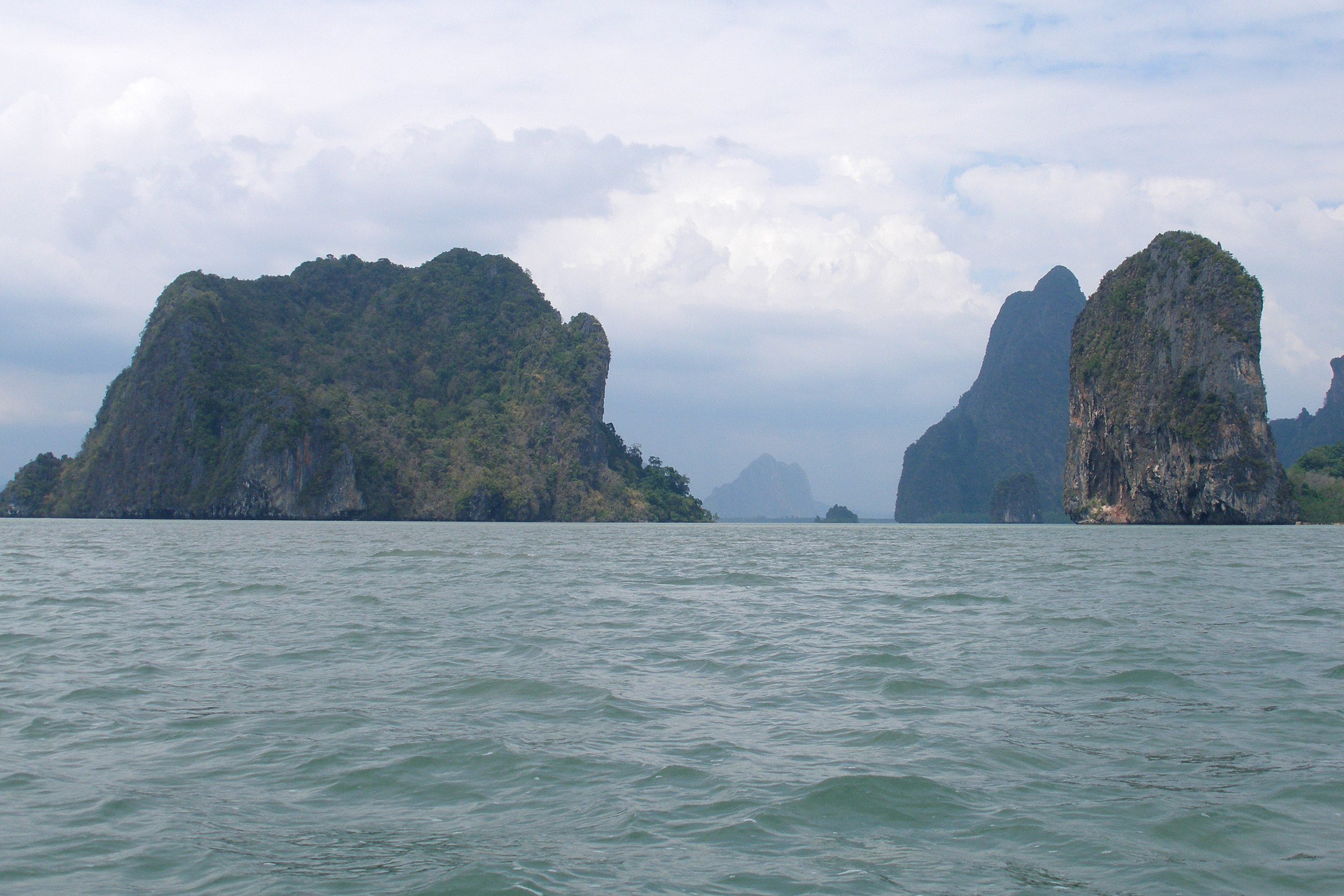
Phang Nga Bay, Thailand. Karst formations.
Summary
[edit]
| Description |
English: Phang Nga is a shallow bay with 100+ islands, comprising shallow marine waters and intertidal forested wetlands. Limestone cliffs with caves, collapsed cave systems, and archaeological sites. Karst islands. Phang Nga Bay, Andaman Sea, Thailand.
Русский: Карстовые образования на мелководье. Пхангнга (залив), Андаманское море, Таиланд. |
| Date | |
| Source | Own work |
| Author | Vyacheslav Argenberg |
| Camera location | | View this and other nearby images on: OpenStreetMap |
|---|

|
This image was taken by Vyacheslav Argenberg
If you have any questions, comments or queries, please contact me. |

|
Licensing
[edit]
Vyacheslav Argenberg, the copyright holder of this work, hereby publishes it under the following license:
This file is licensed under the Creative Commons Attribution 4.0 International license.
Attribution: © Vyacheslav Argenberg / http://www.vascoplanet.com/
- You are free:
- to share – to copy, distribute and transmit the work
- to remix – to adapt the work
- Under the following conditions:
- attribution – You must give appropriate credit, provide a link to the license, and indicate if changes were made. You may do so in any reasonable manner, but not in any way that suggests the licensor endorses you or your use.
| This file was uploaded as part of Wiki Science Competition 2021. |
File history
Click on a date/time to view the file as it appeared at that time.
| Date/Time | Thumbnail | Dimensions | User | Comment | |
|---|---|---|---|---|---|
| current | 17:55, 26 October 2021 | | 3,072 × 2,048 (4.13 MB) | Argenberg (talk | contribs) | Uploaded own work with UploadWizard |
You cannot overwrite this file.
File usage on Commons
The following 4 pages use this file:
File usage on other wikis
The following other wikis use this file:
- Usage on be.wikipedia.org
- Usage on es.wikipedia.org
- Usage on gl.wikipedia.org
- Usage on hu.wikipedia.org
- Usage on nn.wikipedia.org
- Usage on no.wikipedia.org
- Usage on pl.wikipedia.org
- Usage on ro.wikipedia.org
- Usage on ru.wikipedia.org
- Usage on vi.wikipedia.org
- Usage on www.wikidata.org