File:Path beside Geilston Burn - geograph.org.uk - 1359934.jpg
From Wikimedia Commons, the free media repository
Jump to navigation
Jump to search
Path_beside_Geilston_Burn_-_geograph.org.uk_-_1359934.jpg (640 × 480 pixels, file size: 148 KB, MIME type: image/jpeg)
File information
Structured data
Captions
Captions
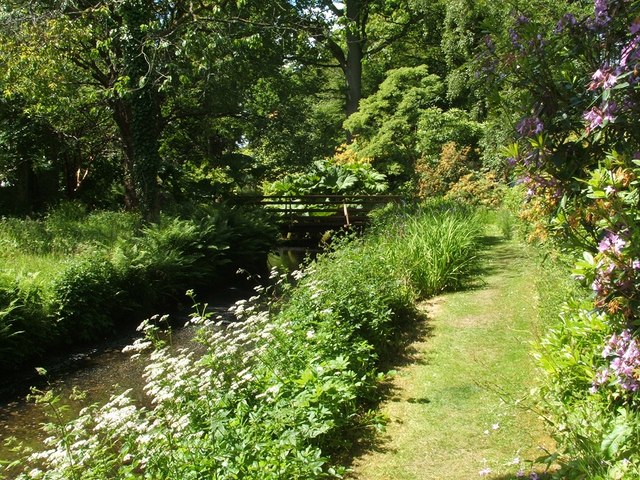
Path beside Geilston Burn
Summary
[edit]| DescriptionPath beside Geilston Burn - geograph.org.uk - 1359934.jpg |
English: Path beside Geilston Burn. This woodland walk is set within the 10-acre estate of Geilston Gardens. (Compare a view of the same section of path from the window of the potting shed of the nearby Walled Garden: [1]). For the view in the opposite direction along the same stretch of path, see: 430047. The Geilston Burn, which winds through this estate, reaches the River Clyde about a kilometre from here, near a timber yard in Cardross: [2] In the background, just behind the little footbridge over the burn, a patch of Gunnera (a large rhubarb-like non-native plant) can be seen. Gunnera also grows in several places in a shaded glen below the eastern wall of the Walled Garden. |
||
| Date | |||
| Source | From geograph.org.uk | ||
| Author | Lairich Rig | ||
| Permission (Reusing this file) |
This file is licensed under the Creative Commons Attribution-Share Alike 2.0 Generic license. Attribution: Lairich Rig
|
||
| Attribution (required by the license) InfoField | Lairich Rig / Path beside Geilston Burn / | ||
InfoField | Lairich Rig / Path beside Geilston Burn |
| Camera location | 55° 58′ 09.3″ N, 4° 39′ 38″ W | View this and other nearby images on: OpenStreetMap |
|---|
| Object location | 55° 58′ 09.6″ N, 4° 39′ 40″ W | View this and other nearby images on: OpenStreetMap |
|---|
File history
Click on a date/time to view the file as it appeared at that time.
| Date/Time | Thumbnail | Dimensions | User | Comment | |
|---|---|---|---|---|---|
| current | 08:30, 28 February 2011 |  | 640 × 480 (148 KB) | GeographBot (talk | contribs) | == {{int:filedesc}} == {{Information |description={{en|1=Path beside Geilston Burn This woodland walk is set within the 10-acre estate of Geilston Gardens. (Compare a view of the same section of path from the window of the potting shed of the nearby Walle |
You cannot overwrite this file.
File usage on Commons
There are no pages that use this file.
File usage on other wikis
The following other wikis use this file:
- Usage on en.wikipedia.org
Metadata
This file contains additional information such as Exif metadata which may have been added by the digital camera, scanner, or software program used to create or digitize it. If the file has been modified from its original state, some details such as the timestamp may not fully reflect those of the original file. The timestamp is only as accurate as the clock in the camera, and it may be completely wrong.
| _error | 0 |
|---|

