File:Paris-atlas by Fernand Bournon - 28. 11e arrondissement - David Rumsey 2.jpg
Jump to navigation
Jump to search

Size of this preview: 466 × 599 pixels. Other resolutions: 187 × 240 pixels | 373 × 480 pixels | 597 × 768 pixels | 796 × 1,024 pixels | 1,592 × 2,048 pixels | 4,643 × 5,971 pixels.
Original file (4,643 × 5,971 pixels, file size: 25.86 MB, MIME type: image/jpeg)
Captions
Captions
Add a one-line explanation of what this file represents
Summary
[edit]
| Title |
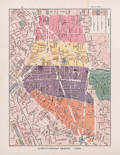
11e arrondissement |
| Description |
English: An old map of Paris from Paris-atlas by Fernand Bournon, Libraire Larousse, 1900. |
| Date | |
| Source | David Rumsey Historical Map Collection |
| Creator |
Fernand Bournon |
| Geotemporal data | |
| Date depicted | |
| Map location | Paris |
| Georeferencing | If inappropriate please set warp_status = skip to hide. |
| Bibliographic data | |
| Publication |
Title: Paris-Atlas. Texte par Fernand Bournon, Archiviste-Paleographe. 28 Cartes dont 24 en couleurs. 595 Reproductions photographques 32 Dessins. Libraire Larousse. Paris. |
| Language | French |
| Place of publication | Paris |
| Publisher |
Libraire Larousse |
| Archival data | |
| Collection | David Rumsey Historical Map Collection |
Licensing
[edit]
|
This work is in the public domain in its country of origin and other countries and areas where the copyright term is the author's life plus 100 years or fewer. | |
| This file has been identified as being free of known restrictions under copyright law, including all related and neighboring rights. | |
File history
Click on a date/time to view the file as it appeared at that time.
| Date/Time | Thumbnail | Dimensions | User | Comment | |
|---|---|---|---|---|---|
| current | 07:38, 15 November 2020 | | 4,643 × 5,971 (25.86 MB) | Paris 16 (talk | contribs) | Uploaded own work with UploadWizard |
You cannot overwrite this file.
File usage on Commons
The following 3 pages use this file:
Metadata
Categories:
- Maps of Paris from the David Rumsey Historical Map Collection
- Paris-atlas by Fernand Bournon, David Rumsey Historical Map Collection
- Old maps of Paris 11e arrondissement
- Street maps of Paris 11e arrondissement
- Maps of administrative quartiers of Paris by Fernand Bournon
- Quartier de la Folie-Méricourt
- Quartier Saint-Ambroise
- Quartier de la Roquette
- Quartier Sainte-Marguerite
- Maps of administrative quartiers of Paris 11e arrondissement