File:Panorama von Roeti 1.jpg
Jump to navigation
Jump to search
Size of this preview: 800 × 336 pixels. Other resolutions: 320 × 134 pixels | 640 × 269 pixels | 1,024 × 430 pixels | 1,280 × 538 pixels | 2,560 × 1,076 pixels | 5,995 × 2,519 pixels.
Original file (5,995 × 2,519 pixels, file size: 1.86 MB, MIME type: image/jpeg)
Captions
Captions
Add a one-line explanation of what this file represents
Summary
[edit]
| Description |
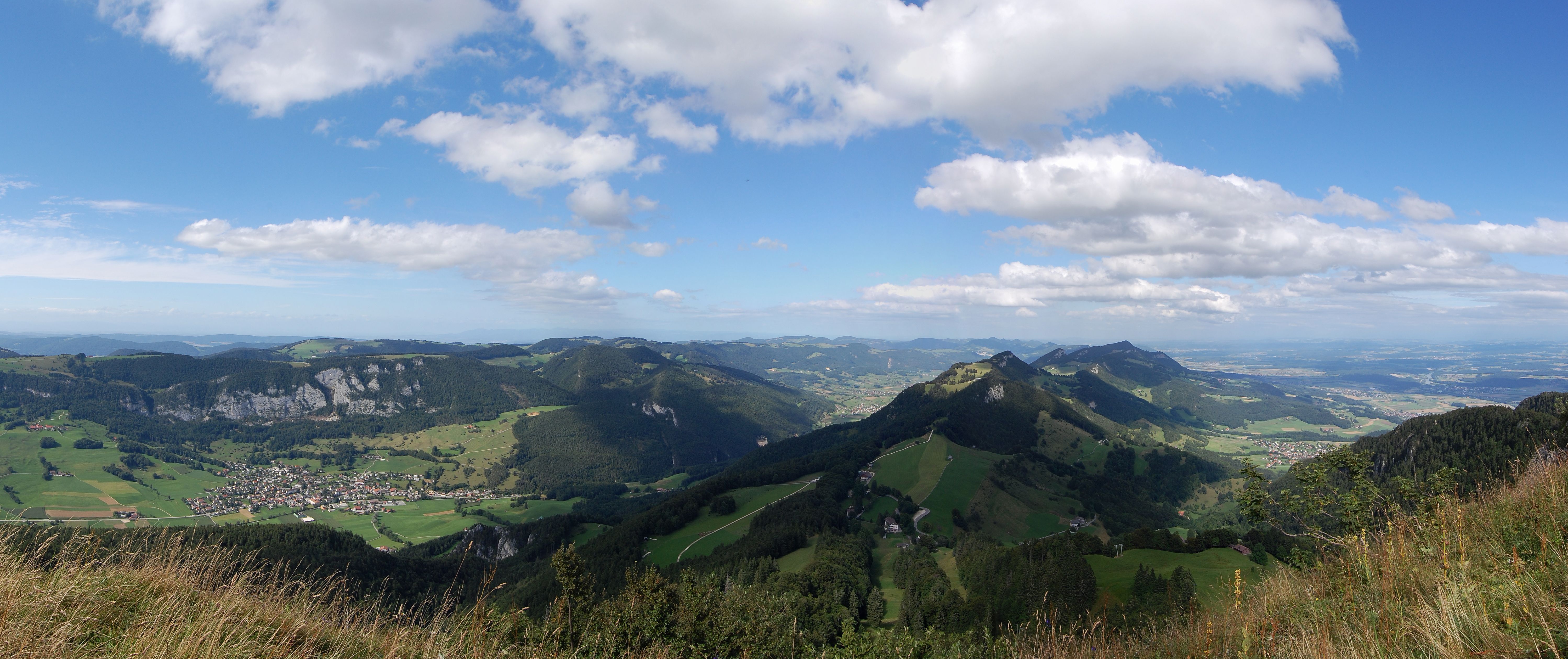
Deutsch: Panorama, aufgenommen von der Röti im Weissensteinzug. Links im Bild ist Welschenrohr zu erkennen, in der Mitte der Balmberg
English: The picture, which is taken from the Röti (near Weissenstein), shows the Jura. On the left is the town Welschenrohr. |
| Date | |
| Source | Own work |
| Author | IqRS, stitched by Hd pano |
| Other versions | Image:Panorama von Roeti.jpg |
| Camera location | | View this and other nearby images on: OpenStreetMap |
|---|
Licensing
[edit]
I, the copyright holder of this work, hereby publish it under the following license:
This file is licensed under the Creative Commons Attribution-Share Alike 3.0 Unported license.
- You are free:
- to share – to copy, distribute and transmit the work
- to remix – to adapt the work
- Under the following conditions:
- attribution – You must give appropriate credit, provide a link to the license, and indicate if changes were made. You may do so in any reasonable manner, but not in any way that suggests the licensor endorses you or your use.
- share alike – If you remix, transform, or build upon the material, you must distribute your contributions under the same or compatible license as the original.
Original upload log
[edit]
The original description page was here. All following user names refer to de.wikipedia.
- 2008-08-20 08:48 Hd pano 5995×2519×??? (1953827 bytes) {{Information |Description={{de|1=Panorama, aufgenommen von der Röti im Weissensteinzug. Links im Bild ist Welschenrohr zu erkennen, in der Mitte der Balmberg}} |Source= Self-made |Date= August 13th, 2008 |Author= [[:de:user:IqRS|IqRS]], stitched by [[Us
This image has been assessed using the Quality image guidelines and is considered a Quality image.
|
File history
Click on a date/time to view the file as it appeared at that time.
| Date/Time | Thumbnail | Dimensions | User | Comment | |
|---|---|---|---|---|---|
| current | 21:24, 20 August 2008 | | 5,995 × 2,519 (1.86 MB) | IqRS~commonswiki (talk | contribs) | {{Information |Description={{de|1=Panorama, aufgenommen von der Röti im Weissensteinzug. Links im Bild ist Welschenrohr zu erkennen, in der Mitte der Balmberg}} |Source=Eigenes Werk (own work) |Author=IqRS, stitched by Hd pano |Date=August |
You cannot overwrite this file.
File usage on Commons
The following 4 pages use this file:
File usage on other wikis
The following other wikis use this file:
- Usage on de.wikipedia.org
- Usage on eo.wikipedia.org
- Wasseramt (distrikto)
- Bucheggberg (distrikto)
- Lebern (distrikto)
- Thal (distrikto)
- Ŝablono:Navigilo:Distriktoj de Kantono Soloturno
- Gäu (distrikto)
- Olten (distrikto)
- Soloturno (distrikto)
- Gösgen (distrikto)
- Dorneck (distrikto)
- Thierstein (distrikto)
- Bucheggberg-Wasseramt (oficdistrikto)
- Ŝablono:Navigilo:Oficdistriktoj de Kantono Soloturno
- Dorneck-Thierstein (oficdistrikto)
- Olten-Gösgen (oficdistrikto)
- Soloturno-Lebern (oficdistrikto)
- Thal-Gäu (oficdistrikto)
- Usage on fr.wikipedia.org
- Usage on nn.wikipedia.org