File:Paigah tombs arch.jpg
Jump to navigation
Jump to search

Size of this preview: 555 × 600 pixels. Other resolutions: 222 × 240 pixels | 444 × 480 pixels | 711 × 768 pixels | 947 × 1,024 pixels | 1,895 × 2,048 pixels | 3,120 × 3,372 pixels.
Original file (3,120 × 3,372 pixels, file size: 2.52 MB, MIME type: image/jpeg)
Captions
Captions
Add a one-line explanation of what this file represents
Summary
[edit]
| Description |
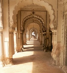
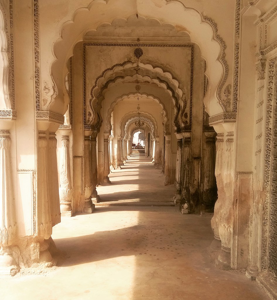
Paigah tombs arch:
The paigah tombs are located at Pisabandla on the road to santhosh nagar colony from the Mirjumla Tank.It represent the final resting places of several generations of the paigah nobles, including Asman Jah,Viqar-ul-Umara and shams Ul Umara.Constructed between 1787 and 1880s, the tombs eith unique designs,are magnificent structures with stucco work,reflecting Deccani,Mughal,Greek,Persian,Asaf Jahi and Rajasthani styles of architecture.
|
| Date | 6 December 2017 (according to Exif data) |
| Source | Own work |
| Author | Adbh266 |
| Camera location | | View this and other nearby images on: OpenStreetMap |
|---|
Licensing
[edit]
I, the copyright holder of this work, hereby publish it under the following license:
This file is licensed under the Creative Commons Attribution-Share Alike 4.0 International license.
- You are free:
- to share – to copy, distribute and transmit the work
- to remix – to adapt the work
- Under the following conditions:
- attribution – You must give appropriate credit, provide a link to the license, and indicate if changes were made. You may do so in any reasonable manner, but not in any way that suggests the licensor endorses you or your use.
- share alike – If you remix, transform, or build upon the material, you must distribute your contributions under the same or compatible license as the original.
| This file was uploaded via Mobile Android App (Commons mobile app) 2.4.2. |
File history
Click on a date/time to view the file as it appeared at that time.
| Date/Time | Thumbnail | Dimensions | User | Comment | |
|---|---|---|---|---|---|
| current | 16:29, 6 December 2017 | | 3,120 × 3,372 (2.52 MB) | Adbh266 (talk | contribs) | Uploaded using Android Commons app |
You cannot overwrite this file.
File usage on Commons
The following page uses this file:
File usage on other wikis
The following other wikis use this file:
- Usage on te.wikipedia.org