File:Orzonebil 02.jpg
Jump to navigation
Jump to search

Size of this preview: 800 × 600 pixels. Other resolutions: 320 × 240 pixels | 640 × 480 pixels | 1,024 × 768 pixels | 1,280 × 960 pixels | 2,560 × 1,920 pixels | 4,128 × 3,096 pixels.
Original file (4,128 × 3,096 pixels, file size: 7.37 MB, MIME type: image/jpeg)
Captions
Captions
Add a one-line explanation of what this file represents
Summary
[edit]
| Description |
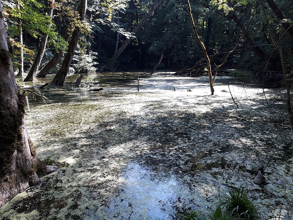
English: It is a forest pond located in Lerik, south region of Azerbaijan. There is no much visit to this small lake in last 50 years. It is totally isolated, and there is no any designated path to reach there. I have heard some rumours from old people that smugglers has used this pond to hide their stuff. It has a incredible view. It is now inhabited by a mass of frogs and some wild algae.
|
||
| Date | |||
| Source | Own work | ||
| Author | Havzeqodush |
| Camera location | | View this and other nearby images on: OpenStreetMap |
|---|
I think it is belong to Rvarud State Nature Sanctuaries. It is hard to make aproper distinction between those state reserves.
Although there is no any proper car road, forest is being constantly destroyed by a group of people.
Licensing
[edit]
I, the copyright holder of this work, hereby publish it under the following license:
This file is licensed under the Creative Commons Attribution-Share Alike 4.0 International license.
- You are free:
- to share – to copy, distribute and transmit the work
- to remix – to adapt the work
- Under the following conditions:
- attribution – You must give appropriate credit, provide a link to the license, and indicate if changes were made. You may do so in any reasonable manner, but not in any way that suggests the licensor endorses you or your use.
- share alike – If you remix, transform, or build upon the material, you must distribute your contributions under the same or compatible license as the original.
This image was uploaded as part of Wiki Loves Earth 2018.
|
 |
File history
Click on a date/time to view the file as it appeared at that time.
| Date/Time | Thumbnail | Dimensions | User | Comment | |
|---|---|---|---|---|---|
| current | 08:38, 24 May 2018 | | 4,128 × 3,096 (7.37 MB) | Havzeqodush (talk | contribs) | User created page with UploadWizard |
You cannot overwrite this file.
File usage on Commons
There are no pages that use this file.