File:Okhotsk Plate map - de.png
Jump to navigation
Jump to search
Size of this preview: 443 × 600 pixels. Other resolutions: 177 × 240 pixels | 628 × 850 pixels.
Original file (628 × 850 pixels, file size: 93 KB, MIME type: image/png)
Captions
Captions
Add a one-line explanation of what this file represents
| Description |
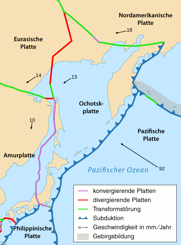
Deutsch: Das tektonische Gebiet rund um die Ochotskplatte.
English: Area around Okhotsk plate. |
||
| Date | see file history | ||
| Source | |||
| Author |
|
||
| Permission (Reusing this file) |
I, the copyright holder of this work, hereby publish it under the following license: This file is licensed under the Creative Commons Attribution-Share Alike 2.5 Generic license.
|
||
| Other versions |
|
File history
Click on a date/time to view the file as it appeared at that time.
| Date/Time | Thumbnail | Dimensions | User | Comment | |
|---|---|---|---|---|---|
| current | 19:54, 14 March 2011 | | 628 × 850 (93 KB) | Chumwa (talk | contribs) | Philippinenseeplatte → Philippinische Platte |
| 06:47, 13 March 2011 |  | 628 × 850 (94 KB) | Chumwa (talk | contribs) | Schrift | |
| 06:42, 13 March 2011 |  | 628 × 850 (92 KB) | Chumwa (talk | contribs) | Schrift | |
| 06:39, 13 March 2011 |  | 628 × 850 (92 KB) | Chumwa (talk | contribs) | Information |Description={{de|Das tektonische Gebiet rund um die Ochotskplatte.}} {{en|Area around Okhotsk plate.}} |Source=*Tectonic_plates_boundaries_detailed-fr.svg |Date=see file hist |
You cannot overwrite this file.
File usage on Commons
The following page uses this file:
File usage on other wikis
The following other wikis use this file:
- Usage on als.wikipedia.org
- Usage on be.wikipedia.org
- Usage on de.wikipedia.org
- Usage on rm.wikipedia.org
- Usage on ru.wikipedia.org