File:Ohio Wesleyan University Student Observatory.jpg
Jump to navigation
Jump to search
Size of this preview: 800 × 600 pixels. Other resolutions: 320 × 240 pixels | 640 × 480 pixels | 1,024 × 768 pixels | 1,280 × 960 pixels | 2,560 × 1,920 pixels | 2,816 × 2,112 pixels.
Original file (2,816 × 2,112 pixels, file size: 2.46 MB, MIME type: image/jpeg)
Captions
Captions
Add a one-line explanation of what this file represents
|
This is an image of a place or building that is listed on the National Register of Historic Places in the United States of America. Its reference number is 85000633. |
| Camera location | | View this and other nearby images on: OpenStreetMap |
|---|
| Description |
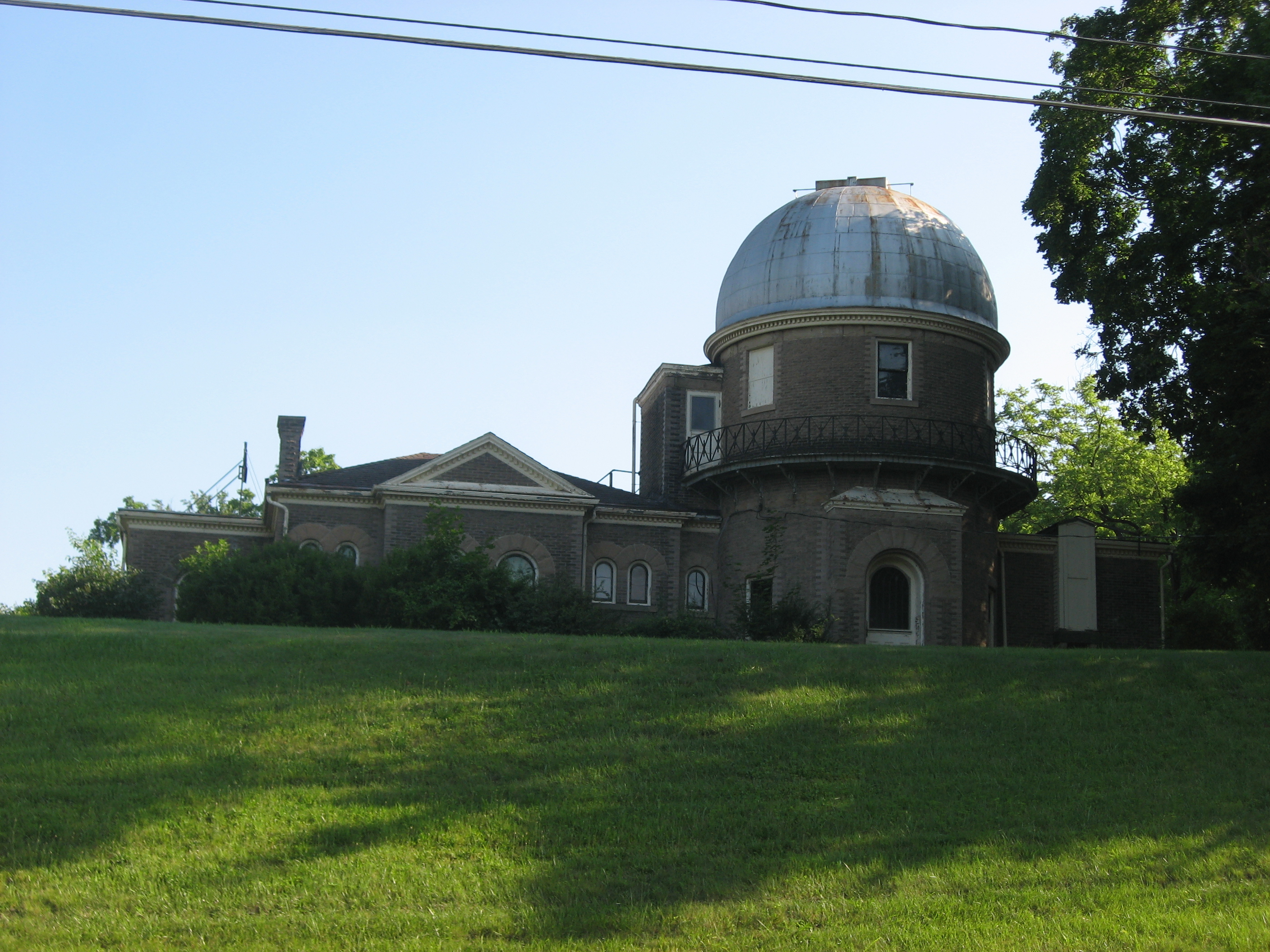
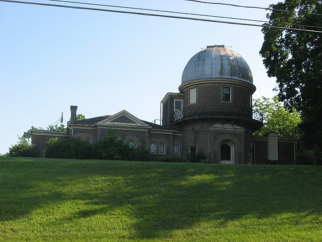
English: Front of the old Ohio Wesleyan University Student Observatory (now superseded by the Perkins Observatory), located along W. William Street (U.S. Route 36) on the campus of Ohio Wesleyan University in Delaware, Ohio, United States. Built in 1900, it is listed on the National Register of Historic Places. |
||
| Date | Taken on 18 June 2010 | ||
| Source | Own work | ||
| Author | Nyttend | ||
| Permission (Reusing this file) |
|
File history
Click on a date/time to view the file as it appeared at that time.
| Date/Time | Thumbnail | Dimensions | User | Comment | |
|---|---|---|---|---|---|
| current | 05:21, 21 June 2010 | | 2,816 × 2,112 (2.46 MB) | Nyttend (talk | contribs) | {{Location|40|17|55|N|83|4|35|W}} {{Information |Description={{en|Front of the old {{w|Ohio Wesleyan University Student Observatory}} (now superseded by the {{w|Perkins Observatory}}), located along W. William Street ({{w|U.S. Route 36}}) on the campus of |
You cannot overwrite this file.
File usage on Commons
There are no pages that use this file.
File usage on other wikis
The following other wikis use this file:
- Usage on es.wikipedia.org