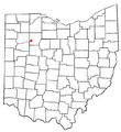
File:OHMap-doton-Mount Cory.png
From Wikimedia Commons, the free media repository
Jump to navigation
Jump to search
OHMap-doton-Mount_Cory.png (274 × 300 pixels, file size: 10 KB, MIME type: image/png)
File information
Structured data
Captions
Captions
Add a one-line explanation of what this file represents
| DescriptionOHMap-doton-Mount Cory.png |
English: Map of Mount Cory. |
||||||||
| Date | 1 August 2004 (original upload date) | ||||||||
| Source | Own work by the original uploader | ||||||||
| Author | Catbar at English Wikipedia | ||||||||
| Permission (Reusing this file) |
|
Original upload log
[edit]The original description page was here. All following user names refer to en.wikipedia.
- 2004-08-01 23:39 Catbar 274×300×8 (10457 bytes) {{msg:GFDL}}<br>Adapted from Wikipedia's OH county maps by Catbar.
File history
Click on a date/time to view the file as it appeared at that time.
| Date/Time | Thumbnail | Dimensions | User | Comment | |
|---|---|---|---|---|---|
| current | 22:16, 9 July 2007 |  | 274 × 300 (10 KB) | SieBot (talk | contribs) | {{Information |Description=<br>Adapted from Wikipedia's OH county maps by Catbar. |Source=Originally from [http://en.wikipedia.org en.wikipedia]; description page is/was [http://en.wikipedia.org/w/index.php?title=Image%3AOHMap-doton-Mount_Cory.png here]. |
You cannot overwrite this file.
File usage on Commons
The following page uses this file:
File usage on other wikis
The following other wikis use this file:
- Usage on ar.wikipedia.org
- Usage on ca.wikipedia.org
- Usage on cy.wikipedia.org
- Usage on en.wikipedia.org
- Usage on eu.wikipedia.org
- Usage on fr.wikipedia.org
- Usage on ht.wikipedia.org
- Usage on sh.wikipedia.org
- Usage on sr.wikipedia.org
- Usage on sv.wikipedia.org
- Usage on vi.wikipedia.org
- Usage on www.wikidata.org

