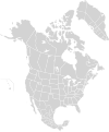
File:North America second level political division 2 and Greenland.svg

Original file (SVG file, nominally 1,789 × 2,154 pixels, file size: 367 KB)
Captions
Captions
| DescriptionNorth America second level political division 2 and Greenland.svg |
English: Map of North America and its second-level political divisions. Canadian provinces and territories, US and Mexican states. Canada, Mexico, United States.
Non-contiguous parts of a states/provinces are "grouped" together with the main area of the state/provinces, so any state/provinces can be coloured in completion with one click anywhere on the state/provinces's area. Also, all states/provinces have a "id" attached to them, making them easy to find. Select "find" and then enter in the state/provinces's ISO 3166-2 code in the "id" field to find it. The codes can be found here (Canada), here (USA) and here (Mexico). |
| Date | |
| Source |
Canada and US map: BlankMap-USA-states-Canada-provinces, HI closer.svg by Lokal_Profil. |
| Author | Alex Covarrubias |
| Permission (Reusing this file) |
This file is licensed under the Creative Commons Attribution-Share Alike 2.5 Generic license.
|
| Other versions |
Derivative works of this file: |
File history
Click on a date/time to view the file as it appeared at that time.
| Date/Time | Thumbnail | Dimensions | User | Comment | |
|---|---|---|---|---|---|
| current | 13:57, 18 March 2008 |  | 1,789 × 2,154 (367 KB) | CarolSpears (talk | contribs) | minor validation problems repaired |
| 13:41, 18 March 2008 |  | 1,789 × 2,154 (367 KB) | CarolSpears (talk | contribs) | {{Information |Description={{en|Map of North America and its second-level political divisions. Canadian provinces, US and Mexican states. Canada, Mexico, United States. Non-contiguous parts of a states/provinces are "grouped" together with the main area |
You cannot overwrite this file.
File usage on Commons
More than 100 pages use this file. The following list shows the first 100 pages that use this file only. A full list is available.
- File:Bombus affinis distribution.svg
- File:Bombus bifarius distribution.svg
- File:Bombus bimaculatus distribution.svg
- File:Bombus impatiens distribution.svg
- File:Bombus occidentalis distribution.svg
- File:Bombus pensylvanicus distribution.svg
- File:Bombus terricola distribution.svg
- File:Bombus vosnesenskii distribution.svg
- File:Canis lupus range north america.png
- File:Curve-billed Thrasher range map.gif
- File:Etheostoma bison distribution.svg
- File:Etheostoma burri distribution.svg
- File:Etheostoma caeruleum distribution.svg
- File:Etheostoma fragi distribution.svg
- File:Etheostoma kantuckeense distribution.svg
- File:Etheostoma lawrencei distribution.svg
- File:Etheostoma pulchellum distribution.svg
- File:Etheostoma spectabile distribution.svg
- File:Etheostoma squamosum distribution.svg
- File:Etheostoma teddyroosevelt distribution.svg
- File:Etheostoma uniporum distribution.svg
- File:Northeast Blackout of 1965.svg
- File:Oreamnos americanus distribution.svg
- File:Present (as of 2015) distribution of Canis lupus in North America.png
- File:Present canis lupus nubilus range.png
- File:Present canis lupus occidentalis range.png
- File:Sceloporus jarrovii.svg
- File:Sceloporus undulatus distribution.svg
- File:Second Chance states map.png
- File:Southwest Blackout of 2011.svg
- File:Symphyotrichum amethystinum distribution.png
- File:Symphyotrichum anomalum distribution.png
- File:Symphyotrichum anticostense distribution.png
- File:Symphyotrichum boreale distribution.png
- File:Symphyotrichum campestre distribution.png
- File:Symphyotrichum chilense distribution.png
- File:Symphyotrichum ciliolatum distribution.png
- File:Symphyotrichum cordifolium distribution.png
- File:Symphyotrichum divaricatum distribution.svg
- File:Symphyotrichum drummondii distribution.png
- File:Symphyotrichum eatonii distribution.png
- File:Symphyotrichum elliottii distribution.png
- File:Symphyotrichum ericoides distribution.png
- File:Symphyotrichum eulae distribution.png
- File:Symphyotrichum falcatum distribution.png
- File:Symphyotrichum fendleri distribution.png
- File:Symphyotrichum firmum distribution.png
- File:Symphyotrichum foliaceum distribution.jpg
- File:Symphyotrichum frondosum distribution.png
- File:Symphyotrichum grandiflorum distribution.png
- File:Symphyotrichum hendersonii distribution.png
- File:Symphyotrichum kentuckiense distribution.png
- File:Symphyotrichum laeve distribution.png
- File:Symphyotrichum lateriflorum distribution.jpg
- File:Symphyotrichum laurentianum distribution.png
- File:Symphyotrichum novi-belgii distribution.png
- File:Symphyotrichum oblongifolium distribution.png
- File:Symphyotrichum ontarionis distribution.png
- File:Symphyotrichum oolentangiense distribution.png
- File:Symphyotrichum parviceps distribution.png
- File:Symphyotrichum pilosum distribution.png
- File:Symphyotrichum pilosum pilosum native distribution.png
- File:Symphyotrichum pilosum pringlei native distribution.png
- File:Symphyotrichum praealtum distribution.png
- File:Symphyotrichum pratense distribution.png
- File:Symphyotrichum prenanthoides distribution.png
- File:Symphyotrichum puniceum distribution.png
- File:Symphyotrichum racemosum distribution.jpg
- File:Symphyotrichum racemosum distribution.png
- File:Symphyotrichum robynsianum distribution.png
- File:Symphyotrichum sericeum distribution.png
- File:Symphyotrichum shortii distribution.png
- File:Symphyotrichum simmondsii distribution.png
- File:Symphyotrichum spathulatum distribution.png
- File:Symphyotrichum subspicatum distribution.jpg
- File:Symphyotrichum tradescantii distribution.png
- File:Symphyotrichum turbinellum distribution.png
- File:Symphyotrichum undulatum distribution.png
- File:Symphyotrichum urophyllum distribution.png
- File:Symphyotrichum welshii distribution.png
- File:Symphyotrichum × batesii distribution.png
- File:Symphyotrichum × columbianum distribution.png
- File:Symphyotrichum × gravesii distribution.png
- File:Symphyotrichum × longulum distribution.png
- File:Symphyotrichum × salignum distribution.png
- File:Symphyotrichum × schistosum distribution.png
- File:Symphyotrichum × subgeminatum distribution.png
- File:Symphyotrichum × tardiflorum distribution.png
- File:Verkaufsalter für Tabakwaren in Nordamerika.svg
- File talk:North America - First level political divisions.svg
- File talk:North America second level political division 2 and Greenland.svg
- Template:North Americabymonthyear
- Category:1721 in North America by month
- Category:1743 in North America by month
- Category:1755 in North America by month
- Category:1759 in North America by month
- Category:1760 in North America by month
- Category:1761 in North America by month
- Category:1763 in North America by month
- Category:1764 in North America by month
View more links to this file.
File usage on other wikis
The following other wikis use this file:
- Usage on en.wikipedia.org
- Usage on es.wikipedia.org