File:Nor'easter 1960-12-12 weather map.jpg
Jump to navigation
Jump to search
Size of this preview: 619 × 599 pixels. Other resolutions: 248 × 240 pixels | 496 × 480 pixels | 755 × 731 pixels.
Original file (755 × 731 pixels, file size: 592 KB, MIME type: image/jpeg)
Captions
Captions
Add a one-line explanation of what this file represents
Summary
[edit]
| Description |
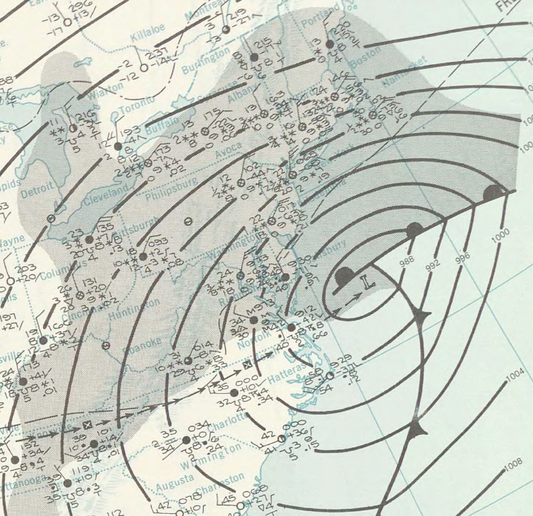
English: Surface weather analysis of the December 1960 nor'easter on December 12, 1960, while located off the coast of the Northeastern United States. |
|||
| Date | ||||
| Source | http://www.lib.noaa.gov/collections/imgdocmaps/daily_weather_maps.html | |||
| Author | NOAA Central Library Data Imaging Project | |||
| Permission (Reusing this file) |
|
File history
Click on a date/time to view the file as it appeared at that time.
| Date/Time | Thumbnail | Dimensions | User | Comment | |
|---|---|---|---|---|---|
| current | 03:14, 28 April 2015 | | 755 × 731 (592 KB) | Juliancolton (talk | contribs) | {{Information |Description ={{en|1=Surface weather analysis of the {{w|December 1960 nor'easter}} on December 12, 1960, while located off the coast of the Northeastern United States.}} |Source =http://www.lib.noaa.gov/collections/imgdocmaps/... |
You cannot overwrite this file.
File usage on Commons
There are no pages that use this file.
File usage on other wikis
The following other wikis use this file:
- Usage on en.wikipedia.org