File:National Geographic map of Korea and Japan, 1945.jpg
Jump to navigation
Jump to search
Size of this preview: 800 × 569 pixels. Other resolutions: 320 × 227 pixels | 640 × 455 pixels | 1,024 × 728 pixels | 1,280 × 910 pixels | 2,560 × 1,820 pixels | 5,339 × 3,795 pixels.
Original file (5,339 × 3,795 pixels, file size: 6.58 MB, MIME type: image/jpeg)
Captions
Captions
Add a one-line explanation of what this file represents
Summary
[edit]
| Description |
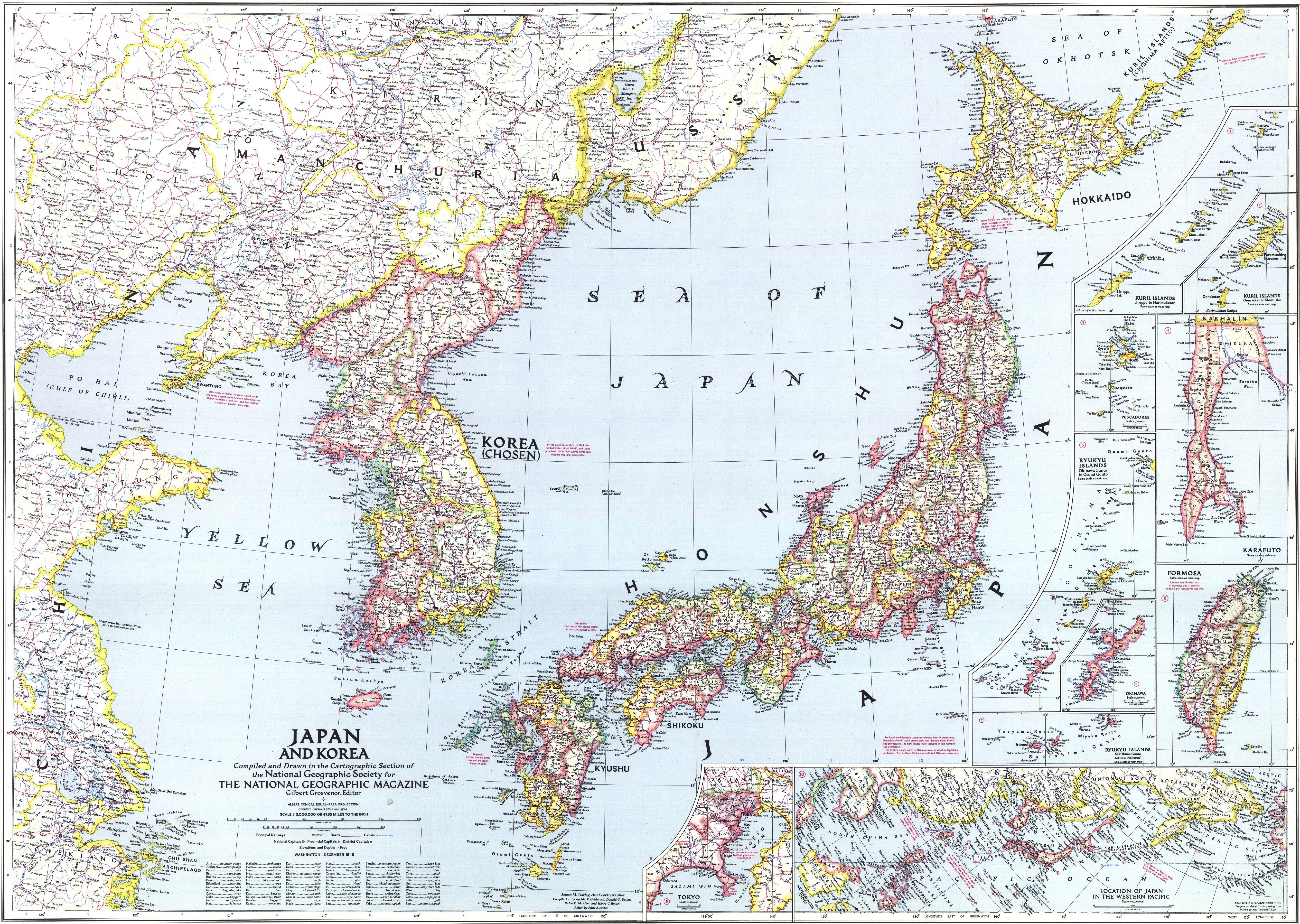
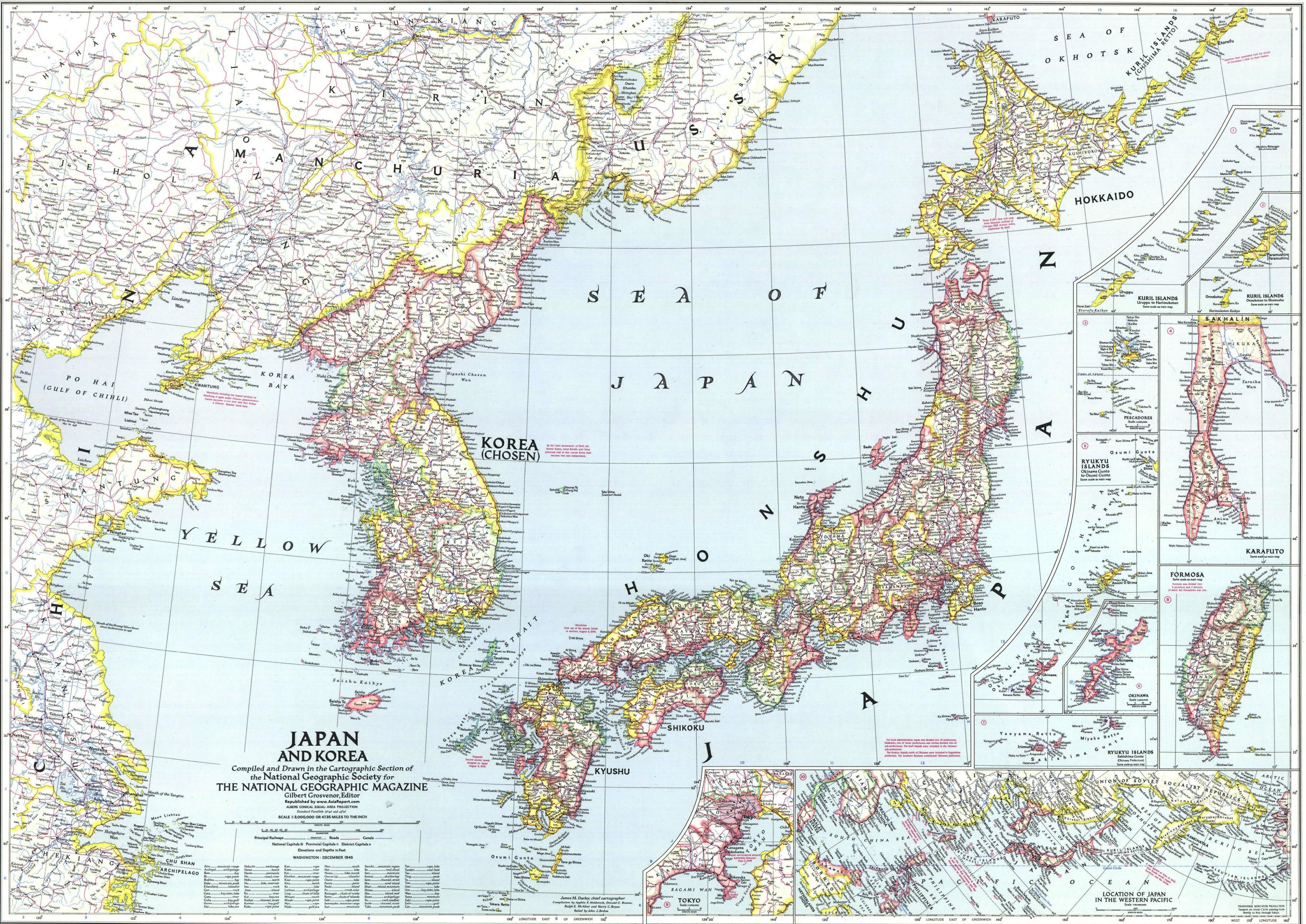
English: National Geographic map of Korea and Japan, 1945. This map reflects ROC's claim around Paektu Mountain. This map does not reflect de facto Sino-Korean border in 1945. |
| Date | |
| Source | http://www.drben.net/publishImages/Koreas_Report~Sources~Korea_Maps~Historic~1945~Map-Japan-Korea-1945-01~~element1972.jpg |
| Author | National Geographic |
Licensing
[edit]
This work is in the public domain because it was published in the United States between 1929 and 1963, and although there may or may not have been a copyright notice, the copyright was not renewed. For further explanation, see Commons:Hirtle chart and the copyright renewal logs.
|
 |
File history
Click on a date/time to view the file as it appeared at that time.
| Date/Time | Thumbnail | Dimensions | User | Comment | |
|---|---|---|---|---|---|
| current | 15:19, 29 March 2018 | | 5,339 × 3,795 (6.58 MB) | FDRMRZUSA (talk | contribs) | High resolution; better image quality; same license. |
| 15:42, 25 July 2017 |  | 4,395 × 3,109 (2.97 MB) | Illegitimate Barrister (talk | contribs) | User created page with UploadWizard |
You cannot overwrite this file.
File usage on Commons
There are no pages that use this file.
File usage on other wikis
The following other wikis use this file:
- Usage on af.wikipedia.org