File:Nagorye Rayon 1940.png
Jump to navigation
Jump to search

Size of this preview: 800 × 593 pixels. Other resolutions: 320 × 237 pixels | 640 × 475 pixels | 1,024 × 760 pixels | 1,280 × 950 pixels | 1,526 × 1,132 pixels.
Original file (1,526 × 1,132 pixels, file size: 36 KB, MIME type: image/png)
Captions
Captions
Add a one-line explanation of what this file represents
| Description |
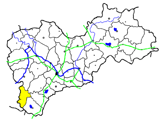
Русский: Нагорьевский район на схеме "Ярославская область в 1940 году". Указаны границы и центры районов, железные дороги и основные водные объекты. Первоисточники:
|
|||
| Date | ||||
| Source | Own work | |||
| Author | Бериллий | |||
| Permission (Reusing this file) |
I, the copyright holder of this work, hereby publish it under the following license:
|
File history
Click on a date/time to view the file as it appeared at that time.
| Date/Time | Thumbnail | Dimensions | User | Comment | |
|---|---|---|---|---|---|
| current | 16:44, 25 December 2011 | | 1,526 × 1,132 (36 KB) | Бериллий (talk | contribs) | {{Information |description={{ru|1=Нагорьевский район на схеме "Ярославская область в 1940 году". Указаны границы и центры районов, железные дороги и основные |
You cannot overwrite this file.
File usage on Commons
There are no pages that use this file.
File usage on other wikis
The following other wikis use this file:
- Usage on ru.wikipedia.org