File:Meyers Geographischer Handatlas 1912-Tsingtau.jpg
Jump to navigation
Jump to search
Size of this preview: 465 × 599 pixels. Other resolutions: 186 × 240 pixels | 372 × 480 pixels | 596 × 768 pixels | 794 × 1,024 pixels | 1,589 × 2,048 pixels | 4,131 × 5,325 pixels.
Original file (4,131 × 5,325 pixels, file size: 10.33 MB, MIME type: image/jpeg)
Captions
Captions
Add a one-line explanation of what this file represents
Summary
[edit]
| Description |
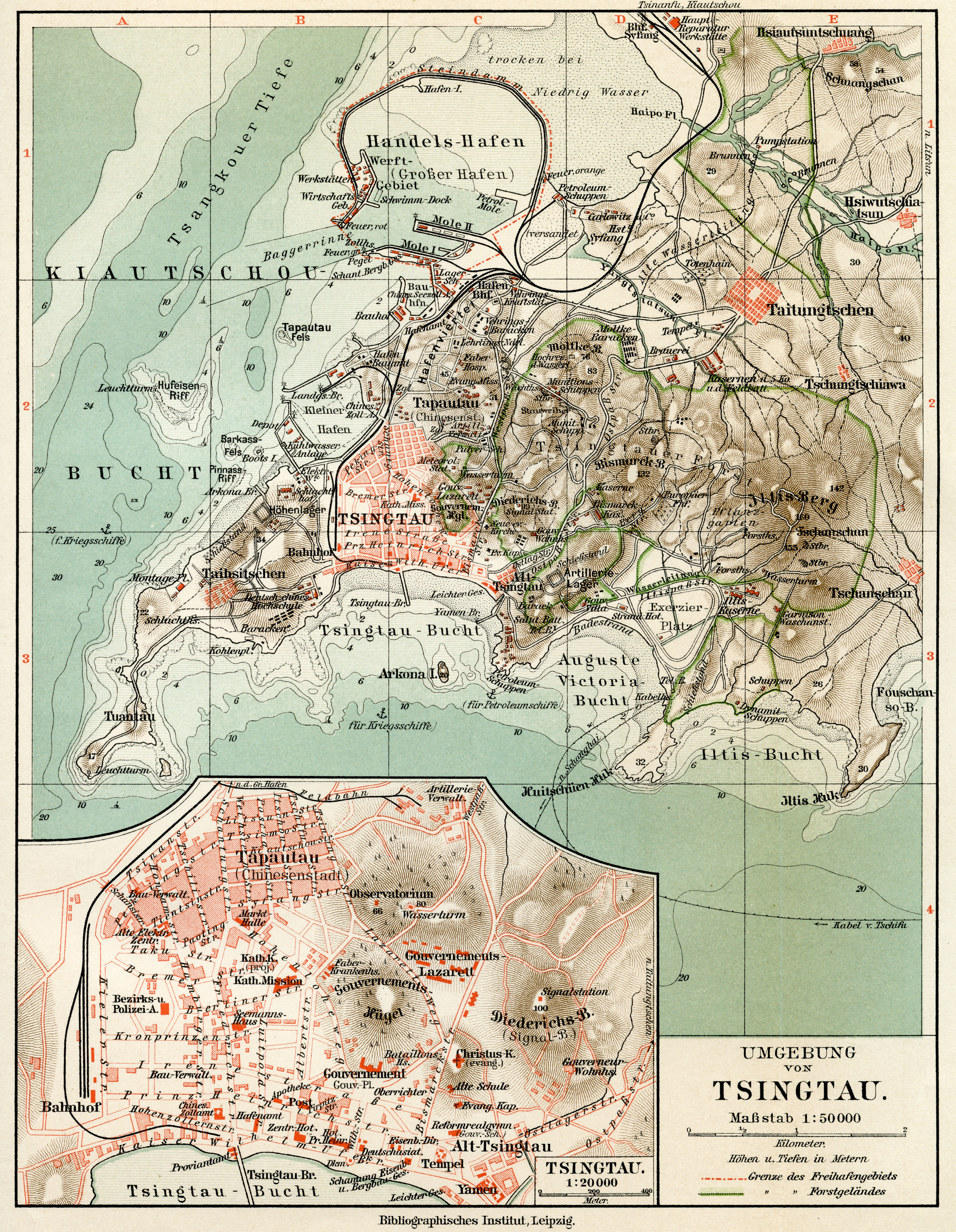
English: Map of German colony of Tsingtau, 1912
Deutsch: Karte der deutschen Kolonie Tsingtau, 1912 |
||||
| Date | (Scan) | ||||
| Source | Meyers Geographischer Handatlas, Leipzig/Wien, 4th ed. 1912 | ||||
| Author | Till Niermann | ||||
| Permission (Reusing this file) |
|
||||
File history
Click on a date/time to view the file as it appeared at that time.
| Date/Time | Thumbnail | Dimensions | User | Comment | |
|---|---|---|---|---|---|
| current | 16:21, 14 September 2022 | | 4,131 × 5,325 (10.33 MB) | Till.niermann (talk | contribs) | Reverted to version as of 17:19, 13 June 2010 (UTC) |
| 07:31, 10 September 2022 |  | 4,131 × 5,325 (9.65 MB) | 1970gemini (talk | contribs) | endschleiart | |
| 17:19, 13 June 2010 |  | 4,131 × 5,325 (10.33 MB) | Till.niermann (talk | contribs) | {{Information |Description={{en|1=Map of German colony of Tsingtau, 1912}} {{de|1=Karte der deutschen Kolonie Tsingtau, 1912}} |Source=Meyers Geographischer Handatlas, Leipzig/Wien, 4th ed. 1912 |Author=Till Niermann |Date=2010-06-1 |
You cannot overwrite this file.
File usage on Commons
The following 3 pages use this file:
File usage on other wikis
The following other wikis use this file:
- Usage on da.wikipedia.org
- Usage on de.wikipedia.org
- Usage on fr.wikipedia.org
- Usage on zh.wikipedia.org