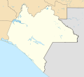
File:Mexico Chiapas location map.svg

Original file (SVG file, nominally 516 × 475 pixels, file size: 1.32 MB)
Captions
Captions
Summary
[edit]| DescriptionMexico Chiapas location map.svg |
English: Location Map of Chiapas
Equirectangular projection, Geographic limits of the map:
|
| Date | |
| Source |
|
| Author | Addicted04 |
Licensing
[edit]- You are free:
- to share – to copy, distribute and transmit the work
- to remix – to adapt the work
- Under the following conditions:
- attribution – You must give appropriate credit, provide a link to the license, and indicate if changes were made. You may do so in any reasonable manner, but not in any way that suggests the licensor endorses you or your use.
- share alike – If you remix, transform, or build upon the material, you must distribute your contributions under the same or compatible license as the original.
File history
Click on a date/time to view the file as it appeared at that time.
| Date/Time | Thumbnail | Dimensions | User | Comment | |
|---|---|---|---|---|---|
| current | 23:45, 11 April 2015 |  | 516 × 475 (1.32 MB) | Addicted04 (talk | contribs) | + New municipalities |
| 21:17, 9 April 2015 |  | 516 × 475 (1.27 MB) | Addicted04 (talk | contribs) | Corrigiendo errores | |
| 00:13, 9 April 2015 |  | 516 × 475 (1.59 MB) | Addicted04 (talk | contribs) | - Letras en Tabasco | |
| 00:10, 9 April 2015 |  | 516 × 475 (1.59 MB) | Addicted04 (talk | contribs) | User created page with UploadWizard |
You cannot overwrite this file.
File usage on Commons
The following 11 pages use this file:
File usage on other wikis
The following other wikis use this file:
- Usage on ay.wikipedia.org
- Usage on de.wikipedia.org
- Tuxtla Gutiérrez
- Tapachula
- Chiapas-Brücke
- San Cristóbal de las Casas
- La Angostura (Mexiko)
- El Chichón
- Cascadas de Agua Azul
- Chamula
- Villa Corzo
- Cañón del Sumidero
- Nationalpark Cañón del Sumidero
- Wikipedia:Kartenwerkstatt/Positionskarten/Nordamerika
- Estadio Víctor Manuel Reyna
- Nueva Alemania
- Ocosingo
- Nationalpark Lagunas de Montebello
- Tonalá (Chiapas)
- Chiapa de Corzo
- Vorlage:Positionskarte Mexiko Chiapas
- Estadio Olímpico de Tapachula
- Comitán de Domínguez
- Palenque (Mexiko)
- Usage on en.wikipedia.org
- Acteal massacre
- San Cristóbal de las Casas
- Tapachula International Airport
- Francisco Sarabia National Airport
- Frontera Corozal, Chiapas
- Tuxtla Gutiérrez International Airport
- Las Margaritas, Chiapas
- Villaflores, Chiapas
- Chicoasén
- La Concordia, Chiapas
- Pueblo Nuevo Solistahuacán
- San Cristóbal de las Casas National Airport
- Sak tzʼi (Maya site)
- Palenque International Airport
- Sierra Madre Formation
- Module:Location map/data/Mexico Chiapas
- Module:Location map/data/Mexico Chiapas/doc
- Module:Location map/data/Chiapas
- 2018–19 Liga TDP season
- User:FiveFaintFootprints/sandbox/sandboxexperiments
- User:Ty654/List of earthquakes exceeding magnitude 8+
- User:Ty654/List of earthquakes from 1900-1949 exceeding magnitude 7+
- User:Ty654/List of earthquakes from 1950-1999 exceeding magnitude 7+
- User:Ty654/List of earthquakes from 1955-1959 exceeding magnitude 6+
- User:Ty654/List of earthquakes from 1960-1964 exceeding magnitude 6+
- User:Ty654/List of earthquakes from 1965-1969 exceeding magnitude 6+
- User:Ty654/List of earthquakes from 1970-1974 exceeding magnitude 6+
View more global usage of this file.
Metadata
This file contains additional information such as Exif metadata which may have been added by the digital camera, scanner, or software program used to create or digitize it. If the file has been modified from its original state, some details such as the timestamp may not fully reflect those of the original file. The timestamp is only as accurate as the clock in the camera, and it may be completely wrong.
| Width | 413pt |
|---|---|
| Height | 380pt |