File:Marquette WV.jpg
Jump to navigation
Jump to search
Size of this preview: 800 × 457 pixels. Other resolutions: 320 × 183 pixels | 640 × 365 pixels | 1,024 × 584 pixels | 1,372 × 783 pixels.
Original file (1,372 × 783 pixels, file size: 594 KB, MIME type: image/jpeg)
Captions
Captions
Add a one-line explanation of what this file represents
Summary
[edit]
| Description |
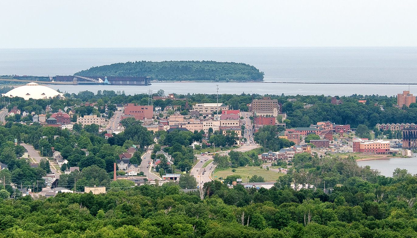
English: Marquette, Michican seen from Mount Marquette in 2012. To the right is the lower harbor and its ore dock, which was used from 1932 to 1971. To the left of that is the central business district. To the left and behind that is the Superior Dome. Behind that is the Upper Harbor with a boat at the ore dock. Behind the ore dock is Presque Isle. |
| Date | |
| Source | Own work |
| Author | Steven Fine |
| Other versions |
| Camera location | | View this and other nearby images on: OpenStreetMap |
|---|
Licensing
[edit]
I took this photograph and I encourage others to use it, subject to the terms described below in the section "License Terms".
If you are interested in different license terms or a higher resolution version for this photo, please email me via Wikimedia.
If you will use this photo outside of Wikipedia or other Wikimedia sites, I would appreciate it if
- you let me know via email through Wikimedia or on my talk page; and
- the acknowledgement you include with the photo, where feasible, linked to the Wikimedia web page for the photo (this page) and/or to my Wikimedia web page.
License Terms
[edit]
Steven Fine, the copyright holder of this work, hereby publishes it under the following license:
This file is licensed under the Creative Commons Attribution-Share Alike 4.0 International license.
Attribution: Steven Fine
- You are free:
- to share – to copy, distribute and transmit the work
- to remix – to adapt the work
- Under the following conditions:
- attribution – You must give appropriate credit, provide a link to the license, and indicate if changes were made. You may do so in any reasonable manner, but not in any way that suggests the licensor endorses you or your use.
- share alike – If you remix, transform, or build upon the material, you must distribute your contributions under the same or compatible license as the original.
File history
Click on a date/time to view the file as it appeared at that time.
| Date/Time | Thumbnail | Dimensions | User | Comment | |
|---|---|---|---|---|---|
| current | 17:30, 5 December 2016 | | 1,372 × 783 (594 KB) | ויקיג'אנקי (talk | contribs) | File:Marquette from Mount Marquette.jpg cropped 33 % horizontally using CropTool with precise mode. |
You cannot overwrite this file.
File usage on Commons
The following page uses this file:
File usage on other wikis
The following other wikis use this file:
- Usage on he.wikivoyage.org